Guam is a U.S. territory in the western Pacific Ocean, at the boundary of the Philippine Sea. It is the southernmost and largest member of the Mariana Islands archipelago, which is itself the northernmost group of islands in Micronesia. The closest political entity is the Commonwealth of the Northern Mariana Islands (CNMI), another U.S. territory. Guam shares maritime boundaries with CNMI to the north and the Federated States of Micronesia to the south. It is located approximately one quarter of the way from the Philippines to Hawaii. Its location and size make it strategically important. It is the only island with both a protected harbor and land for multiple airports between Asia and Hawaii, on an east–west axis, and between Papua New Guinea and Japan, on a north–south axis.

The Northern Mariana Islands, officially the Commonwealth of the Northern Mariana Islands, is an unincorporated territory and commonwealth of the United States consisting of 14 islands in the northwestern Pacific Ocean. The CNMI includes the 14 northernmost islands in the Mariana Archipelago; the southernmost island, Guam, is a separate U.S. territory.

The Northern Mariana Islands, together with Guam to the south, compose the Mariana Islands. The southern islands are limestone, with level terraces and fringing coral reefs. The northern islands are volcanic, with active volcanoes on Anatahan, Pagan and Agrihan. The volcano on Agrihan has the highest elevation at 3,166 feet (965 m). About one-fifth of the land is arable; another tenth is pasture. The primary natural resource is fish, some of which are endangered species, which leads to conflict. Also, development has created landfills which have contaminated the groundwater on Saipan, which could lead to disease.

The Mariana Islands are a crescent-shaped archipelago comprising the summits of fifteen longitudinally oriented, mostly dormant volcanic mountains in the northwestern Pacific Ocean, between the 12th and 21st parallels north and along the 145th meridian east. They lie south-southeast of Japan, west-southwest of Hawaii, north of New Guinea and east of the Philippines, demarcating the Philippine Sea's eastern limit. They are found in the northern part of the western Oceanic sub-region of Micronesia, and are politically divided into two jurisdictions of the United States: the Commonwealth of the Northern Mariana Islands and, at the southern end of the chain, the territory of Guam. The islands were named after the influential Spanish queen Mariana of Austria following their colonization in the 17th century.

Farallón de Pájaros, also known as Uracus or Urracas, is a small (2.3 km2) uninhabited volcanic island, the northernmost island in the Northern Mariana Islands chain.

Pagan is a volcanic island in the Marianas archipelago in the northwest Pacific Ocean, under the jurisdiction of the Commonwealth of the Northern Mariana Islands. It lies midway between Alamagan to the south, and Agrihan to the north. The island has been largely uninhabited ever since most of the residents were evacuated due to volcanic eruptions in 1981.

Anatahan is an island in the Northern Mariana Islands in the Pacific Ocean, and has one of the most active volcanoes of the archipelago. Formerly inhabited, the island currently does not have any population due to the always-present danger of volcanic eruptions. Anatahan is located 60 kilometers (32 nmi) northwest of Farallon de Medinilla and 120 km (65 nmi) north of Saipan.

Maug consists of a group of three small uninhabited islands. This island group is part of the Northern Islands Municipality of the Commonwealth of the Northern Mariana Islands, itself part of the Marianas archipelago in the Oceanian sub-region of Micronesia.

Asuncion is the third northernmost island in the Northern Mariana Islands chain in the Pacific Ocean. The island is uninhabited. Asuncion is situated 101 kilometers (63 mi) northwest of Agrihan and 37 km (23 mi) southeast of the Maug Islands.

Zealandia Bank, also known as Farallon de Torres or Piedras de Torres in Spanish, or Papaungan in Chamorro, consists of two rocky pinnacles about 1.5 kilometers apart, in the Northern Mariana Islands in the Pacific Ocean. One reaches a height of approximately 1 meter (3.3 ft) at low tide; the other does not normally broach the surface. They are located 11 nautical miles (20 km) north-northeast from Sarigan, in between Sarigan and Guguan, but because of their small size, they are not listed in most maps. Zealandia Bank is one of 18 units within the Mariana Arc of Fire National Wildlife Refuge, of the Marianas Trench Marine National Monument.

Alamagan is an island in the Northern Mariana Islands in the Pacific Ocean, 30 nautical miles (56 km) north of Guguan, 250 nautical miles (463 km) north of Saipan, and 60 nautical miles (111 km) south of Pagan. It is currently uninhabited.

Agrihan is an island in the Northern Mariana Islands in the Pacific Ocean. The island is currently uninhabited. Agrihan is located 62 kilometers (39 mi) to the north of Pagan.

Guguan is an island in the Northern Mariana Islands in the Pacific Ocean. The island is currently uninhabited. Guguan is located 30 nautical miles (56 km) south from Alamagan and 250 nautical miles (463 km) north from Saipan, and is 67 nautical miles (124 km) northeast from Sarigan.

Sarigan is an uninhabited volcanic island in the Pacific Ocean. It is part of the Northern Mariana Islands, a U.S. territory. Sarigan is located 37 kilometers (20 nmi) northeast of Anatahan island, 67 km (36 nmi) south of Guguan and 150 km (81 nmi) north of Saipan, the largest island in the Northern Marianas.
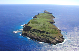
Farallon de Medinilla is an uninhabited small island in the Northern Mariana Islands in the Pacific Ocean. It is located 45 nautical miles (83 km) north of Saipan, and is the smallest island in the archipelago. Politically, it is part of the Northern Islands Municipality.

Commonwealth of the Northern Mariana Islands Public School System is a school district serving the Northern Mariana Islands, a United States territory.
The following outline is provided as an overview of and topical guide to the Northern Mariana Islands:

The following is an alphabetical list of articles related to the Commonwealth of the Northern Mariana Islands.
The Marianas tropical dry forests is a tropical and subtropical dry broadleaf forests ecoregion on the Marianas Islands in the western Pacific Ocean.