Nosedo (Nosed in Lombard)[1] is a district ("quartiere") of the city of Milan, Italy. It is part of the Zone 4 administrative division, located south of the city centre. Until 1870, it was an autonomous comune. The name comes from the Latinnocetum, meaning "walnut forest", as walnut trees used to be common in the area.
A settlement has been reported to exist in Nosedo since the Middle Ages, when the Goths controlled the Milanese. It is reported that Milanese bishop Onorato was buried in a church of the area in 569, and that the local population tried to seek shelter from the Goths in a church called "San Giorgio al Pozzo" (Saint George by the Pit).
The oldest reference to the name "Nosedo" (then Nosea) is found in a document dating back to 1346. When the territory around Milan was partitioned in "pieves", Nosedo was part of the Pieve di San Donato.
In 1870, Nosedo was merged with Chiaravalle Milanese, which in turn was annexed to Milan in 1923.
Nosedo today
Nosedo is an outlying district, which has partially kept its rural character. It still has several cascine (i.e., farmhouses), some of which abandoned. Some of these cascine have been illegally occupied by homeless and Romani nomads, and friction between these and the local population has occurred, especially between 2006 and 2008.
In 2003, a large water purification facility (one of the largest in Europe) has been established in Nosedo.[2]
Landmarks
The 13th century chapelCascina Nosedo
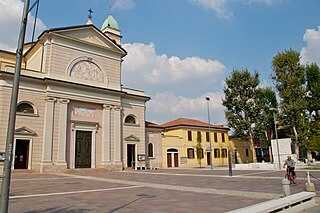
The main landmark of Nosedo is an old cascina with a 13th chapel, located in Via San Dionigi, 77. The church was built by the Cistercians coming from the nearby Chiaravalle Abbey, on the ruins of an oldest church. The church was named after Saints Philip and James.
In the following centuries, the church fell in decay, to the point of being used as a warehouse, but later returned to its original functions. In 1825, the wedding of Ferdinand I of the Two Sicilies and Isabella was celebrated in the chapel.
The chapel was restored in 1985. In 1998, an association was founded with the mission of preserving the church and the cascina and, in general, the historical and religious tradition of Nosedo.[3]
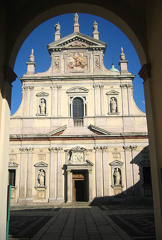
The Abbey of Santa Maria di Rovegnano is a Cistercian monastic complex in the comune of Milan, Lombardy, northern Italy. The borgo that has developed round the abbey was once an independent commune called Chiaravalle Milanese, now included in Milan and referred to as the Chiaravalle district.
The District of Milan was one of the four divisions of the Department of Olona, the province of Milan during the Napoleonic Italian Republic. It received the numeral I and its capital was Milan. Founded on May 13, 1801, it had a population of 217,807 inhabitants.
Taliedo is a peripheral district ("quartiere") of the city Milan, Italy, part of the Zone 4 administrative division, located south-east of the city centre. The informal boundaries of the district are three main city streets, respectively Via Mecenate, Via Bonfadini and Via Salomone.
Rogoredo is a former municipality, currently border district ("quartiere") of the city of Milan, Italy. It is part of the Zone 4 administrative division, and it is located 6–7 km south-east of the city centre. It borders on the Nosedo district to the east, on the Morsenchio district to the north, on the piazzale Corvetto neighbourhood to the north-west, and on the San Donato Milanese comune to the south-east. The name derives from the medieval Latin word robur, meaning "sessile oak, and stands for "oak wood".
Vaiano Valle is a rural district ("quartiere") of Milan, Italy, part of the Zone 5 administrative division. It is located south of the city's urban area, within the Parco Agricolo Sud Milano nature reserve. Before 1869, it was an autonomous comune.
Chiaravalle is a district (quartiere) of Milan, Italy, part of the Zone 5 administrative division of the city. It is located in the periphery south of the city centre, within the Parco Agricolo Sud Milano nature reserve.
Quintosole is a district ("quartiere") of Milan, Italy, part of the Zone 5 administrative division. It is a rural district, located within the Parco Agricolo Sud Milano nature reserve, south of Milan's urban area. Before 1869, it was an autonomous comune.
Giambellino and Lorenteggio are two historical and populous residential neighborhoods of Milan, Italy. Together, they form a district ("quartiere"), part of the Zone 6 administrative division of Milan.
Quarto Cagnino is a district (quartiere) of Milan, Italy, part of the Zone 7 administrative division of the city. It borders the districts of Trenno (north), San Siro (east), Baggio (south), and Quinto Romano (west). Before being annexed to Milan, in 1869, it was an autonomous comune and, briefly, a part of Trenno.
Figino is a district ("quartiere") of Milan, Italy, part of the Zone 7 administrative division. It is located north-west of the centre, within the Parco Agricolo Sud Milano nature reserve. Before being annexed to Milan, in 1869, it was an autonomous comune, named Figino di Milano.
Baggio is a district (quartiere) of Milan, Italy, part of the Zone 7 administrative division of the city. Before being annexed to Milan in 1923, it was an autonomous comune.
Assiano is a rural district ("quartiere") of Milan, Italy, part of the Zone 7 administrative division. It is a border district, at the western end of the city area. Before being annexed to Milan, it was an autonomous comune, except for a brief period (1808-1816) when it was included in Cusago.
Muggiano is a district (quartiere) of Milan, Italy, part of the Zone 7 administrative division of the city. It is located in western periphery, bordering on the comunes of Cesano Boscone, Cusago, Settimo Milanese, and Trezzano sul Naviglio. Before being annexed to Baggio, which in turn was annexed to Milan, Muggiano used to an autonomous comune.
Garegnano is a district ("quartiere") of Milan, Italy, part of the Zone 8 administrative division of the city, north-west of the city centre. Before being annexed to Milan, it has been an autonomous comune, originally known as Garegnano Marcido.
Affori is a ward of Milan, Italy, part of the Zone 9 administrative division of the city, located north of the city centre. It borders with the wards of Bruzzano, Comasina, Bovisasca, Dergano and Niguarda. Before being annexed to Milan in 1923, it was an autonomous comune.
In Italy, cascina a corte, more simply known as cascina, refers to a type of rural building traditional of the Po Valley, especially of Lombardy and of some areas of Piedmont and Emilia-Romagna.
The Oratorio di San Protaso is a church in via Lorenteggio, Milan, Lombardy.
The Zone 6 of Milan, since 2016 officially Municipality 6 of Milan, is one of the 9 administrative divisions of Milan, Italy.
Musocco is a district of Milan, located in the north-western outskirts of the city, belonging to Zone 8.
Cascina Guzzina is a farmhouse located in the southern part of Brugherio, on the border with Cologno Monzese. The name comes from gussetta, which formerly referred to the cocoon of the silkworm, whose breeding was widespread in the area. Agricultural complexes known as "agricultural courts", which once held prolific agricultural activity, are now civilian residences and businesses.
This page is based on this Wikipedia article Text is available under the CC BY-SA 4.0 license; additional terms may apply. Images, videos and audio are available under their respective licenses.