Quartiere Feltre

Last updated
Quartiere Feltre
Quartiere of Milan
Quartiere Feltre.jpg
CountryFlag of Italy.svg  Italy
Region Lombardy
Province Milan
Comune Milan
Zone 3
Time zone CET (UTC+1)
  Summer (DST) CEST (UTC+2)

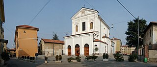
Quartiere Feltre is a residential district ("quartiere") of Milan, Italy. It is located in the Zone 3 administrative division, extending east of the city centre, adjacent to the districts of Lambrate and Cimiano, the Lambro river and the Tangenziale Est ring road. It is named after Via Feltre, a large suburban street that connects Milan to the Parco Lambro city park.

A quartiere is a territorial subdivision of certain Italian towns. The word derives from quarto, or fourth, and was thus properly used only for towns divided into four neighborhoods by the two main roads. It has been later used as a synonymous of neighbourhood, and an Italian town can be now subdivided into a greater number of quartieri. The Swiss town of Lugano is subdivided into quarters also.

Milan Italian city

Milan is a city in northern Italy, capital of Lombardy, and the second-most populous city in Italy after Rome, with the city proper having a population of 1,395,274 while its metropolitan city has a population of 3,245,308. Its continuously built-up urban area has a population estimated to be about 5,270,000 over 1,891 square kilometres. The wider Milan metropolitan area, known as Greater Milan, is a polycentric metropolitan region that extends over central Lombardy and eastern Piedmont and which counts an estimated total population of 7.5 million, making it by far the largest metropolitan area in Italy and the 54th largest in the world. Milan served as capital of the Western Roman Empire from 286 to 402 and the Duchy of Milan during the medieval period and early modern age.

Italy republic in Southern Europe

Italy, officially the Italian Republic, is a European country consisting of a peninsula delimited by the Italian Alps and surrounded by several islands. Located in the middle of the Mediterranean sea and traversed along its length by the Apennines, Italy has a largely temperate seasonal climate. The country covers an area of 301,340 km2 (116,350 sq mi) and shares open land borders with France, Slovenia, Austria, Switzerland and the enclaved microstates of Vatican City and San Marino. Italy has a territorial exclave in Switzerland (Campione) and a maritime exclave in the Tunisian sea (Lampedusa). With around 60 million inhabitants, Italy is the fourth-most populous member state of the European Union.

The district mainly comprises large apartment blocks, built in the late 1950s with state subsidies. The leading architects involved in the realization of this residential area were Luciano Baldessari, Giancarlo De Carlo, Ignazio Gardella and Angelo Mangiarotti, supervised by Gino Pollini. Two main types of apartment blocks were realized, respectively 4-floor and 9-floor high. The 4-floor buildings are located in the centre of the district, where most shops and public services are found, while the taller builinds are located in the district's periphery.

Giancarlo De Carlo Italian architect

Giancarlo De Carlo was an Italian architect.

Ignazio Gardella Italian architect

Ignazio Gardella was an Italian architect and designer.

Angelo Mangiarotti Italian architect

Angelo Mangiarotti was an Italian architect and industrial designer with a reputation built on "never forgetting the real needs of users". He mainly focused on the industrial process for buildings and design production. The main concept in Mangiarotti's architecture was established through the correct use of matter and technique.
Related Research Articles

Lambrate is a district (quartiere) of Milan, Italy, located within the Zone 3 administrative division, 6 km north-east of the city centre. It owes its name to the Lambro river that traverses the area. Lambrate houses one of the major railway stations of north-eastern Milan, the Stazione di Milano Lambrate. The district is also well known for Parco Lambro, a large urban park established in 1934. The famous Lambretta motor scooter was manufactured in Lambrate, and named after this district, as is Birrificio Lambrate, a craft brewery established in 1996.

Forlanini is a district ("quartiere") of Milan, Italy. It is part of the Zone 4 administrative division, located east of the city centre.

Monluè Quartiere of Milan in Lombardy, Italy

Monluè is a district ("quartiere") of Milan, Italy, part of the Zone 4 administrative division, located east of the city centre. It is a small residential district that originated as a rural settlement. As a consequence of its isolation from the city proper, it has maintained wide green areas and the general appearance of a small country town. The prominent landmark of the district is the eponymous Cascina Monluè, an ancient abbey built by the Humiliati religious order, that has been later adapted as a cascina (farmhouse) and is now used as the venue for a number of concerts and cultural events, especially in summer. Also of interest is the Church of Saint Lawrence, also built by the Humiliati in the 13th century.

Ponte Lambro is a district ("quartiere") of Milan, Italy. It is the outermost part of the Zone 4 administrative division, extending south-east of the city centre.

Calvairate is a district (quartiere) of Milan, Italy. It is part of the Zone 4 administrative division, located east of the city centre.

Morivione is a district ("quartiere") of the city of Milan, Italy, part of the Zone 5 administrative division, located south of the city centre. It is informally defined as the area enclosed within four streets, namely Viale Toscana, Via Ripamonti, Via Antonini and Via Bazzi. The district is especially associated to the celebrations in honour of Saint George, where Milanese people would traditionally drink milk and eat a kind of sweet called pan de mein.

Vigentino is a district ("quartiere") of Milan, Italy, part of the Zone 5 administrative division, located south of the city centre. Before 1923, Vigentino was an autonomous, rural comune. By the mid 20th century, agricultural activities were dismissed, and the area was largely urbanized, with the construction of large apartment blocks.

Gratosoglio Quartiere of Milan in Lombardy, Italy

Gratosoglio is a district (quartiere) of the city of Milan, Italy, part of the Zone 5 administrative division. It is located at southernmost end of the city, bordering on the comune of Rozzano, and it is traversed by the Lambro river.

Giambellino-Lorenteggio Quartiere of Milan in Lombardy, Italy

Giambellino and Lorenteggio are two historical and populous residential blocks of Milan, Italy. Together, they form a district ("quartiere") which is variously called "Giambellino", "Lorenteggio", Giambellino-Lorenteggio or Lorenteggio-Giambellino; the district is part of the Zone 6 administrative division of Milan.

San Siro is a vast district ("quartiere") of Milan, Italy, part of the Zone 7 administrative division of the city. About 5 km north-west of the city centre, it borders the districts of Lampugnano, QT8, FieraMilano, and Trenno.

Quarto Cagnino is a district (quartiere) of Milan, Italy, part of the Zone 7 administrative division of the city. It borders the districts of Trenno (north), San Siro (east), Baggio (south), and Quinto Romano (west). Before being annexed to Milan, in 1869, it was an autonomous comune and, briefly, a part of Trenno.

Muggiano is a district (quartiere) of Milan, Italy, part of the Zone 7 administrative division of the city. It is located in western periphery, bordering on the comunes of Cesano Boscone, Cusago, Settimo Milanese, and Trezzano sul Naviglio. Before being annexed to Baggio, which in turn was annexed to Milan, Muggiano used to an autonomous comune.

Ghisolfa is a district ("quartiere") of Milan, Italy, part of the Zone 8 administrative division of the city, located north-west of the city centre. It is named after the "Ghisolfa Bridge" overpass, part of the external Circonvallazione ring road enclosing the centre of Milan. In turn, the bridge was named after two cascine, "Cascina Ghisolfa" and "Cascina Ghisolfetta", that existed in the area before the urbanization of the mid 20th century. The bridge was completed in 1941, prolonged in the 1960s, and enlarged in the 1990s.

Villapizzone Quartiere of Milan in Lombardy, Italy

Villapizzone is a district ("quartiere") of Milan, Italy, part of the Zone 8 administrative division of the city, located north of the city centre. It was an autonomous comune until 1869.

Vialba is a district ("quartiere") of Milan, Italy, part of the Zone 8 administrative division of the city. It is located north of the city centre, adjacent to the municipality (comune) of Novate Milanese. Until 1841, Vialba itself was an autonomous comune.

Gallaratese Quartiere of Milan in Lombardy, Italy

Gallaratese is a district ("quartiere") of Milan, Italy, part of the Zone 8 administrative division of the city. It is located about 7 km north-west of the city centre. It borders on the comune of Pero to the north and on the districts of Trenno to the west and Lampugnano to the south; to the east, its ideal border is the eponymous street, which in turn is named after Gallarate, the town it leads to.

Trenno Quartiere of Milan in Lombardy, Italy

Trenno is a district ("quartiere") of Milan, Italy, part of the Zone 8 administrative division of the city. It borders on green areas to the north and west and to the south ; to the east, it is adjacent to the Gallaratese district. Before being annexed to Milan, in 1923, it was an autonomous comune.

The Centro Direzionale di Milano is a business district (quartiere) in Milan, Italy, part of the Zone 9 administrative division. It is located north-west of the city centre, between the major railway stations of Milano Centrale and Milano Porta Garibaldi. The district developed in the second half of the 20th century; its realization was planned by the city administration to relieve congestion in the city centre by moving business and tertiary activities in the new area. Coherently with this plan, the district is mainly occupied by modern office buildings, including several of Milan's skyscrapers.

Udine (Milan Metro) underground station in Milan, Italy

Udine is a station on Line 2 of the Milan Metro. It is located in Piazzale Udine; near Parco Lambro, a large urban park, and Quartiere Feltre, a major residential district of Milan.

Zone 3 of Milan Zona of Milan in Lombardy, Italy

The Zone 3 of Milan is one of the 9 administrative zones of Milan, Italy. It corresponds to the north-eastern area of the city.

References

Coordinates: 45°29′21″N9°14′45″E / 45.48917°N 9.24583°E / 45.48917; 9.24583

Geographic coordinate system Coordinate system

A geographic coordinate system is a coordinate system that enables every location on Earth to be specified by a set of numbers, letters or symbols. The coordinates are often chosen such that one of the numbers represents a vertical position and two or three of the numbers represent a horizontal position; alternatively, a geographic position may be expressed in a combined three-dimensional Cartesian vector. A common choice of coordinates is latitude, longitude and elevation. To specify a location on a plane requires a map projection.