Barona is a border district ("quartiere") of the city of Milan, Italy. It is part of the Zone 6 administrative division, and it is located south of the city centre. Its population can be roughly estimated to 85,000 (official data are not available as districts are not formal divisions). It borders on the comunes of Buccinasco, Assago, and Corsico and the districts of Lorenteggio and Torretta. Its boundaries are marked by the Parco Agricolo Sud Milano nature reserve to the south, by the Naviglio Grande and Naviglio Pavese canals to the east and to the west, and by the Circonvallazione ring road to the north (more specifically, by the Viale Cassala and Viale Tibaldi avenues).
Barona is a mainly residential district, and one of those having a higher proportion of green areas still devoted to agriculture. The most typical features of the agricultural areas in Barona, as well as in the neighbouring semi-rural districts and communes, are the water-meadows and paddy fields.
It has two main urban sub-districts, Sant'Ambrogio I and Sant'Ambrogio II. Sant'Ambrogio I has landmark, curvy buildings, constructed in the 1960s, housing about 5,000 people. Sant'Ambrogio II developed between the 1960s and 1970s and has prefabricated apartment buildings of simpler design. The district includes two well known community centres, Barrio's and Villaggio Barona.
History
A settlement in the area of Barona is reported since the 2nd millennium BC, when the area was inhabited by Ligures; archaeological findings from this early settlement are exhibited in the Sforza Castle Museum.[1] The older reference to the name "Barona" is from a 973 document, now preserved in the Curia Arcivescovile di Milano archives, where the place is mentioned as Vicus Baronis, i.e., "town of the Baron".[1] In Roman times, the area including Barona and adjacent rural towns was called "Pomerio", meaning "after the walls", with reference to the Walls of Milan; later on the area was renamed Corpi Santi ("Holy Bodies"), as the Milanese would bury their dead past the city walls, in the surrounding country. Corpi Santi formally became a comune in the 18th century, and in the 20th century it was annexed to Milan.[1]
Until the early decades of the 20th century, Barona was an agricultural area, characterized by water-meadows established by the Benedictine monks. After World War I the district quickly turned into an urban and industrial area.[1]
In the 1960s, the Barona district received much media attention as it was the scene of many killings by far left-wing terrorist Cesare Battisti.[2]
Transportation
The district benefits several public transportation services, including two stops of the Milan Metro subway, tramways, and buses, connecting it to the city centre. There are also interurban buses connecting the district to Corsico, Rosate and Buccinasco.
Services
Barona houses one of the leading hospitals of Milan, Ospedale San Paolo, as well as branches of three universities, the Università degli Studi di Milano (faculty of Medicine), IULM and NABA (academy of arts).
Monuments
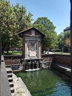
The district has several relevant churches, including a sanctuary named after Saint Rita of Cascia, the church of Saints Nazarius and Celsus, dating back to at least the 14th century, and the church of San Marchetto (16th century). In the southern part of the district, that is partially included in the Parco Agricolo Sud Milano reserve, there are several notable cascine (ancient farmhouses), some of which date back to the 17th century.
References in popular culture
The popular Italian pop band 883 mentions Barona in the song Comuli, from the 1992 album Nord Sud Ovest Est. The 2003 independent Italian movie Fame chimica is set in Barona, although some scenes have been shot in other peripheral districts of Milan, such as Quarto Oggiaro and Bonola.[3][4]
The Province of Milan was a province in the Lombardy region, Italy. Its capital was the city of Milan. The provincial territory was highly urbanized, resulting in the third highest population density among the Italian provinces with more than 2,000 inhabitants/km2, just behind the provinces of Naples and the bordering Monza e Brianza, created in 2004 splitting the north-eastern part from the province of Milan itself. On January 1, 2015 it was replaced by the Metropolitan City of Milan.
Rodano is a city and comune in the Metropolitan City of Milan, Lombardy, northern Italy.
Taliedo is a peripheral district ("quartiere") of the city Milan, Italy, part of the Zone 4 administrative division, located south-east of the city centre. The informal boundaries of the district are three main city streets, respectively Via Mecenate, Via Bonfadini and Via Salomone.
Porta Lodovica was a city gate of the Spanish walls of Milan, Italy, named after Ludovico Sforza. Today, the name refers to the district (quartiere) of Milan where the gate used to be, which is part of the Zone 5 administrative division. The gate was demolished at the end of the 19th century; plans were made to rebuild it inside the Parco di Monza city park in Monza, but they were not implemented.
Vaiano Valle is a rural district ("quartiere") of Milan, Italy, part of the Zone 5 administrative division. It is located south of the city's urban area, within the Parco Agricolo Sud Milano nature reserve. Before 1869, it was an autonomous comune.
Chiaravalle is a district (quartiere) of Milan, Italy, part of the Zone 5 administrative division of the city. It is located in the periphery south of the city centre, within the Parco Agricolo Sud Milano nature reserve.
Gratosoglio is a district (quartiere) of the city of Milan, Italy, part of the Zone 5 administrative division. It is located at southernmost end of the city, bordering on the comune of Rozzano, and it is traversed by the Lambro river.
Quintosole is a district ("quartiere") of Milan, Italy, part of the Zone 5 administrative division. It is a rural district, located within the Parco Agricolo Sud Milano nature reserve, south of Milan's urban area. Before 1869, it was an autonomous comune.
Ronchetto sul Naviglio is a district ("quartiere") of Milan, Italy, part of the Zone 6 administrative division of the city. Before being annexed to Milan, it has been an autonomous comune until 1870, and a frazione of Buccinasco between 1870 and 1923.
Giambellino and Lorenteggio are two historical and populous residential neighborhoods of Milan, Italy. Together, they form a district ("quartiere"), part of the Zone 6 administrative division of Milan.
Porta Magenta, formerly known as Porta Vercellina, was one of the city gates of Milan, Italy. The gate was established in the 9th century, with the Roman walls of the city; it was moved with the medieval and Spanish walls, and was finally demolished in the 19th century. The phrase "Porta Magenta" is now used to refer to the district ("quartiere") where the gate used to be; the district is part of the Zone 7 administrative division of Milan, west of the city centre.
Figino is a district ("quartiere") of Milan, Italy, part of the Zone 7 administrative division. It is located north-west of the centre, within the Parco Agricolo Sud Milano nature reserve. Before being annexed to Milan, in 1869, it was an autonomous comune, named Figino di Milano.
Quarto Oggiaro is a district of Milan in the north-west of the city. It belongs to Zone 8, and has a population of 35000 inhabitants.
Parco Agricolo Sud Milano is a large protected rural area located south and south-east of Milan, Italy. The park was established in 1990 with the purpose of preserving, safeguarding, and enhancing the natural and historical heritage of the Po Valley. It is 47,000 hectares wide and shaped like a half-circle, located between Milan and the southern border of its Province. It also connects two other large protected natural areas: Ticino Park to the west and Adda Park to the east.
Corpi Santi di Milano is a former Italian comune, established in 1782 and annexed to Milan in 1873. It comprised the rural territory around the city walls of Milan. It was originally known just as Corpi Santi; "di Milano" was added in 1859, possibly to avoid confusion with the comune with the same name located in the area of Pavia.
The Zone 1 of Milan is one of the 9 administrative zones of Milan, Italy.
The Zone 6 of Milan is one of the 9 administrative zones of Milan, Italy. It corresponds to the south-western zone of the city.
The following outline is provided as an overview of and topical guide to Milan:
The Visconti Castle or Castello Visconteo is a castle in the town of Cusago near Milan, Lombardy, Northern Italy. It was built in the 14th century by Bernabò Visconti and used as a hunting lodge by him and other members of his family. The castle underwent significant changes in the Renaissance period. Today it is in a state of neglect.
Conca del Naviglio is a district ("quartiere") of Milan, Italy, part of the Zone 1 of Milan. It preserves the remains of the basin and some remains of the Milan amphitheatre. The urban fabric originated around the creation of the Conca di Viarenna in the 15th century.
This page is based on this Wikipedia article Text is available under the CC BY-SA 4.0 license; additional terms may apply. Images, videos and audio are available under their respective licenses.