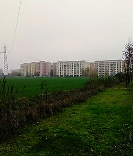
Roserio is a district ("quartiere") of Milan, Italy, part of the Zone 8 administrative division of the city. It is the northernmost district, bordering on the comune of Baranzate. Before being annexed to Milan, it has been an autonomous comune, as well as part of Bollate and of Musocco.
Roserio is best known for the Luigi Sacco hospital, located in Piazzale Roserio, which is a prominent hospital of Milan, and the most advanced in the treatment of infectious diseases.
Roserio's main connection to Milan is a tramway (line 12) that has its terminal in Piazzale Roserio; the tramway goes south to the very centre of Milan (Piazza Duomo). Anyway, due to its geographical location, Roserio is much more connected to Baranzate than it is to Milan.
Roserio is also the seat of a major CMP (Centro di Meccanizzazione Postale, Postal Mechanization Centre), i.e., a centre devoted to forwarding and sorting mail (especially international mail). In the 2000s, the Roserio CMP has been largely criticized for poor service, long delays and lost packages.[1]
History
Roserio developed from an ancient rural settlement. When the Milanese territory was partitioned into pieves, Roserio was assigned to the pieve of Bollate. Under Napoleonic rule, it became part of Bollate, to regain its autonomy with the advent of the Kingdom of Lombardy–Venetia. In 1869 it was annexed to Musocco, which in turn became part of Milan in 1923.[2]
After being annexed to Milan, the area of Roserio changed rapidly from a rural to a suburban environment. A major development of the area occurred with the construction of the Luigi Sacco hospital and connections to the A4 and Laghi motorways.
Bollate is a comune (municipality) in the Metropolitan City of Milan in the Italian region Lombardy, located about 10 kilometres (6 mi) northwest of Milan.
Garbagnate Milanese is a comune (municipality) in the Metropolitan City of Milan in the Italian region Lombardy, located about 15 kilometres (9 mi) northwest of Milan.
Baranzate, formerly a frazione of the neighboring comune of Bollate, is a comune (municipality) in the Metropolitan City of Milan, in the Italian region of Lombardy, about 8 kilometres (5 mi) northwest of Milan. It was created in 2004 after its previous establishment, in 2001, was declared unconstitutional.
The District of Milan was one of the four divisions of the Department of Olona, the province of Milan during the Napoleonic Italian Republic. It received the numeral I and its capital was Milan. Founded on May 13, 1801, it had a population of 217,807 inhabitants.
Taliedo is a peripheral district ("quartiere") of the city Milan, Italy, part of the Zone 4 administrative division, located south-east of the city centre. The informal boundaries of the district are three main city streets, respectively Via Mecenate, Via Bonfadini and Via Salomone.
Nosedo is a district ("quartiere") of the city of Milan, Italy. It is part of the Zone 4 administrative division, located south of the city centre. Until 1870, it was an autonomous comune. The name comes from the Latin nocetum, meaning "walnut forest", as walnut trees used to be common in the area.
Rogoredo is a former municipality, currently border district ("quartiere") of the city of Milan, Italy. It is part of the Zone 4 administrative division, and it is located 6–7 km south-east of the city centre. It borders on the Nosedo district to the east, on the Morsenchio district to the north, on the piazzale Corvetto neighbourhood to the north-west, and on the San Donato Milanese comune to the south-east. The name derives from the medieval Latin word robur, meaning "sessile oak, and stands for "oak wood".
Vigentino is a district ("quartiere") of Milan, Italy, part of the Zone 5 administrative division, located south of the city centre. Before 1923, Vigentino was an autonomous, rural comune. By the mid 20th century, agricultural activities were dismissed, and the area was largely urbanized, with the construction of large apartment blocks.
Vaiano Valle is a rural district ("quartiere") of Milan, Italy, part of the Zone 5 administrative division. It is located south of the city's urban area, within the Parco Agricolo Sud Milano nature reserve. Before 1869, it was an autonomous comune.
Chiaravalle is a district (quartiere) of Milan, Italy, part of the Zone 5 administrative division of the city. It is located in the periphery south of the city centre, within the Parco Agricolo Sud Milano nature reserve.
Quintosole is a district ("quartiere") of Milan, Italy, part of the Zone 5 administrative division. It is a rural district, located within the Parco Agricolo Sud Milano nature reserve, south of Milan's urban area. Before 1869, it was an autonomous comune.
Figino is a district ("quartiere") of Milan, Italy, part of the Zone 7 administrative division. It is located north-west of the centre, within the Parco Agricolo Sud Milano nature reserve. Before being annexed to Milan, in 1869, it was an autonomous comune, named Figino di Milano.
Baggio is a district (quartiere) of Milan, Italy, part of the Zone 7 administrative division of the city. Before being annexed to Milan in 1923, it was an autonomous comune.
Assiano is a rural district ("quartiere") of Milan, Italy, part of the Zone 7 administrative division. It is a border district, at the western end of the city area. Before being annexed to Milan, it was an autonomous comune, except for a brief period (1808-1816) when it was included in Cusago.
Villapizzone is a district ("quartiere") of Milan, Italy. It belongs to the Zone 8, located north of the city centre. It was an autonomous comune until 1869.
Garegnano is a district ("quartiere") of Milan, Italy, part of the Zone 8 administrative division of the city, north-west of the city centre. Before being annexed to Milan, it has been an autonomous comune, originally known as Garegnano Marcido.
Quarto Oggiaro is a district of Milan in the north-west of the city. It belongs to Zone 8, and has a population of 35000 inhabitants.
Vialba is a district ("quartiere") of Milan, Italy, part of the Zone 8 administrative division of the city. It is located north of the city centre, adjacent to the municipality (comune) of Novate Milanese. Until 1841, Vialba itself was an autonomous comune.
Affori is a ward of Milan, Italy, part of the Zone 9 administrative division of the city, located north of the city centre. It borders with the wards of Bruzzano, Comasina, Bovisasca, Dergano and Niguarda. Before being annexed to Milan in 1923, it was an autonomous comune.
Musocco is a district of Milan, located in the north-western outskirts of the city, belonging to Zone 8.
This page is based on this Wikipedia article Text is available under the CC BY-SA 4.0 license; additional terms may apply. Images, videos and audio are available under their respective licenses.