
San Siro, officially known as Stadio Giuseppe Meazza, is a football stadium in the San Siro district of Milan, Italy, which is the home of A.C. Milan and Internazionale. It has a seating capacity of 75,923, making it one of the largest stadiums in Europe, and the largest in Italy.

Corso Buenos Aires is a major street in north-eastern Milan, Italy. With over 350 shops and outlets, it features the highest concentration of clothing stores in Europe. The architecture of the area is mostly late 19th- and 20th-century style; the street and its surroundings are pointed with several neo-classical and art nouveau buildings.
Lambrate is a district (quartiere) of Milan, Italy, located within the Zone 3 administrative division, 6 km north-east of the city centre. It owes its name to the Lambro river that traverses the area. Lambrate houses one of the major railway stations of north-eastern Milan, the Stazione di Milano Lambrate. The district is also well known for Parco Lambro, a large urban park established in 1934. The famous Lambretta motor scooter was manufactured in Lambrate, and named after this district, as is Birrificio Lambrate, a craft brewery established in 1996.

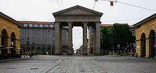
Porta Romana is a former city gate of Milan, Italy. In its present form, the gate dates back to the 16th century Spanish walls of Milan; its origins can be traced further back to the Roman walls of the city, which had a corresponding "Roman Gate" roughly in the same area. Porta Romana was the first and the main imperial entrance of the entire city of Milan, as it was the starting point of the road leading to Ancient Rome.
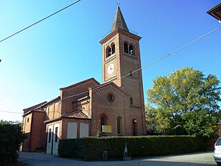
Monluè is a district ("quartiere") of Milan, Italy, part of the Zone 4 administrative division, located east of the city centre. It is a small residential district that originated as a rural settlement. As a consequence of its isolation from the city proper, it has maintained wide green areas and the general appearance of a small country town. The prominent landmark of the district is the eponymous Cascina Monluè, an ancient abbey built by the Humiliati religious order, that has been later adapted as a cascina (farmhouse) and is now used as the venue for a number of concerts and cultural events, especially in summer. Also of interest is the Church of Saint Lawrence, also built by the Humiliati in the 13th century.

Rogoredo is a former municipality, currently border district ("quartiere") of the city of Milan, Italy. It is part of the Zone 4 administrative division, and it is located 6–7 km south-east of the city centre. It borders on the Nosedo district to the east, on the Morsenchio district to the north, on the piazzale Corvetto neighbourhood to the north-west, and on the San Donato Milanese comune to the south-east. The name derives from the medieval Latin word robur, meaning "sessile oak, and stands for "oak wood".
Vigentino is a district ("quartiere") of Milan, Italy, part of the Zone 5 administrative division, located south of the city centre. Before 1923, Vigentino was an autonomous, rural comune. By the mid 20th century, agricultural activities were dismissed, and the area was largely urbanized, with the construction of large apartment blocks.
Porta Ticinese is a former city gate of Milan, Italy. The gate, facing south-west, was first created with the Spanish walls of the city, in the 16th century, but the original structure was later demolished and replaced in the early 19th century. The name "Porta Ticinese" is used both to refer to the gate proper and to the surrounding district, part of the Zone 6 administrative division. In the same district there is also a homonymous medieval gate, although in common speech the name "Porta Ticinese" is usually assumed to refer to the 19th century gate.

Barona is a border district ("quartiere") of the city of Milan, Italy. It is part of the Zone 6 administrative division, and it is located south of the city centre. Its population can be roughly estimated to 85,000. It borders on the comunes of Buccinasco, Assago, and Corsico and the districts of Lorenteggio and Torretta. Its boundaries are marked by the Parco Agricolo Sud Milano nature reserve to the south, by the Naviglio Grande and Naviglio Pavese canals to the east and to the west, and by the Circonvallazione ring road to the north.

Giambellino and Lorenteggio are two historical and populous residential neighborhoods of Milan, Italy. Together, they form a district ("quartiere"), part of the Zone 6 administrative division of Milan.

Porta Magenta, formerly known as Porta Vercellina, was one of the city gates of Milan, Italy. The gate was established in the 9th century, with the Roman walls of the city; it was moved with the medieval and Spanish walls, and was finally demolished in the 19th century. The phrase "Porta Magenta" is now used to refer to the district ("quartiere") where the gate used to be; the district is part of the Zone 7 administrative division of Milan, west of the city centre.
Quarto Cagnino is a district (quartiere) of Milan, Italy, part of the Zone 7 administrative division of the city. It borders the districts of Trenno (north), San Siro (east), Baggio (south), and Quinto Romano (west). Before being annexed to Milan, in 1869, it was an autonomous comune and, briefly, a part of Trenno.

Baggio is a district (quartiere) of Milan, Italy, part of the Zone 7 administrative division of the city. Before being annexed to Milan in 1923, it was an autonomous comune.
Ghisolfa is a district ("quartiere") of Milan, Italy, part of the Zone 8 administrative division of the city, located north-west of the city centre. It is named after the "Ghisolfa Bridge" overpass, part of the external Circonvallazione ring road enclosing the centre of Milan. In turn, the bridge was named after two cascine, "Cascina Ghisolfa" and "Cascina Ghisolfetta", that existed in the area before the urbanization of the mid 20th century. The bridge was completed in 1941, prolonged in the 1960s, and enlarged in the 1990s.

Villapizzone is a district ("quartiere") of Milan, Italy. It belongs to the Zone 8, located north of the city centre. It was an autonomous comune until 1869.

Gallaratese is a district ("quartiere") of Milan, Italy, part of the Zone 8 administrative division of the city. It is located about 7 km north-west of the city centre. It borders on the comune of Pero to the north and on the districts of Trenno to the west and Lampugnano to the south; to the east, its ideal border is the eponymous street, which in turn is named after Gallarate, the town it leads to.
Trenno is a district ("quartiere") of Milan, Italy, part of the Zone 8 administrative division of the city. It borders on green areas to the north and west and to the south ; to the east, it is adjacent to the Gallaratese district. Before being annexed to Milan, in 1923, it was an autonomous comune.
Bicocca is a district ("quartiere") of Milan, Italy, part of the Zone 9 administrative division. It was incorporated in the city in 1841. The main historic landmark of the district is the 15th century Villa Arcimboldi. In the last decades of the 20th century, the district has been subject to a major requalification project that led to the construction of important facilities such as the University of Milan Bicocca seats and the Teatro degli Arcimboldi theatre.

The Zone 2 of Milan is one of the 9 administrative zones of Milan, Italy. In the "sunburst" geometry of the zones of Milan, Zone 2 is the slice that connects the centre to the periphery in the north-east direction.
The Zone 1 of Milan, since 2016 officially Municipality 1 of Milan, is one of the 9 administrative administrative divisions of Milan, Italy.
