Related Research Articles

Chico is the most populous city in Butte County, California, United States. As of the 2010 United States Census, the population was 86,187, reflecting an increase of 26,233 from the 59,954 counted in the 2000 Census. Following the 2018 Camp Fire that destroyed much of the neighboring town of Paradise, the population of Chico surged as many people who lost their homes in the fire moved to Chico. In 2019, the US Census estimated the population of Chico is 103,301. The city is the cultural, economic, and educational center of the northern Sacramento Valley and home to both California State University, Chico and Bidwell Park, the country's 26th largest municipal park and the 13th largest municipally-owned park. Bidwell Park makes up over 17% of the city.

Arbutus menziesii, the Pacific madrone or madrona, is a species of tree in the family Ericaceae, native to the western coastal areas of North America, from British Columbia to California.
Big Basin Redwoods State Park is a state park in the U.S. state of California, located in Santa Cruz County, about 36 km (22 mi) northwest of Santa Cruz. The park contains almost all of the Waddell Creek watershed, which was formed by the seismic uplift of its rim, and the erosion of its center by the many streams in its bowl-shaped depression.
Trione-Annadel State Park is a state park of California in the United States. It is situated at the northern edge of Sonoma Valley and is adjacent to Spring Lake Regional Park in Santa Rosa. It offers many recreational activities within its 5,092-acre (2,061 ha) property.
Area code 530 is a California telephone area code in northeastern and Northern California.

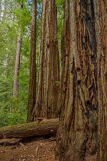
Berry Creek is a census-designated place about 25 miles (40 km) northeast of Oroville, California in hilly terrain at 2,000 feet (610 m) above mean sea level. The community is located along the Oroville-Quincy Highway on the shore of Madrone Lake. The community is home to Berry Creek Elementary School (K-8), 2 small mountain churches, 1 mini mart w/ gas, 1 small community park. Berry Creek is home to the annual Berry Festival which is held during August.
Las Trampas Regional Wilderness is a 5,342-acre (21.62 km2) regional park located in Alameda and Contra Costa counties in Northern California. The nearest city is Danville, California. Las Trampas is Spanish for the traps, or the snares. The park belongs to the East Bay Regional Park District (EBRPD).

Sugarloaf Ridge State Park is a state park in Northern California, U.S.A.. Located in the Mayacamas Mountains north of Kenwood, the park straddles the boundary between Sonoma and Napa counties. The park contains the 2,729-foot (832 m) Bald Mountain and the headwaters of Sonoma Creek including a 25-foot (8 m) tall seasonal waterfall. The park is also home to the volunteer-run Robert Ferguson Observatory. Camping, picnicking, horseback riding, mountain biking, stargazing, fishing and hiking are common attractions of Sugarloaf. The park boasts 25 miles of trails with trails ranging from less than a mile to 8.8 miles, and elevation gains reaching 2,500 feet.

The Landels-Hill Big Creek Reserve is a constituent of the University of California Natural Reserve System. It is located off State Route 1 in the Big Sur area on California's central coast, fifty miles south of Monterey and adjacent to the Big Creek State Marine Reserve and Big Creek State Marine Conservation Area.
The Berry Creek Rancheria of Tyme Maidu Indians are a Native American people inhabiting a northeastern part California, south of Lassen Peak.
Garrity Creek is a 3.0-mile-long (4.8 km) creek in Richmond, California's Hilltop neighborhood. It runs into San Pablo Bay. It is sometimes called Hilltop Creek.
Rodeo Creek is an 8.3-mile-long (13.4 km) intermittent stream in western Contra Costa County, California running through the town of Rodeo to San Pablo Bay.

Alhambra Creek is a stream in Contra Costa County, in the East Bay region of the San Francisco Bay Area in northern California.
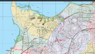
Virginia Mills is a former settlement in Butte County, California, United States. It was located on Berry Creek. A post office operated in Virginia Mills under the name Berry Creek, named from the water way.

Oak Creek Hills is an unincorporated community in El Dorado County, California. It lies at an elevation of 591 feet.

The Bitter Creek National Wildlife Refuge is located in the foothills of the southwestern San Joaquin Valley in Kern County, California. The refuge is one of four units of the Hopper Mountain National Wildlife Refuge Complex for California condors.

Visalia, California, commonly known in the 1850s as Four Creeks, is the oldest continuously inhabited inland European settlement between Stockton and Los Angeles. The city played an important role in the American colonization of the San Joaquin Valley as the county seat of Old Tulare County, an expansive region comprising most if not all of modern-day Fresno, Kings, and Kern counties.

Southwest Bakersfield is the southwest region of Bakersfield, California. It is roughly bounded by the Kern River to the north and Oak Street/Wible Road to the east. The other boundaries are the city limits themselves.

Kinderhook Creek is a 49.0-mile-long (78.9 km) tributary to Stockport Creek, an inlet of the Hudson River in the United States. From its source in Hancock, Massachusetts, the creek runs southwest through the Taconic Mountains into Rensselaer County, New York, and then into Columbia County. It flows through the towns of Stephentown, New Lebanon, Nassau, Chatham, Kinderhook and Stuyvesant to its mouth at Stockport Creek in the town of Stockport.

Pine Creek Wilderness is a wilderness area designated by Congress in 1984. It is located entirely in California, and managed by United States Forest Service as part of the Cleveland National Forest.
References
- 1 2 Durham, David L. (1998). California's Geographic Names: A Gazetteer of Historic and Modern Names of the State. Clovis, Calif.: Word Dancer Press. p. 193. ISBN 1-884995-14-4.

| | This Butte County, California-related article is a stub. You can help Wikipedia by expanding it. |