South Yuba City is an unincorporated community and former census-designated place (CDP) in Sutter County, California, United States. It is part of the Yuba City Metropolitan Statistical Area within the Greater Sacramento CSA. The population was 12,651 at the 2000 census.
Pacific Heights is a former settlement in Butte County, California, United States. It was located 3.25 miles (5.2 km) west-northwest of Palermo. Nearby was the mining camp of Lava Beds, inhabited by Chinese miners.

The Feather River is the principal tributary of the Sacramento River, in the Sacramento Valley of Northern California. The river's main stem is about 73 miles (117 km) long. Its length to its most distant headwater tributary is just over 210 miles (340 km). The main stem Feather River begins in Lake Oroville, where its four long tributary forks join together—the South Fork, Middle Fork, North Fork, and West Branch Feather Rivers. These and other tributaries drain part of the northern Sierra Nevada, and the extreme southern Cascades, as well as a small portion of the Sacramento Valley. The total drainage basin is about 6,200 square miles (16,000 km2), with approximately 3,604 square miles (9,330 km2) above Lake Oroville.
Pinnacles Provincial Park is a provincial park in British Columbia, Canada, located just west of Quesnel, north of Baker Creek.

Centerville is an unincorporated community in Butte County, California along Butte Creek. It was midway between Helltown and Diamondville. The area is about one and three quarters miles, straight-line distance, west of Paradise.

Inskip is an unincorporated community in Butte County, California. It lies at an elevation of 4,777 feet in the northern Sierra Nevada.

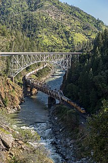
Pulga is an unincorporated community in Butte County, California. It is located along the west slope of the Feather River canyon, at an elevation of 1398 feet. A variant name for the community is Big Bar. Other nearby communities include Mayaro, Poe and Parkhill. The town hosts a Caltrans highway maintenance station along State Route 70 (SR70). The place is at the mouth of the Flea Valley Creek, which gives rise to the toponym.

West Linda is an unincorporated community in Yuba County, California. It lies at an elevation of 62 feet.
Warrior Mountain Wildlife Management Area is a Wildlife Management Area in Oldtown, Allegany County, Maryland.

Bidwell is a former settlement in Butte County, California, United States. It was located 1.25 miles (2.0 km) west of Bidwell's Bar on the Western Pacific Railroad, and Feather River Railway at an elevation of 902 feet. The settlement was near the Bidwell-Sacramento River State Park, and has been inundated by Lake Oroville.

Blavo is an unincorporated community in Butte County, California. It lies at an elevation of 138 feet. Blavo is located 10 miles (16 km) west-northwest of Oroville on the Sacramento Northern Railroad.

Craig is an unincorporated community in Butte County, California. It lies 2 miles (3.2 km) west-northwest of Honcut on the Western Pacific Railroad, at an elevation of 95 feet. Both "Craig" and "Marston" were names of railroad officials.

Land is a former settlement in Butte County, California, United States. It was located 1.5 miles (2.4 km) west-southwest of Bidwell's Bar on the Western Pacific Railroad, at an elevation of 902 feet. Land is now covered by Lake Oroville. The place was named for A.H. Land, a lumber company president.

Nelson Bar is a former settlement in Butte County, California. It was located 5.25 miles (8.45 km) southeast of Paradise on the West Branch of the Feather River, at an elevation of 974 feet. It is now under Lake Oroville.

Oroville Junction is an unincorporated community in Butte County, California. It is located 5 miles (8.0 km) west of Oroville on the abandoned right of way of the Sacramento Northern Railroad, at an elevation of 164 feet.

Ramada is an unincorporated community in Butte County, California. It is located 9 miles (14 km) west-northwest of Oroville on the Sacramento Northern Railroad, at an elevation of 138 feet.

Richland is a former settlement in Butte County, California. It was located 3.5 miles (5.6 km) east-southeast of Biggs, at an elevation of 102 feet. It still appeared at its prior location on maps as of 1912 but moved half a mile west by 1952.

Shippee is an unincorporated community in Butte County, California. It lies at an elevation of 131 feet. It is 7.5 miles (12.1 km) west-northwest of Oroville on the Sacramento Northern Railroad and the Northern Electric Railroad.

Raco is an unincorporated community in Fresno County, California. It is located on the Southern Pacific Railroad 4.25 miles (6.8 km) southwest of Herndon, at an elevation of 269 feet.

Alamorio is an unincorporated community in Imperial County, California. It is located 12.5 miles (20 km), north-northwest of Holtville, at an elevation of 128 feet below sea level. The community resides along the Alamo River, and was named by combining the Spanish words alamo, and rio.


