The London Borough of Newham is a London borough created in 1965 by the London Government Act 1963. It covers an area previously administered by the Essex county boroughs of West Ham and East Ham, authorities that were both abolished by the same act. The name Newham reflects its creation and combines the compass points of the old borough names. Situated in the Inner London part of East London, Newham has a population of 387,576, which is the fourth highest of the London boroughs and also makes it the 26th most populous district in England. The local authority is Newham London Borough Council.

Fordingbridge is a town and broader civil parish with a population of 6,000 on the River Avon in the New Forest District of Hampshire, England, near the Dorset and Wiltshire borders and on the edge of the New Forest, famed for its late medieval seven-arch bridge.

The Borough of Ashford is a local government district with borough status in Kent, England. It is named after its largest town, Ashford, where the council is based. The borough also includes the town of Tenterden and an extensive surrounding rural area including numerous villages; with an area of 580 square kilometres (220 sq mi), it is the largest district in Kent. Parts of the borough lie within the designated Areas of Outstanding Natural Beauty of High Weald and the Kent Downs.

Ham Street railway station is a Grade II listed stop on the Marshlink line in the village of Hamstreet, Kent, between Ashford International and Hastings. Services are provided by Southern.

Chilham is a village and civil parish in the Borough of Ashford in Kent, England. It sits on the north bank of the Great Stour around 5+1⁄2 miles (8.9 km) to the southwest of Canterbury and 7 miles (11 km) northeast of Ashford. It is a mostly agricultural parish, with settlement clustered around Chilham village centre, which is next to the Grade I-listed Chilham Castle. Well-preserved roads and mostly residential listed buildings in the centre have led to its use as a location in television and film. Also lying within the civil parish is the smaller linear settlement of Shottenden, which is situated 1+1⁄2 miles (2.4 km) west of Chilham.
Yaxham is a village and civil parish in centre of the English county of Norfolk. The parish includes the village of Yaxham, together with the neighbouring community of Clint Green and the hamlet of Brakefield Green. Together, they lie some 2 miles (3.2 km) south of Dereham and 20 miles (32 km) west of Norwich.

Mersham is a mostly agricultural large village and civil parish near Ashford in Kent, England. The population of the civil parish includes the area of Cheesman's Green now known as Finberry.

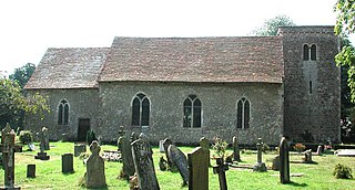
Hamstreet is a village in Kent, in South East England.

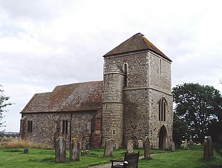
Warehorne is a village and civil parish in the south of the Ashford Borough of Kent, England. It is a scattered community centred on the Hamstreet to Tenterden road (B2067) around seven miles SSW of Ashford. The Royal Military Canal passes through the south of the civil parish.
Ruckinge is a village and civil parish in south Kent centred 5.5 miles (8.9 km) south of Ashford on the B2067 Hamstreet to Hythe road, with two settled neighbourhoods. It is, broadly defined, a narrow, fairly large rural parish of land which is about one quarter woodland.
Kenardington is a small clustered village and the centre of a relatively small rural civil parish of the same name, in the Ashford District of Kent, England. The village is centred 8 miles (13 km) southwest of Ashford on the B2067 Hamstreet to Tenterden road.
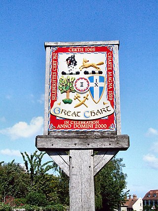
Great Chart is a village and former civil parish, now in the parish of Great Chart with Singleton, in the Ashford borough of Kent, England. The parish is split between the ancient village of Great Chart and the modern Singleton neighbourhood on the western outskirts of Ashford. The village centre of Great Chart is 2 miles (3.2 km) from the town centre. In 1961 the parish had a population of 969.

Hothfield is a village and civil parish in the Ashford Borough of Kent, England and is 3 miles north-west of Ashford on the A20. It is completely split in two by Hothfield Common.

Rolvenden is a village and civil parish in the Ashford District of Kent, England. The village is centred on the A28 Ashford to Hastings road, 5 miles (8.0 km) south-west of Tenterden.

Kingsnorth is a village and civil parish in the Borough of Ashford in Kent, England. The civil parish adjoins the town of Ashford.

Molash is a civil parish and village in Kent, South East England. It contains a small part of an Area of Outstanding Natural Beauty (AONB) - the North Downs - and is on the A252 road between Canterbury, Ashford and Faversham. Each of these is centred 7 miles (11 km) away.
Smeeth is a mostly agricultural land use village and civil parish, centred 4 miles (6.4 km) east of Ashford in the Ashford Borough of Kent, England.
Westwell is a village and relatively elevated civil parish centred 4 miles (6 km) north of Ashford in Kent, England, in the Borough of Ashford.

Woodchurch is a Kent village, the largest civil parish in the Borough of Ashford. It is centred 6 miles (9.7 km) from the market town of Ashford and 4 miles (6 km) from the Cinque Ports town of Tenterden, in Kent, South East England.

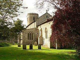
Snave is a village and former civil parish, now in the parish of Brenzett, in the Folkestone and Hythe district, in the county of Kent, England. It is on Romney Marsh in Kent, England centred close to the A2070 road 8 miles (13 km) south of Ashford. Its buildings are a few houses, barns and store sheds and the church of St Augustine which holds one service per year at harvest festival. In spring, the churchyard is heavily clad in daffodils. The church falls under the ecclesiastical parish of Orlestone with Snave, in the Diocese of Canterbury. In 1931 the parish had a population of 70.

