Oxford Historic District (Oxford, Pennsylvania)

Last updated

Oxford Historic District
Oxford PA downtown.jpg
Oxford Historic District, December 2009
USA Pennsylvania location map.svg
Red pog.svg
Usa edcp location map.svg
Red pog.svg
LocationRoughly bounded by Church Rd. Chase St., Hodgson St., Oxford, Pennsylvania
Coordinates 39°47′07″N75°58′44″W / 39.78528°N 75.97889°W / 39.78528; -75.97889
Area640 acres (260 ha)
Built1833
Architectural styleQueen Anne, Italianate, et al.
NRHP reference No. 06001336 [1]
Added to NRHPFebruary 1, 2007

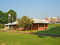
The Oxford Historic District is a national historic district that is located in Oxford, Chester County, Pennsylvania.

Contents

It was added to the National Register of Historic Places in 2007. [1]

History and architectural features

This district encompasses 517 contributing buildings, one contributing site, and one contributing structure that are located in the central business district and surrounding residential areas of Oxford. They are mostly brick residential and commercial structures that were built between 1870 and 1910 and in a variety of popular architectural styles including Queen Anne and Italianate. Notable non-residential buildings include the Oxford Hall, Octoraro Hotel, Oxford Station (Borough Hall), Dickey Building, Masonic Building, Fulton Bank Building (1925), Gibson's Store (c. 1832), Orthodox Friends Meeting House, Methodist Church (1885), United Presbyterian Church (1893), and the Oxford Grain & Hay Company granary (1880). The Oxford Hotel is also located in the district, but is listed separately. [2]

References

  1. 1 2 "National Register Information System". National Register of Historic Places . National Park Service. July 9, 2010.
  2. Robert J. Wise, Jr. (January 2006). National Register of Historic Places Registration: Pennsylvania SP Oxford Historic District. National Archives and Records Administration. Retrieved December 15, 2025. (Downloading may be slow.)