Palermo, New Jersey

Last updated

Palermo, New Jersey
Location map of Cape May County, New Jersey.svg
Red pog.svg
Palermo
Location in Cape May County
USA New Jersey relief location map.svg
Red pog.svg
Palermo
Location in New Jersey
Usa edcp relief location map.png
Red pog.svg
Palermo
Location in the United States
Coordinates: 39°14′24″N74°40′21″W / 39.24000°N 74.67250°W / 39.24000; -74.67250
Country Flag of the United States.svg  United States
State Flag of New Jersey.svg  New Jersey
County Cape May
Township Upper
Area
[1]
  Total
3.18 sq mi (8.23 km2)
  Land3.11 sq mi (8.06 km2)
  Water0.06 sq mi (0.16 km2)
Elevation
16 ft (5 m)
Population
 (2020) [2]
  Total
3,183
  Density1,022.81/sq mi (394.86/km2)
Time zone UTC−05:00 (Eastern (EST))
  Summer (DST) UTC−04:00 (EDT)
FIPS code 34-55710 [3]
GNIS feature ID879097 [4]

Palermo is an unincorporated community and census-designated place (CDP) [5] located in Upper Township, in Cape May County, in the U.S. state of New Jersey. [6] [4]

Contents

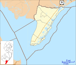
Palermo is located 14 mi (23 km) northeast of Cape May Court House.

The Palermo Air Force Station, closed in 1970, was located south of Palermo. [7]
History

An early settler, Henry Young, arrived in New Jersey aboard a whaling vessel prior to 1700, and established a plantation extending west from Palermo. [8]

The Friendship School in Palermo was built around 1830 and was restored in 1980. It is one of the oldest schools in Upper Township. [9]

A post office was established in 1872. [10]

The Ocean City Railroad constructed a line through Palermo, and a station was erected there in 1897. The line later became part of the Pennsylvania-Reading Seashore Lines. [11] The line is now abandoned. [12]

In 1953, a proposed extension of the Garden State Parkway was to be constructed through Palermo. Several Upper Township farmers complained about the route, including one from Palermo who claimed "the parkway went through the center of his piggery". [13] :234 A commission was established to settle disputes between farmers and the Parkway Authority. [13]

Demographics

Historical population
CensusPop.Note
2020 3,183
U.S. Decennial Census [14]
2020 [2]

Palermo was first listed as a census designated place in the 2020 U.S. Census. [15]

As of 2020, the population was 3,183. [2]

Education

As with other parts of Upper Township, the area is zoned to Upper Township School District [16] (for grades K-8) and Ocean City School District (for high school). The latter operates Ocean City High School.

Countywide schools include Cape May County Technical High School [17] [18] and Cape May County Special Services School District.

References

  1. "ArcGIS REST Services Directory". United States Census Bureau. Retrieved October 11, 2022.
  2. 1 2 3 Census Data Explorer: Palermo CDP, New Jersey, United States Census Bureau. Accessed June 15, 2023.
  3. Geographic Codes Lookup for New Jersey, Missouri Census Data Center. Accessed June 9, 2023.
  4. 1 2 U.S. Geological Survey Geographic Names Information System: Palermo
  5. State of New Jersey Census Designated Places - BVP20 - Data as of January 1, 2020, United States Census Bureau. Accessed December 1, 2022.
  6. Locality Search, State of New Jersey. Accessed June 9, 2016.
  7. U.S. Geological Survey Geographic Names Information System: Palermo Air Force Station (historical)
  8. Ray, Wynn, ed. (1913). The Young Family. H. Stanley Craig. p.  12.{{cite book}}: |work= ignored (help)
  9. "Jersey Cape's Historic Sites". Cape May County Department of Tourism. June 20, 2012.
  10. Law, Mary (March 1993). "Postal History of Upper Township in Cape May County, NJ" (PDF). Journal of the New Jersey Postal History Society. 21 (2). New Jersey Postal History Society: 40. Retrieved April 24, 2015.
  11. Treese, Lorett (2006). Railroads of New Jersey: Fragments of the Past in the Garden State Landscape. Stackpole Books. p. 200. ISBN   9780811732604.
  12. "Ocean City Railroad". Abandoned Rails. Retrieved October 11, 2016.
  13. 1 2 Dorwart, Jeffery M. (1992). Cape May County, New Jersey: The Making of an American Resort Community. Rutgers University. p. 234. ISBN   9780813517841.
  14. Census of Population and Housing, United States Census Bureau. Accessed June 1, 2023.
  15. "2020 Geography Changes". United States Census Bureau.
  16. "2020 CENSUS - SCHOOL DISTRICT REFERENCE MAP: Cape May County, NJ" (PDF). U.S. Census Bureau . Retrieved April 8, 2024.
  17. Frequently Asked Questions Archived October 27, 2019, at the Wayback Machine , Cape May County Technical High School. Accessed October 27, 2019. "All residents of Cape May County are eligible to attend Cape May County Technical High School.... The Cape May County Technical High School is a public school so there is no cost to residents of Cape May County."
  18. Technical High School Admissions Archived October 27, 2019, at the Wayback Machine , Cape May County Technical High School. Accessed October 27, 2019. "All students who are residents of Cape May County may apply to the Technical High School."