Palos Blancos, Corozal, Puerto Rico

Last updated
Palos Blancos
Barrio
Barrio Palos Blancos, Corozal, Puerto Rico.jpg
View from Palos Blancos
Palos Blancos, Corozal, Puerto Rico locator map.png
Location of Palos Blancos within the municipality of Corozal shown in red
Caribbean location map.svg
Red pog.svg
Palos Blancos
Location of Puerto Rico
Coordinates: 18°17′27″N66°18′09″W / 18.29085°N 66.302568°W / 18.29085; -66.302568 [1]
Commonwealth Flag of Puerto Rico.svg  Puerto Rico
Municipality Corozal.svg Corozal
Area
[1]
  Total4.98 sq mi (12.9 km2)
  Land4.98 sq mi (12.9 km2)
  Water0 sq mi (0 km2)
Elevation
[2]
1,345 ft (410 m)
Population
 (2010)
  Total3,458
  Density695.8/sq mi (268.6/km2)
 Source: 2010 Census
Time zone UTC−4 (AST)

Palos Blancos is a rural barrio in the municipality of Corozal, Puerto Rico. Its population in 2010 was 3,458. [3] [4] [5]

Contents

History

Palos Blancos was in Spain's gazetteers [6] until Puerto Rico was ceded by Spain in the aftermath of the Spanish–American War under the terms of the Treaty of Paris of 1898 and became an unincorporated territory of the United States. In 1899, the United States Department of War conducted a census of Puerto Rico finding that the population of Palos Blancos barrio was 1,367. [7]

Features and demographics

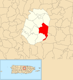
Palos Blancos has 4.98 square miles (12.9 km2) of land area and no water area. In 2010, its population was 3,458 with a population density of 695.8 inhabitants per square mile (268.6/km2).

Historical population
CensusPop.Note
1900 1,367
1910 1,4798.2%
1920 1,5202.8%
1930 1,5522.1%
1940 1,89722.2%
1950 2,22917.5%
1960 2,53313.6%
1970 2,143−15.4%
1980 2,3559.9%
1990 2,91923.9%
2000 3,66425.5%
2010 3,458−5.6%
U.S. Decennial Census
1899 (shown as 1900) [8] 1910-1930 [9]
1930-1950 [10] 1980-2000 [11] 2010 [12]

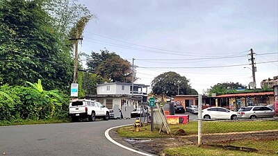
PR-803 is the main north-south road through Palos Blacos. [13]

Monte Choca State Forest

Located in Palos Blancos barrio is Monte Choca State Forest which was declared a state forest with law # 295 on November 21, 2003. [14] [15] [16] [17] Its area is about 244.76 acres and it is located at one of the highest elevations in Corozal. [18]

Sectors

Barrios (which are, in contemporary times, roughly comparable to minor civil divisions) [19] in turn are further subdivided into smaller local populated place areas/units called sectores (sectors in English). The types of sectores may vary, from normally sector to urbanización to reparto to barriada to residencial, among others. [20] [21] [22]

The following sectors are in Palos Blancos barrio: [23]

Parcelas Medina, Sector Amado Suárez, Sector Baldino Ortiz, Sector Carretera (from Ángel Vázquez to Manuel Ortiz), Sector Colón, Sector Demetrio Pacheco, Sector El Cacique, Sector El Pegao, Sector El Siete (7), Sector Gobeo, Sector Héctor Ortiz, Sector La Arena, Sector La Loma, Sector La Perla, Sector La Pollera, Sector La Quinta, Sector La Riviera, Sector La Vega, Sector Lino Caldero, Sector Los Morales, Sector Los Rodríguez, Sector Los Bagué, Sector Los Febus, Sector Los Guzmanes, Sector Los Morales (Emérito), Sector Los Padilla, Sector Los Ramos, Sector Los Ruiz, Sector Los Velilla, Sector Maná, Sector Manuel Ortiz, Sector Marcelino López, Sector Nono Negrón, Sector Pepe Córdova, Sector Pepín Rodríguez, Sector Quiliche, Sector Rolo Pacheco, Sector Pura Molina, Sector Tato López, Sector Varela, and Sector Virella.

See also

Related Research Articles

<span class="mw-page-title-main">Corozal, Puerto Rico</span> Town and municipality in Puerto Rico

Corozal is a town and municipality of Puerto Rico located in the central-eastern region, north of Orocovis and Barranquitas; south of Vega Alta; southwest of Toa Alta; east of Morovis and Orocovis; and west of Naranjito. Corozal is spread over 12 barrios and Corozal Pueblo. It is part of the San Juan-Caguas-Guaynabo Metropolitan Statistical Area.

<span class="mw-page-title-main">Frailes, Guaynabo, Puerto Rico</span> Barrio of Puerto Rico

Frailes is a barrio in the municipality of Guaynabo, Puerto Rico. Its population in 2010 was 32,050.

<span class="mw-page-title-main">Palmarejo, Corozal, Puerto Rico</span> Barrio of Puerto Rico

Palmarejo is a rural barrio with an urban zone in the municipality of Corozal, Puerto Rico. Its population in 2010 was 6,068.

<span class="mw-page-title-main">Cibuco, Corozal, Puerto Rico</span> Barrio of Puerto Rico

Cibuco is a rural barrio with an urban zone in the municipality of Corozal, Puerto Rico. Its population in 2010 was 5,387.

<span class="mw-page-title-main">Pueblo, Corozal, Puerto Rico</span> Barrio of Puerto Rico

Pueblo is an urban barrio in the municipality of Corozal, Puerto Rico. Its population in 2010 was 2,991.

<span class="mw-page-title-main">Ortíz, Toa Alta, Puerto Rico</span> Barrio of Puerto Rico

Ortíz is a large barrio in the municipality of Toa Alta, Puerto Rico. Its population in 2010 was 26,580.

<span class="mw-page-title-main">Abras, Corozal, Puerto Rico</span> Barrio of Puerto Rico

Abras is a rural barrio with a small urban area in the municipality of Corozal, Puerto Rico. Its population in 2010 was 2,262.

<span class="mw-page-title-main">Maná, Corozal, Puerto Rico</span> Barrio of Puerto Rico

Maná is a rural barrio in the municipality of Corozal, Puerto Rico. Its population in 2010 was 2,093.

<span class="mw-page-title-main">Negros, Corozal, Puerto Rico</span> Barrio of Puerto Rico

Negros is a rural barrio in the municipality of Corozal, Puerto Rico. Its population in 2010 was 1,398.

<span class="mw-page-title-main">Padilla, Corozal, Puerto Rico</span> Barrio of Puerto Rico

Padilla is a rural barrio in the municipality of Corozal, Puerto Rico. Its population in 2010 was 3,653.

<span class="mw-page-title-main">Dos Bocas, Corozal, Puerto Rico</span> Barrio of Puerto Rico

Dos Bocas is a rural barrio with an urban zone in the municipality of Corozal, Puerto Rico. Its population in 2010 was 3,060.

<span class="mw-page-title-main">Palmarito</span> Barrio of Corozal, Puerto Rico

Palmarito is a rural barrio in the municipality of Corozal, Puerto Rico. Its population in 2010 was 2,227.

<span class="mw-page-title-main">Magueyes, Corozal, Puerto Rico</span> Barrio of Puerto Rico

Magueyes is a rural barrio in the municipality of Corozal, Puerto Rico. Its population in 2010 was 363.

<span class="mw-page-title-main">Arenalejos, Arecibo, Puerto Rico</span> Barrio of Puerto Rico

Arenalejos is a barrio in the municipality of Arecibo, Puerto Rico. Its population in 2010 was 3,064. Arenalejos is near the center of Arecibo, west of Miraflores.

<span class="mw-page-title-main">Monte Choca State Forest</span> State forest in Puerto Rico

The Monte Choca State Forest is a 244.6-acre (0.990 km2), tropical moist forest, located in the municipality of Corozal in Puerto Rico. It is owned and maintained by the commonwealth of Puerto Rico and co-maintained by local conservation groups.

<span class="mw-page-title-main">Puerto Rico Highway 803</span> Highway in Puerto Rico

Puerto Rico Highway 803 (PR-803) is a north–south road that travels from eastern Corozal to southwestern Naranjito in Puerto Rico. With a length of 10.2 km (6.3 mi), it begins at PR-164 in Palmarejo barrio and ends at its junction with PR-152 and PR-802 in Cedro Arriba barrio.

<span class="mw-page-title-main">Puerto Rico Highway 805</span> Highway in Puerto Rico

Puerto Rico Highway 805 (PR-805) is an east–west road located in the municipality of Corozal in Puerto Rico. With a length of 7.3 km (4.5 mi), it extends from its intersection with PR-568 near the Cuchillas boundary, passing through Negros barrio until its junction with PR-803 in Palos Blancos area.

References

  1. 1 2 "US Gazetteer 2019". US Census. US Government.
  2. U.S. Geological Survey Geographic Names Information System: Palos Blancos barrio
  3. Picó, Rafael; Buitrago de Santiago, Zayda; Berrios, Hector H. (1969). Nueva geografía de Puerto Rico: física, económica, y social, por Rafael Picó. Con la colaboración de Zayda Buitrago de Santiago y Héctor H. Berrios. San Juan Editorial Universitaria, Universidad de Puerto Rico,1969.
  4. Gwillim Law (20 May 2015). Administrative Subdivisions of Countries: A Comprehensive World Reference, 1900 through 1998. McFarland. p. 300. ISBN   978-1-4766-0447-3 . Retrieved 25 December 2018.
  5. Puerto Rico: 2010 Population and Housing Unit Counts.pdf (PDF). U.S. Dept. of Commerce, Economics and Statistics Administration, U.S. Census Bureau. 2010.
  6. "Anuario del comercio, de la industria, de la magistratura y de la administración. 1881". Biblioteca Nacional de España (in Spanish). p. 1614. Retrieved 4 April 2023.
  7. Joseph Prentiss Sanger; Henry Gannett; Walter Francis Willcox (1900). Informe sobre el censo de Puerto Rico, 1899, United States. War Dept. Porto Rico Census Office (in Spanish). Imprenta del gobierno. p.  161.
  8. "Report of the Census of Porto Rico 1899". War Department Office Director Census of Porto Rico. Archived from the original on July 16, 2017. Retrieved September 21, 2017.
  9. "Table 3-Population of Municipalities: 1930 1920 and 1910" (PDF). United States Census Bureau. Archived (PDF) from the original on August 17, 2017. Retrieved September 21, 2017.
  10. "Table 4-Area and Population of Municipalities Urban and Rural: 1930 to 1950" (PDF). United States Census Bureau. Archived (PDF) from the original on August 30, 2015. Retrieved September 21, 2014.
  11. "Table 2 Population and Housing Units: 1960 to 2000" (PDF). United States Census Bureau. Archived (PDF) from the original on July 24, 2017. Retrieved September 21, 2017.
  12. Puerto Rico: 2010 Population and Housing Unit Counts.pdf (PDF). U.S. Dept. of Commerce Economics and Statistics Administration U.S. Census Bureau. 2010. Archived (PDF) from the original on 2017-02-20. Retrieved 2019-08-02.
  13. "P.L. 94-171 VTD/SLD Reference Map 001 (2010 Census): Corozal Municipio, PR" (PDF). www2.census.gov. U.S. DEPARTMENT OF COMMERCE Economics and Statistics Administration U.S. Census Bureau. Archived (PDF) from the original on 22 August 2020. Retrieved 23 August 2020.
  14. "Ley Núm. 295 de 21 de Noviembre de 2003. Ley que crea Bosque Monte Choca del Barrio Palos Blancos de Corozal". vLex (in Spanish).
  15. "Archived copy" (PDF). Archived from the original (PDF) on 2010-08-16. Retrieved 2019-03-08.{{cite web}}: CS1 maint: archived copy as title (link)
  16. http://www.drna.pr.gov/wp-content/uploads/2015/04/El-Bosque-Estatal-Monte-Choca.pdf [ bare URL PDF ]
  17. Adrian Hailey; Byron Wilson; Julia Horrocks (7 April 2011). Conservation of Caribbean Island Herpetofaunas Volume 2: Regional Accounts of the West Indies. BRILL. pp. 342–. ISBN   978-90-04-19409-0.
  18. "Aventura dentro por el Bosque Monte Choca en Corozal". El Nuevo Dia (in Spanish). 7 June 2015.
  19. "US Census Barrio-Pueblo definition". factfinder.com. US Census. Archived from the original on 13 May 2017. Retrieved 5 January 2019.
  20. "Agencia: Oficina del Coordinador General para el Financiamiento Socioeconómico y la Autogestión (Proposed 2016 Budget)". Puerto Rico Budgets (in Spanish). Retrieved 28 June 2019.
  21. Rivera Quintero, Marcia (2014), El vuelo de la esperanza: Proyecto de las Comunidades Especiales Puerto Rico, 1997-2004 (first ed.), San Juan, Puerto Rico Fundación Sila M. Calderón, ISBN   978-0-9820806-1-0
  22. "Leyes del 2001". Lex Juris Puerto Rico (in Spanish). Retrieved 24 June 2020.
  23. "PRECINTO ELECTORAL COROZAL 072" (PDF). Comisión Estatal de Elecciones (in Spanish). PR Government. 21 September 2019. Archived from the original (PDF) on 26 June 2020. Retrieved 24 June 2020.