Paniqui, Tarlac

Last updated
Paniqui
Municipality of Paniqui
Paniqui,Tarlacjf5565 10.JPG
Downtown area
Paniqui Tarlac.png
Seal
Etymology: Paniki (Bats)
Ph locator tarlac paniqui.png
Map of Tarlac with Paniqui highlighted
OpenStreetMap
Paniqui, Tarlac
Philippines location map (square).svg
Red pog.svg
Paniqui
Location within the Philippines
Coordinates: 15°40′N120°35′E / 15.67°N 120.58°E / 15.67; 120.58 Coordinates: 15°40′N120°35′E / 15.67°N 120.58°E / 15.67; 120.58
Country Flag of the Philippines.svg  Philippines
Region Central Luzon (Region III)
Province Tarlac
District 1st District
FoundedMarch 13, 1712
Barangays 35 (see Barangays)
Government
[1]
  Type Sangguniang Bayan
   Mayor Leonardo M. Roxas
   Vice Mayor Aida D. Roxas II
  CongressmanCarlos O. Cojuangco
  Electorate63,909 voters (2019)
Area
[2]
  Total105.16 km2 (40.60 sq mi)
Population
 (2015 census) [3]
  Total92,606
  Density880/km2 (2,300/sq mi)
  Households
22,013
Economy
   Income class 1st municipal income class
   Poverty incidence 12.2% (2015) [4]
  Revenue (₱)211,960,353.05 (2016)
Time zone UTC+8 (PST)
ZIP code
2307
PSGC
IDD : area code +63(0)45
Climate type tropical monsoon climate
Native languagesPangasinan
Ilocano
Tagalog
Kapampangan
Website www.paniqui.gov.ph

Paniqui, officially the Municipality of Paniqui (Ilocano : Ili ti Paniqui; Pangasinan : Baley na Paniqui; Kapampangan : Balen ning Paniqui; Tagalog : Bayan ng Paniqui), is a 1st class municipality in the province of Tarlac, Philippines. According to the 2015 census, it has a population of 92,606 people. [3]

Contents

It is the birthplace of the 11th President of the Philippines, Corazon C. Aquino.

Etymology

Paniqui is a Hispanized term derived from the Ilocano word "pampaniki" which means "bat", [5] since the town has a feature of caves that house a population of bats.

History

The birth of Paniqui could be traced way back in 1712 when the provincial government of Pangasinan sent a group of men south of Bayambang, Pangasinan for the expansion of the Christian faith. The pioneering group was led by two brothers, Raymundo and Manuel Paragas of Dagupan and established the Local Government in a Sitio called "manggang marikit" (mango of an unmarried woman) now part of Guimba, Nueva Ecija. Surprisingly, in this sitio, there is a great number of mammals called by Ilocanos "pampaniki" and it was from this term that the name Paniqui was derived.

An uprising led by Caragay during the early part of 1720 forced the Local Government in "manggang marikit" to abandon the place and to evacuate for lowland called Acocolao, a place two kilometers west of the present Poblacion. It was a historical sitio where the first Filipino Moro, Sultan Ali Mudin, was baptized in 1750.

Paniqui was a sprawling town that covered a wide area that time. Some of the barrios that formerly comprised Paniqui were "San Roque", now Cuyapo; "Barong", now Gerona; "San Jose De Camiling", now Camiling; "Bani", now Ramos; "San Ramon", now Moncada; and Anao.

The period between 1750 and 1896 were painful years of Spanish tyranny and oppression because the insurrectos and sometimes bandits, who are conveniently sprouted among the people, made sporadic attacks upon the conquistadores. These attacks on the Spaniards, who came on the islands bringing the sword and the cross, were marred by cholera and smallpox epidemics punctuated by floods and typhoons.

However, a group of Paniqui patriots, welded together by a common belief of oneness, unselfish devotion for freedom and who are spurred by ruthless Spanish tyranny, organized a legitimate segment of the Katipunan on January 12, 1896, which is far cry from the bandits that used to harass the Spaniards.

These dauntless men made daring exploits, unrecorded in the history of the Katipunan, the most prominent of which was the ambuscade of Spanish soldiers along the road going to Anao and killing a great number of them. These incidents made a prelude to the end of the Spanish occupation in Paniqui.

The advent of American occupation saw a happy transition from the almost aristocratic and enigmatic characteristic of Spanish conquistadores to the democratic way of life under American tutelage.

Geography

Paniqui is situated between the towns of Gerona in the south, Moncada in the north, Anao and Ramos in the west while Camiling and Santa Ignacia are to its east.

The town was originally part of the province of Pangasinan. It is first known as Manggang Marikit, a sitio of Pangasinan, in 1571 and as Pampaniki in 1686.

Paniqui is 146 kilometres (91 mi) from the nation's capital Manila and is 22 kilometres (14 mi) from the provincial capital, Tarlac City.

Barangays

Paniqui is politically subdivided into 35 barangays. [2]

  • Abogado
  • Acocolao
  • Aduas
  • Apulid
  • Balaoang
  • Barang
  • Brillante
  • Burgos
  • Cabayaoasan
  • Canan
  • Cariño, Paniqui, Tarlac
  • Cayanga
  • Colibangbang
  • Coral
  • Dapdap
  • Estacion
  • Mabilang
  • Manaois
  • Matalapitap
  • Nagmisaan
  • Nancamarinan
  • Nipaco
  • Patalan
  • Poblacion Norte
  • Poblacion Sur
  • Rang-ayan
  • Salomague
  • Samput
  • San Carlos
  • San Isidro
  • San Juan de Milla
  • Santa Ines
  • Sinigpit
  • Tablang
  • Ventenilla

Climate

Climate data for Paniqui, Tarlac
MonthJanFebMarAprMayJunJulAugSepOctNovDecYear
Average high °C (°F)30
(86)
31
(88)
33
(91)
35
(95)
33
(91)
31
(88)
30
(86)
29
(84)
29
(84)
30
(86)
31
(88)
30
(86)
31
(88)
Average low °C (°F)19
(66)
19
(66)
20
(68)
22
(72)
24
(75)
24
(75)
24
(75)
24
(75)
23
(73)
22
(72)
21
(70)
20
(68)
22
(71)
Average precipitation mm (inches)3
(0.1)
2
(0.1)
5
(0.2)
10
(0.4)
80
(3.1)
107
(4.2)
138
(5.4)
147
(5.8)
119
(4.7)
70
(2.8)
26
(1.0)
8
(0.3)
715
(28.1)
Average rainy days2.01.72.74.616.120.824.023.021.415.58.03.2143
Source: Meteoblue [6]

Demographics

Population census of Paniqui
YearPop.±% p.a.
1903 12,982    
1918 16,603+1.65%
1939 19,124+0.68%
1948 27,554+4.14%
1960 35,416+2.11%
1970 47,718+3.02%
1975 53,031+2.14%
1980 55,006+0.73%
1990 64,949+1.68%
1995 70,979+1.68%
2000 78,883+2.29%
2007 83,311+0.76%
2015 92,606+1.33%
Source: Philippine Statistics Authority [3] [7] [8] [9]
Paniqui Town Hall Paniqui,Tarlacjf5462 03.JPG
Paniqui Town Hall

In the 2015 census, the population of Paniqui, Tarlac, was 92,606 people, [3] with a density of 880 inhabitants per square kilometre or 2,300 inhabitants per square mile.

Language

The languages predominantly spoken by locals are Ilocano and Kapampangan, but Tagalog (as with most towns and cities in Luzon) and Pangasinan are also used frequently; however, where the older generation will use Ilocano to converse with each other, Tagalog is also being used more and more by the younger generation along with their mother languages. This is perhaps due to the influence of education, migration (especially to find work), television and mobile communications, which is extending the reach of previously localized peer groups.

Related Research Articles

Tarlac Province in Central Luzon, Philippines

Tarlac is a landlocked province located in the Central Luzon region of the Philippines. It is bounded on the north by the province of Pangasinan, Nueva Ecija on the east, Zambales on the west and Pampanga in the south. The province comprises three congressional districts and is subdivided into 17 municipalities and one city, Tarlac City, which is the provincial capital.

Central Luzon Administrative region of the Philippines

Central Luzon, designated as Region III, is an administrative region in the Philippines, primarily serving to organize the 7 provinces of the vast central plains of the island of Luzon, for administrative convenience. The region contains the largest plain in the country and produces most of the country's rice supply, earning itself the nickname "Rice Granary of the Philippines". Its provinces are: Aurora, Bataan, Bulacan, Nueva Ecija, Pampanga, Tarlac and Zambales.

Camiling, Tarlac Municipality in Central Luzon, Philippines

Camiling is a first-class urban municipality of the province of Tarlac in the Philippines. According to the 2015 census, it has a population of 83,248 people.

Bautista, Pangasinan Municipality in Ilocos Region, Philippines

Bautista, officially the Municipality of Bautista, is a 4th class municipality in the province of Pangasinan, Philippines. According to the 2015 census, it has a population of 32,307 people.

Bayambang, Pangasinan Municipality in Ilocos Region, Philippines

Bayambang, officially the Municipality of Bayambang, is a 1st class municipality in the province of Pangasinan, Philippines. According to the 2015 census, it has a population of 118,205 people.

San Nicolas, Pangasinan Municipality in Ilocos Region, Philippines

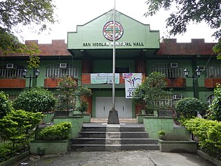
San Nicolas, officially the Municipality of San Nicolas, is a 1st class municipality in the province of Pangasinan, Philippines. According to the 2015 census, it has a population of 35,574 people.

Anao, Tarlac Municipality in Central Luzon, Philippines

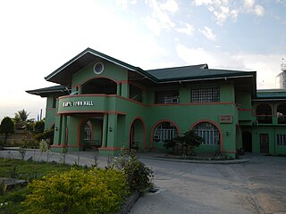
Anao, officially the Municipality of Anao, is a 5th class municipality in the province of Tarlac, Philippines. According to the 2015 census, it has a population of 11,528 people.

Capas Municipality in Central Luzon, Philippines

Capas is a first class highly urbanized municipality in the province of Tarlac, Philippines, and one of the richest towns in the province. The town also consists of numerous subdivisions and exclusive villages.

Gerona, Tarlac Municipality in Central Luzon, Philippines

Gerona, officially the Municipality of Gerona, is a 1st class municipality in the province of Tarlac, Philippines. According to the 2015 census, it has a population of 87,531 people.

Moncada, Tarlac Municipality in Central Luzon, Philippines

Moncada, officially the Municipality of Moncada, is a 1st class municipality in the province of Tarlac, Philippines. According to the 2015 census, it has a population of 57,787 people.

Ramos, Tarlac Municipality in Central Luzon, Philippines

Ramos, officially the Municipality of Ramos, is a 5th class municipality in the province of Tarlac, Philippines. According to the 2015 census, it has a population of 21,350 people. It was formerly named Bani, a barrio of the town of Paniqui from 1878 to December 31, 1920. On January 1, 1921, Bani became a town and was renamed "Ramos" in memory of Gov. Alfonso Ramos who first initiated the creation of the town.

San Clemente, Tarlac Municipality in Central Luzon, Philippines

San Clemente, officially the Municipality of San Clemente, is a 5th class municipality in the province of Tarlac, Philippines. According to the 2015 census, it has a population of 12,657 people.

San Manuel, Tarlac Municipality in Central Luzon, Philippines

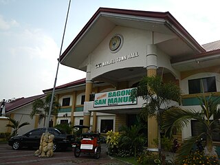
San Manuel, officially the Municipality of San Manuel, is a 4th class municipality in the province of Tarlac, Philippines. According to the 2015 census, it has a population of 25,504 people.

Tarlac City Component city in Central Luzon, Philippines

Tarlac City, officially the City of Tarlac, is a 1st class city and capital of the province of Tarlac, Philippines. According to the 2015 census, it has a population of 342,493 people.

Victoria, Tarlac Municipality in Central Luzon, Philippines

Victoria, officially the Municipality of Victoria, is a 2nd class municipality in the province of Tarlac, Philippines. According to the 2015 census, it has a population of 63,715 people.

Muñoz, Nueva Ecija Component city in Central Luzon, Philippines

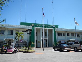
Muñoz, officially the Science City of Muñoz, is a 4th class city in the province of Nueva Ecija, Philippines. According to the 2015 census, it has a population of 81,483 people.

Cuyapo Municipality in Central Luzon, Philippines

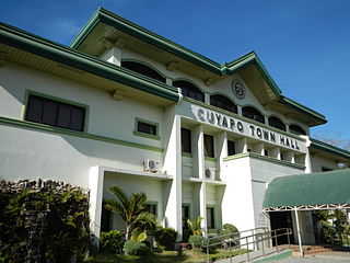
Cuyapo, officially the Municipality of Cuyapo, is a 1st class municipality in the province of Nueva Ecija, Philippines. According to the 2015 census, it has a population of 65,039 people.

Nampicuan, Nueva Ecija Municipality in Central Luzon, Philippines

Nampicuan, officially the Municipality of Nampicuan, is a 5th class municipality in the province of Nueva Ecija, Philippines. According to the 2015 census, it has a population of 14,954 people.

The legislative districts of Tarlac are the representations of the province of Tarlac in the various national legislatures of the Philippines. The province is currently represented in the lower house of the Congress of the Philippines through its first, second, and third congressional districts.

2019 Tarlac local elections Philippine local election

The Province of Tarlac held its local elections on Monday, May 13, 2019, as a part of the 2019 Philippine general election. Voters selected candidates for all local positions: a town mayor, vice mayor and town councilors, as well as members of the Sangguniang Panlalawigan, the vice-governor, governor and representatives for the three districts of Tarlac. In the gubernatorial race, Tarlac's incumbent Governor Susan Yap ran unopposed for Governor while incumbent Vice-Governor Carlito David defeated former Vice-Governor Pearl Pacada in a rematch of the 2016 elections.

References

  1. "Municipality". Quezon City, Philippines: Department of the Interior and Local Government. Retrieved 31 May 2013.
  2. 1 2 "Province: Tarlac". PSGC Interactive. Quezon City, Philippines: Philippine Statistics Authority . Retrieved 12 November 2016.
  3. 1 2 3 4 Census of Population (2015). "Region III (Central Luzon)". Total Population by Province, City, Municipality and Barangay. PSA . Retrieved 20 June 2016.
  4. "PSA releases the 2015 Municipal and City Level Poverty Estimates". Quezon City, Philippines. Retrieved 1 January 2020.
  5. "History of Paniqui". Municipal government of Paniqui. Archived from the original on 22 December 2015. Retrieved 15 December 2015.
  6. "Paniqui: Average Temperatures and Rainfall". Meteoblue. Retrieved 5 May 2020.
  7. Census of Population and Housing (2010). "Region III (Central Luzon)". Total Population by Province, City, Municipality and Barangay. NSO . Retrieved 29 June 2016.
  8. Censuses of Population (1903–2007). "Region III (Central Luzon)". Table 1. Population Enumerated in Various Censuses by Province/Highly Urbanized City: 1903 to 2007. NSO.
  9. "Province of Tarlac". Municipality Population Data. Local Water Utilities Administration Research Division. Retrieved 17 December 2016.