Related Research Articles

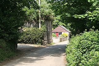
Bodanna is a farmstead in mid Cornwall, England, United Kingdom. It is situated in the civil parish of St Enoder north of the village of Summercourt about four miles (6.5 km) south-west of Newquay.

The River Allen in north Cornwall is one of two rivers in Cornwall which share this name. In this case the name is the result of a mistake made in 1888 by Ordnance Survey, replacing the name Layne with Allen which is the old name for the lower reaches of the Camel. The other River Allen runs through Truro.

The De Lank River is a small river in north Cornwall, England. It is a tributary of the River Camel and is approximately nine miles (14.5 km) long from its source on Bodmin Moor to its confluence with the Camel two miles (3 km) south of St Breward.
Lank is a settlement in Cornwall, England, United Kingdom. It is situated approximately one mile (1.6 km) south of St Breward and six miles (10 km) east-northeast of Wadebridge in St Breward civil parish. It is in the civil parish of Blisland.
Brocton is a hamlet in the parish of St Breock, Cornwall, England, UK.

Carluddon is a hamlet north of St Austell and southeast of Stenalees in Cornwall, England. It is in the civil parish of Treverbyn.
Currian Vale is a hamlet northeast of Nanpean, in mid Cornwall, England. At the 2011 census the population was included in the civil parish of St Stephen-in-Brannel

Demelza is a hamlet in the parish of St Wenn, Cornwall, England, UK. Demelza is situated 1 mile (1.6 km) south-east of St Wenn and lies at around 114 metres (374 ft) above sea level.

Carloggas is a hamlet in the parish of Mawgan-in-Pydar, Cornwall, England.
Edmonton is a hamlet west of Wadebridge in Cornwall, England. It is in the civil parish of St Breock.

Ellenglaze is a hamlet near the village of Cubert north of Perranporth in Cornwall, England. It lies close to the edge of Penhale Sands (dunes).
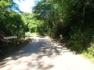
Fletchersbridge is a hamlet about 2 miles (3.2 km) east-south-east of Bodmin in Cornwall, England. in the valley of the River Fowey. Fletchersbridge lies at around 47 metres (154 ft) above sea level and is in the civil parish of Bodmin.
Garker is a hamlet situated 3 miles (4.8 km) north-east of St Austell in Cornwall, England. Garker lies close to the western edge of the Eden Project visitor attraction. Garker is in the civil parish of Carlyon.
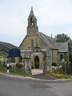
Higher Porthpean is a village south of Duporth and contiguous with Lower Porthpean in Cornwall, England. It has a small church, dedicated to St Levan that is a Grade II building, and that seats 48 people. The church is a Chapel of ease to St Austell Parish Church.
Lane-end is a hamlet in the parish of Egloshayle, Cornwall, England. It is in the civil parish of St Mabyn
Lower Croan is a farmstead in Cornwall, England, UK. It is in the parish of Egloshayle and Croan house and Croanford are to the east. Croan House is a manor house of two storeys and seven bays which was built in the 1690s for a prosperous attorney.
Pennytinney is a hamlet in the parish of St Kew, Cornwall, England, UK.
Penpillick is a hamlet in Cornwall, England, UK. It is about two miles north of St Blazey on the A390 road.
Penpont is a hamlet in the parish of St Breward, in north Cornwall, England, UK, in the Camel Valley.
Rumford is a hamlet in Cornwall, England. Rumford is in the civil parish of St Ervan. The telephone area code for Rumford is 01841.
References
- ↑ Ordnance Survey: Landranger map sheet 200 Newquay & Bodmin (Camelford & St Austell) (Map). Ordnance Survey. ISBN 978-0-319-22938-5.
- ↑ Ordnance Survey Landranger 200; Newquay, Bodmin & surrounding area, 1:50 000. 1988
- ↑ Hatcher, John (1970) Rural Economy and Society in the Duchy of Cornwall 1300-1500. Cambridge University Press; p. 76 ISBN 0-521-08550-0
| Unitary authorities | |
|---|---|
| Major settlements |
|
| Rivers | |
| Topics | |
Coordinates: 50°32′53″N4°54′04″W / 50.548°N 4.901°W
| | This Cornwall location article is a stub. You can help Wikipedia by expanding it. |