
Lakeview is a town in Lake County, Oregon, United States. The population was 2,294 at the 2010 census. It is the county seat of Lake County. The city bills itself as the "Tallest Town in Oregon" because of its elevation, 4802 ft above sea level. Lakeview is situated in the Goose Lake Valley at the foot of the Warner Mountains and at the edge of Oregon's high desert country. Its economy is based on agriculture, lumber production, and government activities. In addition, tourism is an increasingly important part of the city's economy. Oregon's Outback Scenic Byway passes through Lakeview.
The Fremont-Winema National Forest of south central Oregon is a mountainous region with a rich geological, ecological, archaeological, and historical history. Founded in 1908, the Fremont National Forest was originally protected as the Goose Lake Forest Reserve in 1906. The name was soon changed to Fremont National Forest, named after John C. Frémont, who explored the area for the United States Army Corps of Engineers in 1843. It absorbed part of Paulina National Forest on July 19, 1915. In 2002, it was administratively combined with the Winema National Forest as the Fremont–Winema National Forests.
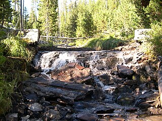
The Fremont–Winema National Forest is a United States National Forest formed from the 2002 merger of the Fremont and Winema National Forests. They cover territory in southern Oregon from the crest of the Cascade Range on the west past the city of Lakeview to the east. The northern end of the forests is bounded by U.S. Route 97 on the west and Oregon Route 31 on the east. To the south, the state border with California forms the boundary of the forests. Klamath Falls is the only city of significant size in the vicinity. The forests are managed by the United States Forest Service, and the national forest headquarters are located in Lakeview.

The Sky Lakes Wilderness is a wilderness area located in the Rogue River–Siskiyou and Fremont–Winema national forests in the southern Cascade Range of Oregon in the United States. It comprises 116,300 acres (47,100 ha), of which 75,695 acres (30,633 ha) are in the Rogue River–Siskiyou National Forest and 40,605 acres (16,432 ha) are in the Fremont–Winema National Forest. It was established in 1984 under the Wilderness Act of 1964.

The Mount Thielsen Wilderness is a wilderness area located on and around Mount Thielsen in the southern Cascade Range of Oregon in the United States. It is located within the Deschutes, Umpqua, and Fremont–Winema national forests. It was established by the United States Congress in 1984 and comprises 55,100 acres (22,300 ha).
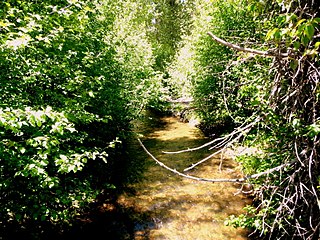
Sun Pass State Forest is one of six state forests managed by the Oregon Department of Forestry. The forest is located 40 miles (64 km) north of Klamath Falls, Oregon near the southeastern corner of Crater Lake National Park. It is the largest single block of Oregon state forestry land east of the Cascade Mountains. The forest is managed as part of the Klamath-Lake District, comprising 21,317 acres (86.27 km2) of the 33,739 state-owned acres within the district.
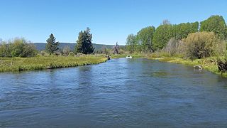
The Wood River is a short river in the southern region of the U.S. state of Oregon, and part of the Klamath Basin drainage. It flows 18 miles (29 km) through the Fremont-Winema National Forests, Bureau of Land Management land, and private property in southern Oregon. Its watershed consists of 220 square miles (570 km2) of conifer forest, rural pasture land, and marsh. The river provides habitat for many species of wildlife including an adfluvial (migratory) and resident populations of native Great Basin redband trout.
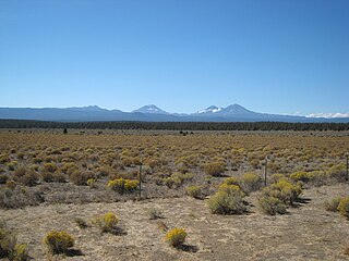
The Eastern Cascades Slopes and Foothills ecoregion is a Level III ecoregion designated by the United States Environmental Protection Agency (EPA) in the U.S. states of Oregon, Washington, and California. In the rain shadow of the Cascade Range, the eastern side of the mountains experiences greater temperature extremes and receives less precipitation than the west side. Open forests of ponderosa pine and some lodgepole pine distinguish this region from the Cascades ecoregion, where hemlock and fir forests are more common, and from the lower, drier ecoregions to the east, where shrubs and grasslands are predominant. The vegetation is adapted to the prevailing dry, continental climate and frequent wildfire. Volcanic cones and buttes are common in much of the region.

Perideridia bolanderi is a species of flowering plant in the family Apiaceae known by the common name Bolander's yampah. It is native to the western United States, where it grows in many types of habitat. It is a perennial herb which may approach one meter in maximum height, its slender, erect stem growing from tubers measuring up to 7 centimeters long. Leaves near the base of the plant have blades up to 20 centimeters long which are divided into many subdivided lobes of various sizes and shapes; the terminal segments are usually lined with teeth. Leaves higher on the plant are smaller and less divided. The inflorescence is a compound umbel of many spherical clusters of small white flowers. These yield ribbed, oblong-shaped fruits about half a centimeter long. The Atsugewi and Miwok of California used the tuberous roots of this plant for food.

Perideridia kelloggii is a species of flowering plant in the family Apiaceae known by the common name Kellogg's yampah. It is endemic to California, where it is known from the north and central coasts, the San Francisco Bay Area, and the Sierra Nevada foothills. It grows in grassland habitat, sometimes on serpentine soils. It is a perennial herb which may reach 1.5 meters in maximum height, its slender, erect stem growing from a cluster of long, narrow, fibrous roots each up to 15 centimeters long. Leaves near the base of the plant have blades up to 45 centimeters wide which are divided into many leaflets subdivided into narrow, elongated lobes. The inflorescence is a compound umbel of many spherical clusters of small white flowers. These yield ribbed, oblong-shaped fruits each about half a centimeter long.
Perideridia lemmonii is a species of flowering plant in the family Apiaceae known by the common names Lemmon's yampah and tuni. It is native to the western United States, where it is known from southeastern Oregon, western Nevada, and the mountains of eastern California. It grows in meadows, forests, and other habitat. It is a perennial herb approaching one meter in maximum height, its slender, erect stem growing from usually a single small tuber about 1.5 centimeters long. Leaves near the base of the plant have blades up to 30 centimeters long divided into one or two pairs of leaflets, each of which may be subdivided. The inflorescence is a compound umbel of many spherical clusters of small white flowers. These yield ribbed, round or oblong-shaped fruits each under half a centimeter long.
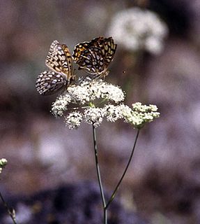
Perideridia oregana is a species of flowering plant in the family Apiaceae known by the common names Oregon yampah and eppaw. It is native to Oregon and California in the western United States, where it grows in woodland and other habitat. This plant is quite variable in appearance. In general, it is a perennial herb 10 to 90 centimeters tall, its green to waxy-grayish erect stem growing from a cluster of small tubers. Leaves near the base of the plant have blades 3 to 30 centimeters long divided into a variable number of leaflets, which may be subdivided into smaller segments. The inflorescence is a compound umbel of many spherical clusters of small white flowers. These yield ribbed, oblong-shaped fruits 3 to 6 millimeters long.
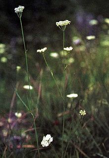
Perideridia parishii is a species of flowering plant in the family Apiaceae known by the common name Parish's yampah. It is native to mountainous regions of the southwestern United States, where it grows in forests and other habitat. It is a perennial herb growing up to 90 centimeters tall, its slender green stem growing from a small tuber. Leaves near the base of the plant have blades 10 to 20 centimeters long divided into pairs of leaflets, which may be subdivided or lobed. The inflorescence is a compound umbel of many spherical clusters of small white flowers. These yield ribbed, round or oblong-shaped fruits each about half a centimeter long.
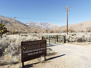
Canebrake Ecological Reserve is a 6,700-acre (27 km2) nature reserve in the South Fork Valley of Kern County, 20 miles (32 km) east of Lake Isabella, California. It is located in the Southern Sierra Nevada region.

Eucephalus vialis is a rare North American species of flowering plant in the aster family known by the common name wayside aster. It is native to southwestern Oregon and northwestern California in the United States.
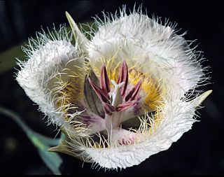
Calochortus coxii is a rare species of flowering plant in the lily family known by the common names Cox's mariposa lily and crinite mariposa lily. It is endemic to Oregon in the United States, where it is known only from Douglas County.
Phyciodes orseis, the Orseis crescentspot or California crescent, is a butterfly of the family Nymphalidae. It is found in the western North America, particularly northern California and Oregon. Formerly, The range was thought to extend along the Coast Range as far south as San Francisco. However, they were either mislabeled or are currently extirpated from these regions. The habitat consists of mountain valleys, meadows and stream canyons. Along with roughly 120 other species, they are check-listed as butterflies occurring on or near the Fremont-Winema National Forests. This checklist has been established based on observations throughout Lake and Klamath counties in Oregon. The list is maintained by the Forest Service in order to monitor health of native ecosystems. Monitoring population levels of butterflies such as P. orseis over time provides a metric for these efforts. These pollinators play an integral role in such systems, as they are beneficial both for the flora of the region and as food sources for regional avian species.
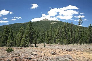
Hager Mountain is a volcanic peak in Oregon in the northwest corner of the Basin and Range Province in the United States. The mountain is located south of the small unincorporated community of Silver Lake in south-central Oregon, and it is in the Fremont–Winema National Forest. On the summit, there is a fire lookout operated during the summer and fall by the United States Forest Service. There are several hiking trails that lead to the lookout station.

The Barry Point Fire was a wildfire that burned over 92,977 acres (376.26 km2) of Oregon and California forest land during the summer of 2012. The fire began on 5 August 2012, the result of a lightning strike. The fire consumed public forest and rangeland as well as private forest and grazing land located in Lake County, Oregon and Modoc County, California. The public lands effected by the fire are administered by the United States Forest Service and the Oregon Department of Forestry. The largest part of the private land was owned by the Collins Timber Company. At the peak of the firefighting effort, there were 1,423 personnel working on the fire. It took 22 days to fully contain the fire and then an additional three weeks to mop it up.
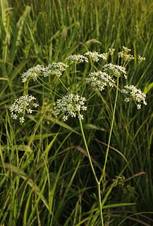
Perideridia americana is a species of flowering plant in the family Apiaceae known by the common names eastern yampah and wild dill. It has been found in 12 Midwestern United States, and is listed as threatened or endangered in at least 3 of them. In Missouri it is a conservation species of concern.


