Perinjanam Perinnanam, Peringanam | |
|---|---|
village | |
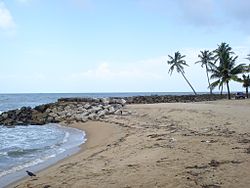 Perinjanam beach | |
 Interactive map of Perinjanam | |
| Coordinates: 10°18′50″N76°8′55″E / 10.31389°N 76.14861°E | |
| Country | |
| State | Kerala |
| District | Thrissur |
| Population (2011) | |
• Total | 21,012 |
| Languages | |
| • Official | Malayalam, English |
| Time zone | UTC+5:30 (IST) |
| PIN | 680686 |
| Telephone code | 0480 |
| Vehicle registration | KL-47 |
| Nearest city | Irinjalakuda and Kodungallur |
| Lok Sabha constituency | Chalakudy |
| Vidhan Sabha constituency | Kaipamangalam |
| Climate | Coastal climate (Köppen) |
| Website | www.perinjanam.com |

Perinjanam is a village in Thrissur district in the state of Kerala, India. [1] It is one of the smallest villages in Kerala. The coastal village is just half a kilometer wide. National Highway 66 passes through Perinjanam. The neighbouring villages are Mathilakam, Padiyoor and Kaipamangalam. It is bordered by Canoli canal in the east and Arabian Ocean in the west.