Perry Township, Snyder County, Pennsylvania

Last updated
Perry Township Building,
Snyder County,
Pennsylvania
Aline Covered Bridge 9.jpg
Aline Covered Bridge over the North Branch of Mahantango Creek
Map of Snyder County, Pennsylvania Highlighting Perry Township.PNG
Map of Snyder County, Pennsylvania highlighting Perry Township
Map of Pennsylvania highlighting Snyder County.svg
Map of Snyder County, Pennsylvania
Country United States
State Pennsylvania
County Snyder
Settled1752
Incorporated1816
Government
  TypeBoard of Supervisors
  ChairmanAaron J. Troup
  Vice-ChairmanNicholas A. Weader
  SupervisorEric J. Vanhorn
Area
[1]
  Total26.41 sq mi (68.39 km2)
  Land26.30 sq mi (68.13 km2)
  Water0.10 sq mi (0.27 km2)
Population
 (2020) [2]
  Total2,064 Decrease2.svg
  Estimate 
(2022) [2]
2,047
  Density84.06/sq mi (32.45/km2)
Time zone UTC-5 (Eastern (EST))
  Summer (DST) UTC-4 (EDT)
Zip code
17853
Area code 570
FIPS code 42-109-59504
Website Perry Township

Perry Township is a township in Snyder County, Pennsylvania, United States. As of the 2020 census, the township population was 2,064. [2]

Contents

Geography

According to the United States Census Bureau, the township has a total area of 26.1 square miles (67.7 km2), all land.

Perry Township is bordered by Franklin Township to the north, Washington Township to the northeast, Chapman Township to the southeast, Juniata County to the south and West Perry Township to the west.

The census-designated place of Mount Pleasant Mills lies within the borders of Perry Township.

Government

The polling place for Perry Township is the Fremont Fire Hall.

Perry Township Building is in the 82nd Legislative District for the Pennsylvania General Assembly held by C. Adam Harris whose office is located on Main St., Middleburg. Pennsylvania Senate District 27 is held by Senator John Gordner. Perry Township Building is in the United States House of Representatives 10th District held by Rep. Chris Carney. Pennsylvania is represented in the United States Senate by Senator Bob Casey, Jr. and Senator Arlen Specter.

Perry Township Building is located at 18 Hoffman Hill Road, Mt. Pleasant Mills, PA 17853 and served by a Board of Supervisors. They are:

Aaron J. Troup, Chairman & Roadmaster: 2584 Pine Swamp Road Mt. Pleasant Mills, Pa 17853 570-539-4784

Nicholas A. Weader, Vice-Chairman: 6022 Flint Valley Road Mt. Pleasant Mills, PA 17853 570-539-4784

Erik J. Vanhorn, Supervisor: 22 Heister Valley Road Mt. Pleasant Mills, PA 17853 570-539-4784

Schools

Midd-West School District is the area's public school system.

History

Perry Township Building was incorporated in 1816. The area known as today's Perry Township was settled in 1752 as Mahantango Township. See also- Mahantango Creek, Snyder and Juniata Counties, Pennsylvania.

Mahantango, sometimes spelled as Mohentango, was on both sides of the Susquehanna River. It was split by The river; the Eastern portion became Mahanoy Twp, Northumberland County, the Western portion became Perry County. Before 1772, the area was named Lancaster County. After 1772 it was in Northumberland County. Today the Western portion is in what is today's Snyder County. Snyder County was formed in 1855, from Union County and Union County was formed in 1813 from Northumberland County, which was formed in 1772 from parts of Lancaster, Berks, Bedford, Cumberland, and Northampton Counties. The Aline Covered Bridge, East Oriental Covered Bridge, and North Oriental Covered Bridge were added to the National Register of Historic Places in 1979. [3]

Demographics

Historical population
CensusPop.Note
2010 2,183
2020 2,064−5.5%
2022 (est.)2,047 [2] −0.8%
U.S. Decennial Census [4]

As of the census [5] of 2000, there were 1,973 people, 686 households, and 539 families residing in the township. The population density was 75.5 inhabitants per square mile (29.2/km2). There were 729 housing units at an average density of 27.9 per square mile (10.8/km2). The racial makeup of the township was 99.24% White, 0.05% African American, 0.10% Asian, 0.05% from other races, and 0.56% from two or more races. Hispanic or Latino of any race were 0.41% of the population.

There were 686 households, out of which 36.2% had children under the age of 18 living with them, 68.7% were married couples living together, 5.8% had a female householder with no husband present, and 21.4% were non-families. 18.8% of all households were made up of individuals, and 7.9% had someone living alone who was 65 years of age or older. The average household size was 2.88 and the average family size was 3.28.

In the township the population was spread out, with 29.5% under the age of 18, 8.1% from 18 to 24, 29.0% from 25 to 44, 23.0% from 45 to 64, and 10.4% who were 65 years of age or older. The median age was 34 years. For every 100 females there were 105.1 males. For every 100 females age 18 and over, there were 99.7 males.

The median income for a household in the township was $35,167, and the median income for a family was $40,474. Males had a median income of $28,808 versus $21,667 for females. The per capita income for the township was $14,631. About 7.3% of families and 12.1% of the population were below the poverty line, including 17.9% of those under age 18 and 10.7% of those age 65 or over.

Notable residents

Related Research Articles

<span class="mw-page-title-main">Snyder County, Pennsylvania</span> County in Pennsylvania, United States

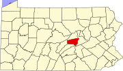
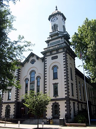
Snyder County is a county in the Commonwealth of Pennsylvania. As of the 2020 census, the population was 39,736. The county seat is Middleburg. Snyder County was formed in 1855 from parts of Union County.

<span class="mw-page-title-main">Northumberland County, Pennsylvania</span> County in Pennsylvania, United States

Northumberland County is a county in the Commonwealth of Pennsylvania. It is part of Northeastern Pennsylvania. As of the 2020 census, the population was 91,647. Its county seat is Sunbury.

<span class="mw-page-title-main">Upper Allen Township, Pennsylvania</span> Township in Pennsylvania, United States

Upper Allen Township is a township in Cumberland County, Pennsylvania, United States. The population was 23,183 at the 2020 census, up from 18,059 at the 2010 census.

<span class="mw-page-title-main">Lykens Township, Pennsylvania</span> Township in Pennsylvania, United States

Lykens Township is a township which is located in Dauphin County, Pennsylvania, United States. The population was 1,558 at the time of the 2020 census, a decline from the figure of 1,618 tabulated in 2010.

<span class="mw-page-title-main">Pillow, Pennsylvania</span> Borough in Pennsylvania, United States

Pillow is a borough in Dauphin County, Pennsylvania, United States. The population was 291 at the 2020 census. It is part of the Harrisburg–Carlisle Metropolitan Statistical Area.

<span class="mw-page-title-main">Franklin Township, Huntingdon County, Pennsylvania</span> Township in Pennsylvania, United States

Franklin Township is a township in Huntingdon County, Pennsylvania, United States. The population was 492 at the 2020 census.

<span class="mw-page-title-main">Snyder Township, Jefferson County, Pennsylvania</span> Township in Pennsylvania, United States

Snyder Township is a township in Jefferson County, Pennsylvania, United States. The population was 2,366 at the 2020 census. It was named for Governor of Pennsylvania Simon Snyder.

<span class="mw-page-title-main">Young Township, Jefferson County, Pennsylvania</span> Township in Pennsylvania, United States

Young Township is a township in Jefferson County, Pennsylvania, United States. The population was 1,715 at the 2020 census. It was named for John Young, the pioneer judge of Westmoreland County. Young Township is the location of adjacent Punxsutawney's Groundhog Day celebration each February 2, during which thousands of attendees and international media outlets visit for an annual weather prediction by the groundhog Punxsutawney Phil. Although named for Punxsutawney, the actual prediction location, Gobbler's Knob, is in Young Township.

<span class="mw-page-title-main">Monroe Township, Juniata County, Pennsylvania</span> Township in Pennsylvania, United States

Monroe Township is a township that is located in Juniata County, Pennsylvania, United States. The population was 2,050 at the time of the 2020 census, a decrease from the figure of 2,237 that was tabulated in 2010.

<span class="mw-page-title-main">Richfield, Pennsylvania</span> Census-designated place in Pennsylvania, United States

Richfield is an unincorporated community and census-designated place (CDP) in Juniata and Snyder counties in Pennsylvania, United States. The population was 549 at the 2010 census.

<span class="mw-page-title-main">Susquehanna Township, Juniata County, Pennsylvania</span> Township in Pennsylvania, United States

Susquehanna Township is a township in Juniata County, Pennsylvania, United States. The population was 1,205 at the 2020 census.

<span class="mw-page-title-main">Perry Township, Lawrence County, Pennsylvania</span> Township in Pennsylvania, United States

Perry Township is a township in Lawrence County, Pennsylvania, United States. The population was 1,854 at the time of the 2020 census, a decline from the figure of 1,938 tabulated in 2010.

<span class="mw-page-title-main">Jordan Township, Northumberland County, Pennsylvania</span> Township in Pennsylvania, United States

Jordan Township is a township that is located in Northumberland County, Pennsylvania, United States. The population at the time of the 2010 Census was 794, an increase over the figure of 761 that was tabulated in 2000.

<span class="mw-page-title-main">Lower Mahanoy Township, Pennsylvania</span> Township in Pennsylvania, United States

Lower Mahanoy Township is a township in Northumberland County, Pennsylvania, United States. The population at the 2010 Census was 1,709, an increase over the figure of 1,586 tabulated in 2000.

<span class="mw-page-title-main">Mount Carmel, Pennsylvania</span> Borough in Pennsylvania, United States

Mount Carmel is a borough in Northumberland County, located in the Coal Heritage Region of Central Pennsylvania's Susquehanna River Valley, United States. The population was 5,725 at the 2020 census. It is located 88 miles (141 km) northwest of Philadelphia and 71 miles (114 km) northeast of Harrisburg, in the Coal Region. It is completely encircled by Mount Carmel Township.

<span class="mw-page-title-main">Upper Augusta Township, Pennsylvania</span> Township in Pennsylvania, United States

Upper Augusta Township is a township in Northumberland County, Pennsylvania, United States. It was formed in 1846 by the division of Augusta Township into Upper and Lower sections. The population at the 2010 Census was 2,586, an increase over the figure of 2,556 tabulated in 2000.

<span class="mw-page-title-main">Spring Township, Snyder County, Pennsylvania</span> Township in Pennsylvania, United States

Spring Township is a township in Snyder County, Pennsylvania, United States. The population was 1,635 at the 2020 census.

<span class="mw-page-title-main">Mead Township, Pennsylvania</span> Township in Pennsylvania, United States

Mead Township is a township in Warren County, Pennsylvania, United States. The population was 1,300 at the 2020 census, down from 1,386 at the 2010 census and 1,555 at the 2000 census.

<span class="mw-page-title-main">Bloomsburg–Berwick metropolitan area</span> Metropolitan area in Pennsylvania, United States

The Bloomsburg–Berwick Metropolitan Statistical Area (MSA), as defined by the United States Census Bureau, is an area consisting of two counties in Pennsylvania, anchored by the town of Bloomsburg and the borough of Berwick. As of the 2010 census, the MSA had a population of 85,562.

Mahantango Creek is a 2.1-mile-long (3.4 km) tributary of the Susquehanna River in Snyder and Juniata counties, Pennsylvania, in the United States. Its name comes from a Delaware Indian word meaning "where we had plenty to eat". The creek flows along the border between Snyder County and Juniata County.

References

  1. "2016 U.S. Gazetteer Files". United States Census Bureau. Retrieved Aug 14, 2017.
  2. 1 2 3 4 Bureau, US Census. "City and Town Population Totals: 2020-2022". Census.gov. US Census Bureau. Retrieved January 31, 2024.
  3. "National Register Information System". National Register of Historic Places . National Park Service. July 9, 2010.
  4. "Census of Population and Housing". Census.gov. Retrieved June 4, 2016.
  5. "U.S. Census website". United States Census Bureau . Retrieved 2008-01-31.
  6. "Portzline Family Cemetery". pagenweb.org. Retrieved Apr 4, 2019.

40°40′00″N76°58′59″W / 40.66667°N 76.98306°W / 40.66667; -76.98306