McClure, Pennsylvania

Last updated
McClure, Pennsylvania
Trinity Church McClure PA.jpg
Trinity Lutheran Church
Snyder County Pennsylvania Incorporated and Unincorporated areas McClure Highlighted.svg
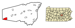
Location of McClure in Snyder County, Pennsylvania.
USA Pennsylvania location map.svg
Red pog.svg
McClure
Location within the U.S. state of Pennsylvania
Usa edcp location map.svg
Red pog.svg
McClure
McClure (the United States)
Coordinates: 40°42′23″N77°18′51″W / 40.70639°N 77.31417°W / 40.70639; -77.31417
Country United States
State Pennsylvania
County Snyder
Area
[1]
  Total3.76 sq mi (9.74 km2)
  Land3.75 sq mi (9.72 km2)
  Water0.01 sq mi (0.02 km2)
Elevation
695 ft (212 m)
Population
 (2020) [2]
  Total889
  Density236.81/sq mi (91.44/km2)
Time zone Eastern (EST)
  Summer (DST)EDT
ZIP code
17841
Area code 570
FIPS code 42-45992

McClure is a borough in Snyder County, Pennsylvania, United States. The population was 889 at the 2020 census. [3] The town is named for the 19th century Pennsylvania politician and journalist Alexander Kelly McClure. McClure owes its origin to the building of the Sunbury and Lewistown Railroad, that at one time ran through the center of town. The town was founded in 1867. The borough of McClure was established on January 1, 1967, when the residents decided to incorporate.

Contents

The town was originally named Stuckton after George Stuck who owned the farm land that today is known as McClure. In the year 1867, when it was certain that the Middlecreek Valley Railroad would be located practically through the center of the Stuck Farm, George Stuck staked out a section of his farm, laid out a few lots and named the place “STUCKTON.” Thus a town was born, but without houses, except an old rotted log hut. It remained as such for the next four years. No one seemed interested in buying lots or building a home.

Geography

According to the United States Census Bureau, the borough has a total area of 3.7 square miles (9.6 km2), all land.

Demographics

Historical population
CensusPop.Note
1880 94
1970 1,094
1980 1,024−6.4%
1990 1,0704.5%
2000 975−8.9%
2010 941−3.5%
2020 889−5.5%
2021 (est.)883 [3] −0.7%
Sources: [4] [5] [6] [2]

As of the census [5] of 2010, there were 941 people, 435 households, and 382 families residing in the borough. The population density was 263.6(2000) people per square mile (101.7/km2). There were 441(2000) housing units at an average density of 119.2(2000) per square mile (46.0/km2). The racial makeup of the borough was 97.30% White, 0.21% African American, 0.00% Asian, and 0.20% from two or more races.

There were 403 households, out of which 27.3%(2000) had children under the age of 18 living with them, 57.6%(2000) were married couples living together, 6.2% had a female householder with no husband present, and 30.0% were non-families. 25.1% of all households were made up of individuals, and 14.6% had someone living alone who was 65 years of age or older. The average household size was 2.42 and the average family size was 2.83.

In the borough the population was spread out, with 22.4% under the age of 18, 9.3% from 18 to 24, 24.9% from 25 to 44, 22.9% from 45 to 64, and 20.5% who were 65 years of age or older. The median age was 40 years. For every 100 females there were 96.2 males. For every 100 females age 18 and over, there were 92.6 males.

The median income for a household in the borough was $30,865, and the median income for a family was $37,083. Males had a median income of $28,698 versus $25,739 for females. The per capita income for the borough was $15,466. About 4.2% of families and 7.9% of the population were below the poverty line, including 10.6% of those under age 18 and 3.4% of those age 65 or over.

Churches

Mount Bethel Church of Christ Mt Bethel Church McClure SnyderCo PA.jpg
Mount Bethel Church of Christ

Several churches fall within the borough lines: McClure First United Methodist Church, Mount Bethel Church of Christ, Trinity Lutheran Church. Other churches have addresses within the McClure ZIP code but are not inside the borough: Bannerville Christian and Missionary Alliance (C&MA), Bannerville Church of the Brethren, Samuel's Church, and St. John's Lutheran Church.

Related Research Articles

<span class="mw-page-title-main">Elizabeth, Pennsylvania</span> Borough in Pennsylvania, United States

Elizabeth is a borough in Allegheny County, Pennsylvania, United States, on the east bank of the Monongahela River, where Pennsylvania Route 51 crosses, 15 miles (24 km) upstream (south) of Pittsburgh and close to the county line. The population was 1,398 at the 2020 census. The borough of Elizabeth is entirely contained within the 15037 USPS ZIP code. The local school district is the Elizabeth Forward School District. The borough is home to neighborhoods Walker Heights and Town Hill. Elizabeth Borough is the birthplace of Town Hill Hockey established in 1978.

<span class="mw-page-title-main">Franklin Park, Pennsylvania</span> Borough in Pennsylvania, United States

Franklin Park is a borough in Allegheny County, Pennsylvania, United States. The population was 15,479 at the 2020 census. It is a suburb of the Pittsburgh metropolitan area.

<span class="mw-page-title-main">Rosslyn Farms, Pennsylvania</span> Borough in Pennsylvania, United States

Rosslyn Farms is a suburban borough located 5 miles (8 km) west of Pittsburgh in Allegheny County, Pennsylvania, United States. It is a small community, with an area of only 0.6 square miles (1.6 km2). The population was 441 at the 2020 census.

<span class="mw-page-title-main">Manorville, Pennsylvania</span> Borough in Pennsylvania, United States

Manorville is a borough in Armstrong County, Pennsylvania, United States. The population was 382 at the 2020 census.

<span class="mw-page-title-main">Manns Choice, Pennsylvania</span> Borough in Pennsylvania, United States

Manns Choice is a borough in Bedford County, Pennsylvania, United States. The population was 313 at the 2020 census.

<span class="mw-page-title-main">Karns City, Pennsylvania</span> Borough in Pennsylvania, United States

Karns City is a borough that is located in Butler County, Pennsylvania, United States. The population was 209 at the time of the 2010 census.

<span class="mw-page-title-main">Loretto, Pennsylvania</span> Borough in Pennsylvania, United States

Loretto is a borough in Cambria County, Pennsylvania, United States. As of the 2010 census it had a population of 1,302. Like the rest of Cambria County, it is part of the Johnstown, Pennsylvania Metropolitan Statistical Area. Loretto is the home of Saint Francis University.

<span class="mw-page-title-main">Avondale, Pennsylvania</span> Borough in Pennsylvania, United States

Avondale is a borough in Chester County, in southeastern Pennsylvania, United States. The population was 1,272 at the 2020 census.

<span class="mw-page-title-main">Callensburg, Pennsylvania</span> Borough in Pennsylvania, United States

Callensburg is a borough in Clarion County, Pennsylvania, United States. The population was 207 at the 2010 census.

<span class="mw-page-title-main">Mahaffey, Pennsylvania</span> Borough in Pennsylvania, United States

Mahaffey is a borough in Clearfield County, Pennsylvania, United States. The population was 329 at the 2020 census.

<span class="mw-page-title-main">Upper Tyrone Township, Pennsylvania</span> Township in Pennsylvania, United States

Upper Tyrone Township is a township that is located in Fayette County, Pennsylvania, United States. The population was 1,768 at the time of the 2020 census. It is served by the Southmoreland School District.

<span class="mw-page-title-main">Timblin, Pennsylvania</span> Borough in Pennsylvania, United States

Timblin is a borough in Jefferson County, Pennsylvania, United States. The population was 157 at the 2010 census.

<span class="mw-page-title-main">Sharpsville, Pennsylvania</span> Borough in Pennsylvania, United States

Sharpsville is a borough that is located in western Mercer County, Pennsylvania, United States, along the Shenango River. The population was 4,253 as of the 2020 census. It is part of the Hermitage micropolitan area.

<span class="mw-page-title-main">Beavertown, Snyder County, Pennsylvania</span> Borough in Pennsylvania, United States

Beavertown is a borough in Snyder County, located in Central Pennsylvania's Susquehanna River Valley, United States. The population was 1,005 at the 2020 census.

<span class="mw-page-title-main">Freeburg, Pennsylvania</span> Borough in Pennsylvania, United States

Freeburg is a borough in Snyder County, Pennsylvania, United States. The population was 557 at the 2020 census.

<span class="mw-page-title-main">Berlin, Pennsylvania</span> Borough in Pennsylvania, United States

Berlin is a borough located approximately 75 miles southeast of Pittsburgh in Somerset County, Pennsylvania, United States. The population was 2,004 at the 2020 census. It is part of the Johnstown, Pennsylvania Metropolitan Statistical Area.

<span class="mw-page-title-main">Meyersdale, Pennsylvania</span> Borough in Pennsylvania, United States

Meyersdale is a borough in Somerset County, Pennsylvania, United States, situated on the Casselman River, 73 miles (117 km) southeast of Pittsburgh. It is part of the Johnstown, Pennsylvania, Metropolitan Statistical Area.

<span class="mw-page-title-main">New Berlin, Pennsylvania</span> Borough in Pennsylvania, United States

New Berlin is a borough in Union County, Pennsylvania, United States. The population was 791 at the 2020 census.

<span class="mw-page-title-main">Cross Roads, Pennsylvania</span> Borough in Pennsylvania, United States

Cross Roads is a borough in York County, Pennsylvania, United States. The population was 524 at the 2020 census. The crossroads in the borough is where Church Road intersects Cross Roads Avenue and are joined by Century Farms Road. East of the intersection, Century Farms Road is numbered SR 2050 and Church Road is unnumbered.

<span class="mw-page-title-main">Yorkana, Pennsylvania</span> Borough in Pennsylvania, United States

Yorkana is a borough in York County, Pennsylvania, United States. The population was 236 at the 2020 census. It is a linear town, spread along Mt. Pisgah Road, which is called Main Street in town. The borough includes several dozen houses, two churches, a local fire company, and a few businesses.

References

  1. "ArcGIS REST Services Directory". United States Census Bureau. Retrieved October 12, 2022.
  2. 1 2 "Census Population API". United States Census Bureau. Retrieved Oct 12, 2022.
  3. 1 2 Bureau, US Census. "City and Town Population Totals: 2020-2021". Census.gov. US Census Bureau. Retrieved 14 July 2022.
  4. "Census of Population and Housing". U.S. Census Bureau. Retrieved 11 December 2013.
  5. 1 2 "U.S. Census website". United States Census Bureau . Retrieved 2008-01-31.
  6. "Incorporated Places and Minor Civil Divisions Datasets: Subcounty Resident Population Estimates: April 1, 2010 to July 1, 2012". Population Estimates. U.S. Census Bureau. Archived from the original on 11 June 2013. Retrieved 11 December 2013.