Peru (CDP), New York

Last updated

Peru, New York
Clinton County New York incorporated and unincorporated areas Peru (CDP) highlighted.svg
Location in Clinton County and the state of New York.
Coordinates: 44°34′46″N73°31′50″W / 44.57944°N 73.53056°W / 44.57944; -73.53056
Country United States
State New York
County Clinton
Town Peru
Area
[1]
  Total1.92 sq mi (4.98 km2)
  Land1.92 sq mi (4.98 km2)
  Water0.00 sq mi (0.00 km2)
Elevation
335 ft (102 m)
Population
 (2020)
  Total1,843
  Density957.90/sq mi (369.94/km2)
Time zone UTC-5 (Eastern (EST))
  Summer (DST) UTC-4 (EDT)
ZIP code
12972
Area code 518
FIPS code 36-57364
GNIS feature ID0960223

Peru is a hamlet and census-designated place (CDP) within the town of Peru in Clinton County in the U.S. state of New York. The population of the CDP was 1,591 at the 2010 census, [2] out of a population of 6,998 in the town as a whole.

Contents

Geography

The hamlet of Peru is located east of the geographic center of the town of Peru, at 44°34′46″N73°31′49″W / 44.57944°N 73.53028°W / 44.57944; -73.53028 (44.579556, -73.530539). [3] It is situated on the Little Ausable River, which flows east 6 miles (10 km) to Lake Champlain.

The community is located at the junction of routes 22 and 22B. Interstate 87, the Adirondack Northway, passes 1 mile (1.6 km) east of the hamlet, with access from exit 35. Plattsburgh, the Clinton county seat, is 11 miles (18 km) north, while Keeseville is 6 miles (10 km) to the south.

According to the United States Census Bureau, the Peru CDP has a total area of 1.6 square miles (4.1 km2), all land. [2]

Demographics

Historical population
CensusPop.Note
2000 1,488
2010 1,5916.9%
2020 1,84315.8%
U.S. Decennial Census [4]

The CDP describes the more densely populated central area within the town. The U.S. census reports data on CDP in order to provide separate demographic reporting for urbanized areas. The population and area reported here are also included in the aggregate values reported for the town as a whole, see: Peru, New York.

As of the census [5] of 2000, there were 1,514 people, 543 households, and 415 families residing in the CDP. The population density was 944.8 inhabitants per square mile (364.8/km2). There were 558 housing units at an average density of 348.2 per square mile (134.4/km2). The racial makeup of the CDP was 97.82% White, 0.73% Black or African American, 0.07% Native American, 0.79% Asian, and 0.59% from two or more races. Hispanic or Latino of any race were 0.53% of the population.

There were 543 households, out of which 37.9% had children under the age of 18 living with them, 61.1% were married couples living together, 11.6% had a female householder with no husband present, and 23.4% were non-families. 19.5% of all households were made up of individuals, and 9.6% had someone living alone who was 65 years of age or older. The average household size was 2.69 and the average family size was 3.07.

In the CDP, the population was spread out, with 26.7% under the age of 18, 7.5% from 18 to 24, 26.5% from 25 to 44, 23.2% from 45 to 64, and 16.1% who were 65 years of age or older. The median age was 38 years. For every 100 females, there were 86.5 males. For every 100 females age 18 and over, there were 83.8 males.

The median income for a household in the CDP was $36,442, and the median income for a family was $43,125. Males had a median income of $31,528 versus $25,859 for females. The per capita income for the CDP was $17,142. About 9.1% of families and 14.6% of the population were below the poverty line, including 23.0% of those under age 18 and 6.4% of those age 65 or over.

Culture

In autumn, the village celebrates the annual apple fest. [6] The two-day festival includes a parade, carnival-style games, a bake sale, and live music.

Related Research Articles

Claiborne is an unincorporated community and census-designated place (CDP) in Ouachita Parish, Louisiana, United States. The population was 9,830 at the 2000 census. It is part of the Monroe Metropolitan Statistical Area.

<span class="mw-page-title-main">Lyon Mountain, New York</span> Census-designated place & hamlet in New York, United States

Lyon Mountain is a hamlet and census-designated place located in the town of Dannemora in Clinton County, New York, United States. The population was 423 at the 2010 census.

<span class="mw-page-title-main">Morrisonville, New York</span> Census-designated place in New York, United States

Morrisonville is a hamlet and census-designated place in Clinton County, New York, United States. The population was 1,545 at the 2010 census.

<span class="mw-page-title-main">Redford, New York</span> Census-designated place in New York, United States

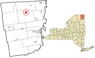
Redford is a hamlet and census-designated place in the town of Saranac in Clinton County, New York, United States. The population was 477 at the 2010 census.

Claverack-Red Mills, commonly known as Claverack, is a census-designated place (CDP) in Columbia County, New York, United States. The population was 913 at the 2010 census.

Stottville is a hamlet and census-designated place (CDP) in Columbia County, New York, United States. The population was 1,375 at the 2010 census.

<span class="mw-page-title-main">Crown Heights, New York</span> Census-designated place in New York, United States

Crown Heights is a hamlet and census-designated place (CDP) in Dutchess County, New York, United States. The population was 2,840 at the 2010 census. It is part of the Poughkeepsie–Newburgh–Middletown, NY Metropolitan Statistical Area as well as the larger New York–Newark–Bridgeport, NY-NJ-CT-PA Combined Statistical Area.

<span class="mw-page-title-main">Hillside Lake, New York</span> Census-designated place in New York, United States

Hillside Lake is a hamlet and census-designated place (CDP) in Dutchess County, New York, United States. The population was 1,084 at the 2010 census. It is part of the Poughkeepsie–Newburgh–Middletown, NY Metropolitan Statistical Area as well as the larger New York–Newark–Bridgeport, NY-NJ-CT-PA Combined Statistical Area.

<span class="mw-page-title-main">Myers Corner, New York</span> Census-designated place in New York, United States

Myers Corner is a hamlet and census-designated place (CDP) in the town of Wappinger, Dutchess County, New York, United States. The population was 6,790 at the 2010 census. It is part of the Poughkeepsie–Newburgh–Middletown, NY Metropolitan Statistical Area as well as the larger New York–Newark–Bridgeport, NY-NJ-CT-PA Combined Statistical Area.

Jefferson Heights is a hamlet and census-designated place (CDP) in Greene County, New York, United States. The population was 1,122 at the 2020 census.

<span class="mw-page-title-main">Carmel Hamlet, New York</span> Hamlet and Census-designated place in New York, United States

Carmel Hamlet, commonly known simply as Carmel, is a hamlet and census-designated place (CDP) located in the Town of Carmel in Putnam County, New York, United States. As of the 2010 census, the population was 6,817.

<span class="mw-page-title-main">Lake Katrine, New York</span> CDP in New York, United States

Lake Katrine is a hamlet in Ulster County, New York, United States. The population was 2,522 at the 2020 census.

<span class="mw-page-title-main">Crompond, New York</span> CDP in New York, United States

Crompond is a hamlet and census-designated place (CDP) located in the town of Yorktown in Westchester County, New York, United States. The population was 2,292 at the 2010 census.

<span class="mw-page-title-main">Crugers, New York</span> Hamlet and census-designated place in Cortlandt, New York

Crugers is a hamlet and census-designated place (CDP) located in the town of Cortlandt, Westchester County, New York, United States. The population was 1,534 at the 2010 census.

<span class="mw-page-title-main">Lincolndale, New York</span> Census-designated place in New York, United States

Lincolndale is a hamlet and census-designated place (CDP) located in the town of Somers in Westchester County, New York, United States. The population was 1,521 at the 2010 census.

<span class="mw-page-title-main">Altona (CDP), New York</span> Census-designated place in New York, United States

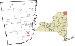
Altona is a hamlet and census-designated place (CDP) in the town of Altona, Clinton County, New York, United States. The population was 730 at the 2010 census, out of a total town population of 2,887.

<span class="mw-page-title-main">Mooers (CDP), New York</span> Hamlet and CDP in New York, United States

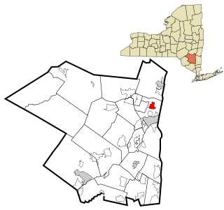
Mooers, formerly Mooers-upon-the-Chazy, is a hamlet and census-designated place in the town of Mooers, in Clinton County, New York, United States. The population was 442 at the 2010 census, out of a total population of 3,592 in the town. It was once an incorporated village, but dissolved in 1994.

Germantown is a census-designated place (CDP) in the town of Germantown in Columbia County, New York, United States, on the east side of the Hudson River. The population of the CDP was 845 at the 2010 census, out of a total town population of 1,954.

<span class="mw-page-title-main">Amenia (CDP), New York</span> Hamlet in the state of New York, United States

Amenia is a hamlet and census-designated place (CDP) in Dutchess County, New York, United States. The population was 955 at the 2010 census. It is part of the Poughkeepsie–Newburgh–Middletown, NY Metropolitan Statistical Area as well as the larger New York–Newark–Bridgeport, NY-NJ-CT-PA Combined Statistical Area.

<span class="mw-page-title-main">Pine Plains (CDP), New York</span> Census-designated place in New York, United States

Pine Plains is a hamlet and census-designated place (CDP) in Dutchess County, New York, United States. The population was 1,142 at the 2020 census. It is part of the Poughkeepsie–Newburgh–Middletown, NY Metropolitan Statistical Area as well as the larger New York–Newark–Bridgeport, NY-NJ-CT-PA Combined Statistical Area.

References

  1. "ArcGIS REST Services Directory". United States Census Bureau. Retrieved September 20, 2022.
  2. 1 2 "Geographic Identifiers: 2010 Demographic Profile Data (G001): Peru CDP, New York". U.S. Census Bureau, American Factfinder. Archived from the original on February 12, 2020. Retrieved December 8, 2014.
  3. "US Gazetteer files: 2010, 2000, and 1990". United States Census Bureau. February 12, 2011. Retrieved April 23, 2011.
  4. "Census of Population and Housing". Census.gov. Retrieved June 4, 2016.
  5. "U.S. Census website". United States Census Bureau . Retrieved January 31, 2008.
  6. "It's Applefest Time | The Peru Gazette" . Retrieved October 19, 2016.