Piagapo, Lanao del Sur

Last updated
Piagapo
Municipality
Municipality of Piagapo

Piagapo Municipal Complex.jpg

Municipal Hall
Ph locator lanao del sur piagapo.png
Map of Lanao del Sur with Piagapo highlighted
Philippines location map (square).svg
Red pog.svg
Piagapo
Location within the Philippines
Coordinates: 8°00′N124°12′E / 8°N 124.2°E / 8; 124.2 Coordinates: 8°00′N124°12′E / 8°N 124.2°E / 8; 124.2
Country Flag of the Philippines.svg  Philippines
Region Autonomous Region in Muslim Mindanao (ARMM)
Province Lanao del Sur
District 1st District
Barangays 37 (see Barangays)
Government [1]
  Type Sangguniang Bayan
   Mayor Ali L. Sumandar
   Vice Mayor Ansari L. Sumandar
  Electorate 14,381 voters (2016)
Area [2]
  Total 340.07 km2 (131.30 sq mi)
Population (2015 census) [3]
  Total 25,440
  Density 75/km2 (190/sq mi)
Time zone PST (UTC+8)
ZIP code 9710
PSGC 153621000
IDD : area code +63(0)63
Climate type tropical climate
Income class 4th municipal income class
Website www.piagapo-lds.gov.ph

Piagapo, officially the Municipality of Piagapo, is a 4th class municipality in the province of Lanao del Sur, Philippines. According to the 2015 census, it has a population of 25,440 people. [3]

Lanao del Sur Province in Bangsamoro Autonomous Region in Muslim Mindanao, Philippines

Lanao del Sur, officially the Province of Lanao del Sur, is a province in the Philippines located in the Bangsamoro Autonomous Region in Muslim Mindanao (BARMM). The capital is the city of Marawi, and it borders Lanao del Norte to the north, Bukidnon to the east, and Maguindanao and Cotabato to the south. To the southwest lies Illana Bay, an arm of the Moro Gulf.

Philippines Republic in Southeast Asia

The Philippines, officially the Republic of the Philippines, is an archipelagic country in Southeast Asia. Situated in the western Pacific Ocean, it consists of about 7,641 islands that are categorized broadly under three main geographical divisions from north to south: Luzon, Visayas, and Mindanao. The capital city of the Philippines is Manila and the most populous city is Quezon City, both part of Metro Manila. Bounded by the South China Sea on the west, the Philippine Sea on the east and the Celebes Sea on the southwest, the Philippines shares maritime borders with Taiwan to the north, Vietnam to the west, Palau to the east, and Malaysia and Indonesia to the south.

It is located in the first district of the province of Lanao del Sur, Autonomous Region in Muslim Mindanao (ARMM) and has total land area of 340.09 square kilometers distributed over the 37 barangays that are predominantly populated by Maranao people.

Maranao people ethnic group

The Maranao people, also spelled Meranao, Maranaw(based on Marapatik) and Mëranaw, is the term used by the Philippine government to refer to the southern tribe who are the "people of the lake", a predominantly-Muslim region of the Philippine island of Mindanao. They are known for their artwork, weaving, wood, plastic and metal crafts and epic literature, the Darengen.

History

The municipality was named Piagapo as the word relates closely to several royal houses of the Pat A Pangampong a Ranao. It is believed[ by whom? ] that during the ancient time, Piagapo was territorial land originally ruled by a queen ruler “Dayang Labi", a direct descendant of Sharief Kabungsuan, the first Muslim missionary who landed in Maguindanao to spread the religion Islam. Being queen ruler of the land, she was popularly enthroned and widely known as the “Bai sa Radapan”. Furthermore, to retain her name and legacy in the history of Piagapo, one of the Barangays was named after her title as the Bai sa radapan. It was called Radapan. This is the place where most of her descendants reside. Moreover, claimants of the sultanate leadership in the different areas of Piagapo usually trace up their genealogical origin from the progenitor, the Bai sa Radapan. Only her progeny can claim a royal title. The Municipality of Piagapo was once a component of the Municipality of Saguiaran, Lanao del Sur. On March 17, 1957, the president signed Executive Order No. 431 creating Piagapo into a municipal district which took effect effectively. The name Piagapo was proposed by a group of leaders from Sendigan led by Sultan a Diamla and presented by Mangompia S. Gunting. The name Piagapo was unanimously adopted as the name of the municipal district. Piagapo was then converted into a regular municipality on July 1, 1965, by virtue of Executive Order No. 166 signed on August 27, 1965. Piagapo also divided into three districts: Sundigan A Piagapo, Pat a Panoroganan, Bubonga Marantao and composed of 37 barangay.

Martial Law

Piagapo is one of the Municipalities suffered and receiving Evacuees from municipality of Munai and municipality of Tangcal during Martial Law in 1972. Almost Evacuees living in Munai at the time were abandoned their home, livestock, land, etc. and they moved to boundary somewhere in Lanao del Sur and Lanao del Norte. Most of the people stay meanwhile to Barangay Lininding of Munai, a boundary of Municipality of Piagapo, Lanao del Sur. The only remaining people that time of evacuation process were the Moro (Male and Female including Children) Fighter and one of their Leader Commander was Commander Tagoranao "AKA James Bond" Macapaar bin Sabbar, a MNLF Top Commander for Lanao del Norte. Late Commander James Bond is the sibling of MILF Top Commander Abdullah Macapaar "Commander Bravo". Moro Rebels from Munai had a fight side-by-side with the Moro Rebels from neighboring Tangkal against Philippines Constabulary (PC) Army.

After peaceful was process in the middle of 1980s, The Team of MILF Commander Sultan Saifudin Romandiar Tomawis and MILF Commander Sultan Tagoranao Goldiano Macapaar bin Sabbar along with the MILF Commander Sansarona from Maguindanao had stay and made a Temporary "MILF Camp Bansayan" in Bansayan, a barangay of Piagapo until end of EDSA Revolution on 1986. During the stay, there were enormous battle between MILF forces and Government Forces. Both MILF Commanders had went to Afghanistan to join the war against Russian on 1984. The said Camp was abandoned by MILF Soldiers when civilian had gave the map and provide with guide the Government Forces when that MILF Camp on early EDSA Revolution. On the Attack of Government Forces, they come secretly at night in barangay bansayan and they stay at the near of the MILF Camp Bansayan for almost 10hrs until 3:00AM and strike the Camp. The One of the Field Commander who stay long and withdraw later to fight is Commander Abiden Dimacuta Umpar because he handle .30 Machine Gun.

Geography

Climate

Piagapo being part of Lanao del Sur has predominantly cold climate. The climate observed in the community is very unpredictable where rainfalls are mostly observed during the month of July, August, September and October. Dry season is observed during summer the month of March, April and May. The Municipality is hilly and mountainous. The beautiful mountains with vast trees in the area serve as natural barriers against typhoon and strong wind and other natural calamities.

Terrain and Natural Resources

The area is hilly and mountainous with scattered plain areas suitable for agricultural activities. These plain portions are either upland or lowland. It is rich in natural resources such as wide vast of forest area with varieties of good trees, rivers, springs and streams that have good potentials for further development. However, the local government unit should pay attention on the issues regarding illegal logging and kainging otherwise the community would be prone to erosion and landslides that will endanger many lives. The natural resources of the Municipality especially its wide and diverse forest should be protected and preserved.

Barangays

Piagapo is divided into 3 districts and composed of 37 barangays.

Demographics

Population census of Piagapo
YearPop.±% p.a.
1970 7,248    
1975 12,920+12.29%
1980 12,108−1.29%
1990 16,730+3.29%
1995 19,198+2.61%
2000 23,903+4.81%
2007 34,792+5.31%
2010 21,974−15.40%
2015 25,440+2.83%
Source: Philippine Statistics Authority [3] [4] [5] [6]

Population

The Municipality of Piagapo is a Muslim area that is predominantly populated by Maranao tribe who are culturally bounded people. As a matter of fact, its people, majority of which, do not accept birth control, birth spacing and other methods. They believe it is against their religious belief. However, majority of them learned to accept other health intervention particularly to maintain and improve health status. This belief and value of the people of Piagapo had caused an increased in its population from time to time. This is revealed by the different census conducted by NSO in different year. The latest and current population of the municipality as distributed to its 37 barangays is 21,974 as shown in the table below. The average household size is 3.78 or 4 persons per household. But based on 2007 census of population, Piagapo has 5,417 household and the average household size is 6.42.

Population Growth Rate

It is to be noted that the population of Piagapo varies according to the different population census conducted by the NSO, at an increasing trend. In the year 1995, its total population was 19,198. It increased of about 4,705 or 24.50% in a span of 5 years. Hence, the annual growth rate between the year 1995 and 2000 is 4.5%. In the year 2007, another census was conducted by the NSO. That census that revealed that piagapo’s population was increased to 34,792. Between 2000 and 2007, the population increased by 10,889 or 45.5% for a span of 7 years. Hence, the population growth rates is 6.5% annually, which is very high. However, it was somehow unbelievable and unrealistic, that between the year 2007 and 2010, The Population of Piagapo tremendously declined from 34,792 to 21,974 in just a span of 3 years. The decrease was unusual and very abrupt. The constituents of Piagapo could not believe it, even when some of the residents migrated to other areas in the Philippines temporarily after occurrence of the all-out war against the MILF in the previous years.


Economy

Agricultural Products

People of Piagapo are mostly farmers by occupation who generally produce corn, rice as major agricultural products. However, there are few of them who also plant other agricultural products such as trees like mahogany, acacia, and various fruit trees. Vegetables, species and root crops particularly cassava, camote and the like are among the secondary products in the municipality. Due to problem on farm to market road, farmers usually produce mostly for home consumption.

Livestock

Aside from producing agricultural products as the main source of income, some of the residents in the municipality raised carabaos, and cows as working animals. Poultry products such as chicken, duck, and goose are also raised but in limited number and for household consumption only. Raising poultry products is a way of subsidizing the basic needs of the people. Raising livestock like chicken is becoming very discouraging due to lack of knowledge on controlling disease of this livestock. Livestock like carabao and cows are in some cases raised in the community by some well off families, farmers and landlord in limited quantity and mainly as work animal or some times for rent.

Market Outlet

Farm-to-Market road has been a problem almost all over the municipality. Poor road coupled with the absence of Municipal Local Public Market, make it more difficult for the farmers to market their products. The agricultural products are usually marketed either to Saguiaran, Baloi, Lanao del Norte, Pantaoaragat and Iligan City. The decision of the farmers where to market their products is usually dependent on the price offered by the different buyers/middlemen available in the above-mentioned market areas. However, more frequently the price offered is unreasonable. In addition thereto, the expensive transportation cost of products makes farming a losing, discouraging and undesirable low profile venture to the people. Hence, the municipality, in cooperation with other agencies, should give careful attention to these issues and should provide, improve and rehabilitate farm to market road and educate farmers on adoptable agricultural technology and provide a centralized Public Market in a strategic area in the locality where the products of the farmers can be marketed at reasonable fair price and less transportation cost.

Local government

Engr. Ali L. Sumandar, present Mayor of Piagapo Engr. Ali Sumandar.jpg
Engr. Ali L. Sumandar, present Mayor of Piagapo

The municipal hall of Piagapo is situated at Barangay Bobo, the first barangay to be reached from Saguiaran, Lanao del Sur, with an area of 11,270 square meter.

Elected officials 2016-2019:

List of former Chief Executives

  • Datu Dimapunung Limbo
  • Hadji AbdulRahman Masiu Orangot
  • Maungangun Macalimbon
  • Guimba Mandangan
  • Bashier Amairomag
  • Manaros Barao
  • Sultan Jabber Amairomag
  • Mitoon Ampang
  • Manso Panganting
  • Sultan Pindaton H. Omar
  • Sultan Mawiyag Acoon
  • Macondara Compa
  • Amrossi Macatanong
  • Umohanie B. Macatanong
  • Ali L. Sumandar

Mayors after People Power Revolution 1986

  • 1986 - 1989, Sultan Mawiyag Acoon
  • 1989 - 1992, Sultan Mawiyag Acoon
  • 1992 - 1995, Macondara Compa
  • 1995 - 1998, Macondara Compa
  • 1998 - 2001, Amrossi Macatanong
  • 2001 - 2004, Amrossi Macatanong
  • 2004 - 2007, Amrossi Macatanong
  • 2007 - 2010, Umohanie B. Macatanong
  • 2010 - 2013, Umohanie B. Macatanong
  • 2013 - 2016, Ali L. Sumandar
  • 2016 present, Ali L. Sumandar

Infrastructure

Transportation

The accessibility and the availability of farm to market roads had been for many years the widely known problems of the people of Piagapo especially those residents from the far flung and interior areas of the municipality which usually use horses as the primary mode of transportation. Though some barangays can somehow be reached through land transportation via Saguiaran, through the long winding provincial road that transverse the municipality, and through barangay road extending from Barangay Kabingan, MSU, Marawi City to Barangay Bobo, Piagapo, most areas are still inaccessible. Not all kinds of vehicle can access the area due to the condition of the provincial road and several barangay roads. The provincial road is segmented road. Some parts are cemented while several portions are still earth fill and impassable or inaccessible like TAPORUG, TALAO, KALUNGUNAN, BAGOA INGUD, LININDING, GACAP, BANGCO, and PALACAT especially during rainy season. They usually use horses as the primary mode of transportation.

Availability of electricity

Availability of electric power has been one of the major problems in Piagapo for a very long period of time. While 20 or 50% of the 37 barangays were provided with electricity by LASURECO, it is undeniable that the supply or availability of electricity in the locality is not regular. In fact, 17 barangays (46%) have been dwelling in darkness for a long period of time and had been longing and very eager to avail to such basic service while the rest are asking for its sustainability. Just recently, last August 2013, the municipality is totally in darkness, no electricity in the whole area of Piagapo. The irregularity of electric power in the municipality does not only hamper the development of the area but also slow down and seriously affect the performance and delivery of some services of the LGU. Moreover, the connection or installation of electric wiring has to be improved to avoid accidents and unwanted events relative to electricity.

Education

The Department of Education (DepEd) has been exerting effort and great investment to address the needs for quality education and make it available on a vastly wider scale to develop those potentials. Presently, DepEd has the following number schools of different levels addressing the needs for quality education. The municipality of Piagapo is among the depressed areas that are confronted with problems on illiteracy. Illiteracy problem has been obvious in the area which is one among the major factors that hampers development.

Related Research Articles

Ganassi, Lanao del Sur Municipality in Bangsamoro Autonomous Region in Muslim Mindanao, Philippines

Ganassi, officially the Municipality of Ganassi, is a 4th class municipality in the province of Lanao del Sur, Philippines. According to the 2015 census, it has a population of 23,016 people.

Bacolod-Kalawi Municipality in Bangsamoro Autonomous Region in Muslim Mindanao, Philippines

Bacolod-Kalawi, officially the Municipality of Bacolod-Kalawi, is a 3rd class municipality in the province of Lanao del Sur, Philippines. According to the 2015 census, it has a population of 20,841 people.

Balabagan Municipality in Bangsamoro Autonomous Region in Muslim Mindanao, Philippines

Balabagan, officially the Municipality of Balabagan, is a 4th class municipality in the province of Lanao del Sur, Philippines. According to the 2015 census, it has a population of 26,819 people.

Binidayan Municipality in Bangsamoro Autonomous Region in Muslim Mindanao, Philippines

Binidayan, officially the Municipality of Binidayan, is a 4th class municipality in the province of Lanao del Sur, Philippines. According to the 2015 census, it has a population of 22,079 people.

Bubong, Lanao del Sur Municipality in Bangsamoro Autonomous Region in Muslim Mindanao, Philippines

Bubong, officially the Municipality of Bubong, is a 2nd class municipality in the province of Lanao del Sur, Philippines. According to the 2015 census, it has a population of 22,336 people.

Calanogas Municipality in Bangsamoro Autonomous Region in Muslim Mindanao, Philippines

Calanogas, officially the Municipality of Calanogas, is a 5th class municipality in the province of Lanao del Sur, Philippines. According to the 2015 census, it has a population of 13,750 people.

Kapatagan, Lanao del Sur Municipality in Bangsamoro Autonomous Region in Muslim Mindanao, Philippines

Kapatagan, officially the Municipality of Kapatagan, is a 4th class municipality in the province of Lanao del Sur, Philippines. According to the 2015 census, it has a population of 15,521 people.

Lumba-Bayabao Municipality in Bangsamoro Autonomous Region in Muslim Mindanao, Philippines

Lumba-Bayabao, officially the Municipality of Lumba-Bayabao, is a 2nd class municipality in the province of Lanao del Sur, Philippines. According to the 2015 census, it has a population of 36,151 people.

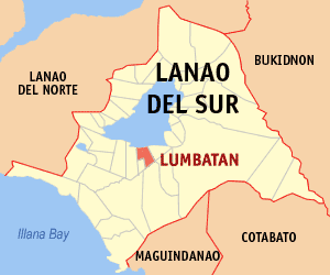
Lumbatan Municipality in Bangsamoro Autonomous Region in Muslim Mindanao, Philippines

Lumbatan, officially the Municipality of Lumbatan, is a 5th class municipality in the province of Lanao del Sur, Philippines. According to the 2015 census, it has a population of 19,105 people.

Marogong Municipality in Bangsamoro Autonomous Region in Muslim Mindanao, Philippines

Marogong, officially the Municipality of Marogong, is a 4th class municipality in the province of Lanao del Sur, Philippines. According to the 2015 census, it has a population of 21,319 people.

Pagayawan Municipality in Bangsamoro Autonomous Region in Muslim Mindanao, Philippines

Pagayawan, officially the Municipality of Pagayawan, is a 5th class municipality in the province of Lanao del Sur, Philippines. According to the 2015 census, it has a population of 13,139 people.

Saguiaran Municipality in Bangsamoro Autonomous Region in Muslim Mindanao, Philippines

Saguiaran, officially the Municipality of Saguiaran, is a 4th class municipality in the province of Lanao del Sur, Philippines. According to the 2015 census, it has a population of 24,619 people.

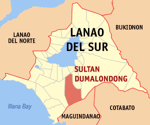
Sultan Dumalondong Municipality in Bangsamoro Autonomous Region in Muslim Mindanao, Philippines

Sultan Dumalondong, officially the Municipality of Sultan Dumalondong, is a 6th class municipality in the province of Lanao del Sur, Philippines. According to the 2015 census, it has a population of 11,298 people.

Picong, Lanao del Sur Municipality in Bangsamoro Autonomous Region in Muslim Mindanao, Philippines

Picong, officially the Municipality of Picong, is a 4th class municipality in the province of Lanao del Sur, Philippines. According to the 2015 census, it has a population of 16,615 people.

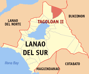
Tagoloan II Municipality in Bangsamoro Autonomous Region in Muslim Mindanao, Philippines

Tagoloan II, officially the Municipality of Tagoloan II, is a 4th class municipality in the province of Lanao del Sur, Philippines. According to the 2015 census, it has a population of 11,169 people.

Tamparan Municipality in Bangsamoro Autonomous Region in Muslim Mindanao, Philippines

Tamparan, officially the Municipality of Tamparan, is a 5th class municipality in the province of Lanao del Sur, Philippines. According to the 2015 census, it has a population of 25,874 people.

Wao, Lanao del Sur Municipality in Bangsamoro Autonomous Region in Muslim Mindanao, Philippines

Wao, officially the Municipality of Wao, is a 2nd class municipality in the province of Lanao del Sur, Philippines. According to the 2015 census, it has a population of 45,862 people.

Munai, Lanao del Norte Municipality in Northern Mindanao, Philippines

Munai, officially the Municipality of Munai, is a 4th class municipality in the province of Lanao del Norte, Philippines. According to the 2015 census, it has a population of 32,973 people.

Tangcal, Lanao del Norte Municipality in Northern Mindanao, Philippines

Tangcal, officially the Municipality of Tangcal, is a 5th class municipality in the province of Lanao del Norte, Philippines. According to the 2015 census, it has a population of 15,181 people.

Abdullah Goldiano Makapaar bin Sabbar was a Moro rebel and a Brigadier Commander of the Moro Islamic Liberation Front (M.I.L.F.), 303rd Brigade, in Lanao del Norte, a province in northern Mindanao Island of the Philippines. He was later promoted to Division Commander and served as Commanding Officer in the northwest of Mindanao, including Camp Bilal. Camp Bilal is one of the biggest military-training camps in northwestern Mindanao, and was previously handled by his elder brother, the late "Commander James Bond". The nickname "Bravo" given to Abdullah came from a candy popular at the time.

References

  1. "Municipality". Quezon City, Philippines: Department of the Interior and Local Government. Retrieved 31 May 2013.
  2. "Province: Lanao del Sur". PSGC Interactive. Quezon City, Philippines: Philippine Statistics Authority . Retrieved 12 November 2016.
  3. 1 2 3 Census of Population (2015). "ARMM – Autonomous Region in Muslim Mindanao". Total Population by Province, City, Municipality and Barangay. PSA . Retrieved 20 June 2016.
  4. Census of Population and Housing (2010). "ARMM – Autonomous Region in Muslim Mindanao". Total Population by Province, City, Municipality and Barangay. NSO . Retrieved 29 June 2016.
  5. Censuses of Population (1903–2007). "ARMM – Autonomous Region in Muslim Mindanao". Table 1. Population Enumerated in Various Censuses by Province/Highly Urbanized City: 1903 to 2007. NSO.
  6. "Province of Lanao del Sur". Municipality Population Data. Local Water Utilities Administration Research Division. Retrieved 17 December 2016.