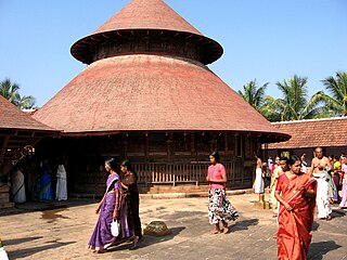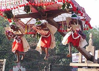
Manjeri is a Town and Municipality in Malappuram District in the state of Kerala, India, with a population of 97104 inhabitants at the 2011 Census.

Adyanpara Falls is a cascading waterfall in the Kurmbalangodu village of Nilambur taluk in Kerala, India. It is 14 kilometres (8.7 mi) from Nilambur town, and attracts tourists from various parts of Kerala. This is a seasonal waterfall. During Summer, water flow is low. This waterfall is of a natural cascading style as the waterfall descends over the rock.

Ezhupunna is a village in the taluk of Cherthala in Alappuzha district in the Indian state of Kerala. It lies between Alappuzha and Kochi, near National Highway 47. It is at a distance of 23 km from Kochi. There is also a railway station, where only passenger trains halt. This is a panchayat which come under the Aroor Assembly constituency and the Alappuzha Parliamentary constituency. The village have borders with Kumbalangy and Chellanam, suburbs of the city of Kochi.
Kulasekharapuram is a village in Kollam district in the state of Kerala, India.
Piravanthoor is a village in Kollam district in the state of Kerala, India. Piravanthoor is a part of Pathanapuram Block Panchayat and Kollam district Panchayat.

Kollengode Town is one of the major towns in the Palakkad district, Kerala, India. Kollengode 1 & Kollengode 2 are the village offices.It forms a part of Kollengode gram panchayat,.

Ezhamkulam is a village in Adoor Thaluk of Pathanamthitta district in the state of Kerala, India. It is located about 5 km from central Adoor.

Vellikulangara is a village in Thrissur district in the state of Kerala, India.
Sasalmari is a village in the southern state of Karnataka, India. It is located in the Sindhnur taluk of Raichur district in Karnataka.
Advikatte is a village in the southern state of Karnataka, India. It is located in the Nagamangala taluk of Mandya district in Karnataka.
Bogur is a village in Dharwad district in the southern state of Karnataka, India.
Kudremani is a village in Belgaum district in Karnataka, India. surrounded by MaharashtraState by all side.
Venktapur is a village in Belgaum district in the southern state of Karnataka, India.
Rustumpur is a village in Belgaum district of Karnataka, India.
Teggihal is a village in Koppal district of Karnataka, India.
Bommasamudra is a village in Dharwad district of Karnataka, India.
Ammanakeri is a village in the southern state of Karnataka, India.
Andralu is a village in the southern state of Karnataka, India.

Kannadi is a gram panchayat in the Palakkad district, state of Kerala, India. It is a local government organisation that serves the villages of Kannadi-I and Kannadi-II.
Karimpuzha is a gram panchayat in the Palakkad district, state of Kerala, India. It is a local government organisation that serves the villages of Karimpuzha-I and Karimpuzha-II.


