
The River Avon, also known as the River Aune, is a river in the county of Devon in the southwest of England. It rises in the southern half of Dartmoor National Park in an area of bog to the west of Ryder's Hill. Close to where the river leaves Dartmoor a dam was built in 1957 to form the Avon reservoir. After leaving the moor it passes through South Brent and then Avonwick and Aveton Gifford and flows into the sea at Bigbury-on-Sea. Near Loddiswell the valley flows through Fosse Copse a 1.88 hectares woodland owned and managed by the Woodland Trust.
Knettishall Heath is a 91.7 hectare biological Site of Special Scientific Interest west of Knettishall in Suffolk. A larger area of 176 hectares is the Knettishall Heath nature reserve, which is managed by the Suffolk Wildlife Trust.

Sustrans is a UK walking and cycling charity and custodian of the National Cycle Network.
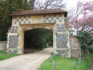
Abinger Hammer is a village or small community in a narrow part of the Vale of Holmesdale where it forms the valley of the River Tillingbourne and mainly on the parallel A25 in Surrey, England. Its homes, land and its parent civil parish are in the Surrey Hills AONB. It is approximately midway between the market towns of Dorking to the east, and Guildford, just over 6 miles (10 km) to the west. The village is named after its mill which powered an iron forge.
Burghfield is a village and large civil parish in West Berkshire, England, with a boundary with Reading. Burghfield can trace its history back to before the Domesday book, and was once home to three manors: Burghfield Regis, Burghfield Abbas and Sheffield. Since the 1980s the population of Burghfield has nearly doubled with the construction of many new housing estates, dependent for its employment on, for instance, Reading, Newbury and Basingstoke and M4 corridor which bisects the edge of the area.

Abinger is a large, well-wooded and mostly rural civil parish that lies between the settlements of Dorking, Shere and Ewhurst in the district of Mole Valley, Surrey, England. It adjoins Wotton Common on the same side of Leith Hill and includes Abinger Hammer, Sutton Abinger, Abinger Common, Forest Green, Walliswood, Oakwood Hill and some outskirts of Holmbury St Mary. More than half of the parish lies on the Greensand Ridge, while the remainder is divided between the Vale of Holmesdale and the North Downs.

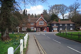
Shere is a village in the Guildford district of Surrey, England 4.8 miles (7.7 km) east south-east of Guildford and 5.4 miles (8.7 km) west of Dorking, centrally bypassed by the A25. It is a small still partly agricultural village chiefly set in the wooded 'Vale of Holmesdale' between the North Downs and Greensand Ridge with many traditional English features. It has a central cluster of old village houses, shops including a blacksmith and trekking shop, tea house, art gallery, two pubs and a Norman church. Shere has a CofE infant and nursery school with 'outstanding academic results' catering for 2- to 7-year-old children which serves the village and surrounding villages and towns, and a museum which opens most afternoons at weekends.

Albury is a village and civil parish in the borough of Guildford in Surrey, England, about 4 miles (6.4 km) south-east of Guildford town centre. The village is within Surrey Hills Area of Outstanding Natural Beauty and part of it forms the 63 acres (0.25 km2) Colyer's Hanger SSSI, financially supported by Natural England. Farley Green, Little London and adjacent Brook form part of the secular parish.
Holmbury St. Mary is a village in Surrey, England centered on shallow upper slopes of the Greensand Ridge. Its developed area is a clustered town 4.5 miles (7 km) southwest of Dorking and 8 miles (13 km) southeast of Guildford. Most of the village is in the borough of Guildford, within Shere civil parish. Much of the east side of the village street is in the district of Mole Valley, within Abinger civil parish.
Westhumble is a village in south east England, approximately 2 km (1.2 mi) north of Dorking, Surrey. The village is not part of a civil parish, however the majority of the settlement is in the ecclesiastical Parish of Mickleham.

Castle Bytham is a village and civil parish of around 300 houses in South Kesteven, Lincolnshire, England. The population was measured at 768 in 317 households at the 2011 census.

Gomshall railway station serves the village of Gomshall in Surrey, England. The station, and all trains serving it, are operated by Great Western Railway. It is on the North Downs Line, 35 miles 21 chains (56.75 km) measured from London Charing Cross via Redhill.

Gomshall is a village in the borough of Guildford in Surrey, England.

The River Tillingbourne runs along the south side of the North Downs and joins the River Wey at Guildford. Its source is near Tilling Springs to the north of Leith Hill at grid reference TQ143437 and it runs through Friday Street, Abinger Hammer, Gomshall, Shere, Albury, Chilworth and Shalford. The source is a semi-natural uninhabited area. The catchment is situated on sandstone which has a low rate of weathering. The Tillingbourne is 24 km (15 mi) in length.

Felbridge is a village and civil parish in the Tandridge district of Surrey with a playing field and Felbridge Nurseries within its focal area, narrowly in West Sussex. Felbridge village forms a contiguous settlement with East Grinstead and had 829 homes and households at the time of the 2011 Census. Domewood is part of Felbridge civil parish, which was created in 1953.
National Cycle Route 12 is part of the National Cycle Network managed by the charity Sustrans. It currently has a length of 121 miles (195 km) but is incomplete. When fully constructed it will run from Enfield Lock (London) to Grimsby (Lincolnshire) in the United Kingdom.

Oxmoor Copse is just south of the village of Abinger Hammer and to the west of the village of Abinger Common, in Surrey. It is 1.23 hectares and is in an AONB lying within the Surrey Hills. The previous owners gave the copse to the Woodland Trust as a gift.

Loddiswell is a parish and village in the South Hams district of Devon, England. It lies on the west side of the River Avon or Aune and is three miles NNW from Kingsbridge. There is evidence of occupation going back to Roman times. The villages most famous son and benefactor was Richard Peek who retired here after being one of the Sheriffs of London. The name Loddiswell is a corruption of Saint Loda's well, named after one of the many saints that occurred all over the westcountry, especially in Cornwall.

Forster Memorial Park, is a public park in London Borough of Lewisham. It takes up the land between Bellingham Road and Whitefoot Lane, Catford – the park and surrounding roads form Southend or Southend Village. The nearest stations are Bellingham and Beckenham Hill.

National Cycle Network (NCN) Route 56 is a Sustrans National Route that runs from Chester to Liverpool. The route utilises country lanes, a former railway trackbed, a coastal path and a seaside promenade.

