Related Research Articles

The Shackleton Range is a mountain range in Antarctica. Rising at Holmes Summit to 1,875 metres (6,152 ft), it extends in an east–west direction for about 160 kilometres (99 mi) between the Slessor and Recovery glaciers.

The Pensacola Mountains are a large group of mountain ranges of the Transantarctic Mountains System, located in the Queen Elizabeth Land region of Antarctica.
The Neptune Range is a mountain range, 112 km (70 mi) long, lying WSW of Forrestal Range in the central part of the Pensacola Mountains in Antarctica. The range is composed of Washington Escarpment with its associated ridges, valleys and peaks, the Iroquois Plateau, and the Schmidt and Williams Hills. It was discovered and photographed on 13 January 1956 on a US Navy transcontinental plane flight from McMurdo Sound to Weddell Sea and return.
The Queen Maud Mountains are a major group of mountains, ranges and subordinate features of the Transantarctic Mountains, lying between the Beardmore and Reedy Glaciers and including the area from the head of the Ross Ice Shelf to the Antarctic Plateau in Antarctica. Captain Roald Amundsen and his South Pole party ascended Axel Heiberg Glacier near the central part of this group in November 1911, naming these mountains for the Norwegian queen Maud of Wales. Despite the name, they are not located within Queen Maud Land.

The Sentinel Range is a major mountain range situated northward of Minnesota Glacier and forming the northern half of the Ellsworth Mountains in Antarctica. The range trends NNW-SSE for about 185 km (115 mi) and is 24 to 48 km wide. Many peaks rise over 4,000 m (13,100 ft) and Vinson Massif (4892 m) in the southern part of the range is the highest elevation on the continent.
The Churchill Mountains are a mountain range group of the Transantarctic Mountains System, located in the Ross Dependency region of Antarctica. They border on the western side of the Ross Ice Shelf, between Byrd Glacier and Nimrod Glacier.

The Heritage Range is a major mountain range, 160 km (99 mi) long and 48 km (30 mi) wide, situated southward of Minnesota Glacier and forming the southern half of the Ellsworth Mountains in Antarctica. The range is complex, consisting of scattered ridges and peaks of moderate height, escarpments, hills and nunataks, with the various units of relief set off by numerous intervening glaciers.
The Darwin Mountains is a group of mountains between the Darwin and Hatherton glaciers in Antarctica. Discovered by the British National Antarctic Expedition (1901–04) and named for Major Leonard Darwin, at that time Honorary Secretary of the Royal Geographical Society.

The Prince Charles Mountains are a major group of mountains in Mac. Robertson Land in Antarctica, including the Athos Range, the Porthos Range, and the Aramis Range. The highest peak is Mount Menzies. Other prominent peaks are Mount Izabelle and Mount Stinear. These mountains together with other scattered peaks form an arc about 260 miles long, extending from the vicinity of Mount Starlight in the north to Goodspeed Nunataks in the south.
The Ford Ranges are a grouping of mountain ranges standing east of Sulzberger Ice Shelf and Block Bay in the northwest part of Marie Byrd Land, Antarctica. Discovered by the Byrd Antarctic Expedition on December 5, 1929, they were named by Byrd for Edsel Ford of the Ford Motor Company, who helped finance the expedition.
The Sør Rondane Mountains are a group of mountains about 100 miles (160 km) long with main peaks rising to 3400 m, between the Queen Fabiola Mountains and Wohlthat Mountains in Queen Maud Land. They were discovered and photographed from the air by members of the Lars Christensen Expedition (LCE) on February 6, 1937, and named after Rondane, a mountain massif in southern Norway. The mountains and their constituent features were mapped in greater detail and named in 1957 by Norwegian cartographers working with air photos taken by U.S. Navy Operation Highjump, 1946–47.
Convoy Range is a broad mountain range in Antarctica. Much of the range has a nearly flat plateau-like summit, extending south from the Fry Saddle and ending at Mackay Glacier. The range has steep cliffs on its east side, but it slopes gently into the Cambridge Glacier on the western side.

Inferno Ridge is a narrow ridge, 8 miles (13 km) long, rising between Schneider Glacier and Rennell Glacier in the Heritage Range, Antarctica. It was so named by the University of Minnesota Geological Party to these mountains, 1963–64, because the area is deeply dissected and composed of black rocks.
The New Zealand Geological Survey Antarctic Expedition (NZGSAE) describes a series of scientific explorations of the continent Antarctica. The expeditions were notably active throughout the 1950s and 1960s.
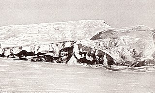
Nimbus Hills is a rugged line of hills and peaks about 14 nautical miles (26 km) long, forming the southeast part of Pioneer Heights in the Heritage Range, Ellsworth Mountains. Mapped by United States Geological Survey (USGS) from ground surveys and U.S. Navy air photos, 1961–66. Named by Advisory Committee on Antarctic Names (US-ACAN) after the National Aeronautics and Space Administration weather satellite, Nimbus, which took photographs of Antarctica from approximately 500 nautical miles (900 km) above earth on September 13, 1964.
The Gross Hills are the line of rugged hills and peaks located east of Schmidt Glacier, in the Heritage Range of Antarctica. They were named by the University of Minnesota Geological Party, 1963–64, for Barton Gross, a geologist with the party.
The Founders Peaks are a cluster of sharp peaks and ridges located just east of Founders Escarpment and between Minnesota Glacier and Gowan Glacier, in the Heritage Range of the Ellsworth Mountains in Antarctica. The peaks were mapped by the United States Geological Survey from surveys and U.S. Navy air photos, 1961–66. The name was applied by the Advisory Committee on Antarctic Names is association with the name Heritage Range.
Hall Peak is a peak, 2,170 metres (7,120 ft) high, in the Heritage Range of Antarctica, surmounting the dividing ridge at the upper reaches of Rennell Glacier, Schmidt Glacier and Larson Valley. It was named by the University of Minnesota Geological Party to these mountains in 1963–64 for Walter D. M. (Mike) Hall, a geologist with the party.
The Haslam Heights are a line of peaks trending north-northeast–south-southwest, rising to about 1,000 metres (3,300 ft) to the west of Vallot Glacier and Nye Glacier in Arrowsmith Peninsula, Graham Land, Antarctica. They were probably first seen by the French Antarctic Expedition, 1908–10 under Jean-Baptiste Charcot, which roughly charted the area in 1909. They were roughly mapped by the Falkland Islands Dependencies Survey (FIDS) in 1948, and named in 1985 by the UK Antarctic Place-Names Committee (UK-APC) after Rear Admiral Sir David W. Haslam, Hydrographer of the Navy, 1975–85.
Schmidt Glacier is a glacier, 20 nautical miles long, in the Pioneer Heights of the Heritage Range, Ellsworth Mountains in Antarctica. The glacier originates near Hall Peak and drains north along the west side of Thompson Escarpment and Gross Hills to coalesce with the lower part of Splettstoesser Glacier, north of Mount Virginia. It was named by the University of Minnesota Ellsworth Mountains Party, 1961–62, for Paul G. Schmidt, geologist with the party.
References
 This article incorporates public domain material from the United States Geological Survey document: "Pioneer Heights".(content from the Geographic Names Information System )
Coordinates: 79°30′S83°30′W / 79.500°S 83.500°W

| | This Ellsworth Land location article is a stub. You can help Wikipedia by expanding it. |