Related Research Articles

There are several hundred languages in China. The predominant language is Standard Chinese, which is based on central Mandarin, but there are hundreds of related Chinese languages, collectively known as Hanyu, that are spoken by 92% of the population. The Chinese languages are typically divided into seven major language groups, and their study is a distinct academic discipline. They differ as much from each other morphologically and phonetically as do English, German and Danish, but meanwhile share the same writing system (Hanzi) and are mutually intelligible in written form. There are in addition approximately 300 minority languages spoken by the remaining 8% of the population of China. The ones with greatest state support are Mongolian, Tibetan, Uyghur and Zhuang.

The Monguor, the Tu people, the White Mongol or the Tsagaan Mongol, are Mongolic people and one of the 56 officially recognized ethnic groups in China. The "Tu" ethnic category was created in the 1950s.
Dynasties in Chinese history, or Chinese dynasties, were hereditary monarchical regimes that ruled over China during much of its history. From the inauguration of dynastic rule by Yu the Great in circa 2070 BC to the abdication of the Xuantong Emperor on 12 February 1912 in the wake of the Xinhai Revolution, China was ruled by a series of successive dynasties. Dynasties of China were not limited to those established by ethnic Han—the dominant Chinese ethnic group—and its predecessor, the Huaxia tribal confederation, but also included those founded by non-Han peoples.

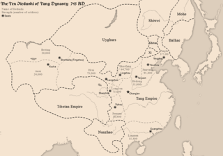
The jiedushi (节度使), or jiedu, was a title for regional military governors in China which was established in the Tang dynasty and abolished in the Yuan dynasty. The post of jiedushi has been translated as "military commissioner", "legate", or "regional commander". Originally introduced in 711 to counter external threats, the jiedushi were posts authorized with the supervision of a defense command often encompassing several prefectures, the ability to maintain their own armies, collect taxes and promote and appoint subordinates.

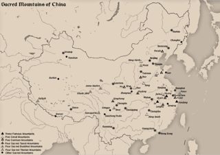
The Sacred Mountains of China are divided into several groups. The Five Great Mountains refers to five of the most renowned mountains in Chinese history, and they were the subjects of imperial pilgrimage by emperors throughout ages. They are associated with the supreme God of Heaven and the five main cosmic deities of Chinese traditional religion. The group associated with Buddhism is referred to as the Four Sacred Mountains of Buddhism, and the group associated with Taoism is referred to as the Four Sacred Mountains of Taoism.

The National Basketball League is a professional basketball minor league in China, called Chinese Basketball League (CBL) before 2006. It is commonly known as the NBL, and this name is often used even in Chinese.
China Table Tennis Super League is the top table tennis division under the Chinese Table Tennis Association.
Physiographic macroregions of China is a term suggested by an American anthropologist G. William Skinner as a subdivision of China Proper into nine areas according to the drainage basins of the major rivers and other travel-constraining geomorphological features. They are distinct in terms of environment, economic resources, culture and more or less interdependent histories with often unsynchronized developmental macrocycles. They were described in Skinner's landmark essays in The City in Late Imperial China.

Ruoqiang Town is a town in Ruoqiang County, Bayin'gholin Mongol Autonomous Prefecture in southeastern Xinjiang, People's Republic of China. Ruoqiang Town is the county seat of the Ruoqiang County, and therefore is the place that less detailed maps label as "Ruoqiang County" or just "Ruoqiang". The postal code is 841 800.

The Shanhai Yudi Quantu is a Ming dynasty Chinese map published in 1609 in the leishu encyclopedia Sancai Tuhui.

Hanchuan is a county-level city in east-central Hubei province, People's Republic of China. It is under the administration of Xiaogan prefecture-level city.

The Yiwu Zhi or Record of Foreign Matters, also known as the Jiaozhou Yiwu Zhi (交州异物志), Nanyi Yiwu Zhi (南裔异物志), Jiaozhi Yiwu Zhi (交趾异物志) and Yangyilang Zhushu (杨议郎著书) amongst others, is a treatise written by Eastern Han court advisor Yáng Fú (杨孚) covering the people, geography, fauna, rice cultivation, fruit, trees, grass, bamboo, insects and fish of the South China Sea region. It is the first written Chinese account of the Lingnan area's produce, production methods and aboriginal customs and uses a detailed methodology that would be adopted as standard by later works of this genre including the Nanfang Caomu Zhuang, Linhai Shuishang Yiwu Zhi (临海水上异物志), Nanzhou Yiwu Zhi (南州异物志), Hainan Yiwu Zhi (凉州异物志), Bashu Yiwu Zhi (巴蜀异物志), Funan Yiwu Zhi (扶南异物志), Lingnan Yiwu Zhi (岭南异物志), Nanzhong Bajun Yiwu Zhi (南中八郡异物志), Guangzhou Yiwu Zhi (广州异物志), and Lingbiao Luyi (岭表录异).
Beijing has many neighborhoods, some of which are new and others with a long history.

Middle Yandang Mountains or Zhong Yandang Shan refers, in the broad sense, to a coastal mountain range in southeastern Zhejiang Province in eastern China, which is close to Yandang Mountains, and both of them are parts of Yandang Ridge. It is said that people found that there was a lake in the top of the mountain, which was covered with reeds. And many wild geese lived there. Therefore, it is called "Yandang". It is historically called "the Best Mountain in Southeastern China". Comparing to Yandang Mountains, it seems like a religious interest rather than a geographic interest, which does not mean that Yandang Mountains are much better than Middle Yandang Mountains when it comes to natural landscape, but the latter is unique because of the religion. With cool climate and convenient traffic, as well as palatable sea food, it has been affirmed as one of the best ten summer resort in Zhejiang Province. It is said a Taoist priest, who believed Taoism came here and built a temple.
Twelve Views of Bayu are popular scenic views in and around the city of Chongqing, China. Ba and Yu are old names of Chongqing in Imperial times. Influenced by Eight Views of Xiaoxiang in Hunan Province, people in Chongqing listed their own most beloved views during the reign of Tianshun Emperor of Ming Dynasty. Scenic views in the list changed throughout the history. Some scenic views appeared in earlier lists no longer exist in modern days due to the change of physical geography, landscapes and land-uses.
Bozhong Mountain, also known by its Chinese name Bozhong Shan, is a mountain mentioned in the Book of Documents. It is said to be the source of the headwaters of the Han River, the namesake of the Han Dynasty and the Han Chinese. The mountain has been identified as a mountain in southern Shaanxi province's Ningqiang County or as another mountain on the border between Gansu province's Tianshui and Li County in the People's Republic of China. Both mountains are referred to as Bozhong Mountain.

The World First Class UniversityandFirst Class Academic Discipline Construction, together known as Double First Class, is a tertiary education development initiative designed by the People's Republic of China central government in 2015, which aims to comprehensively develop elite Chinese universities into world-class institutions by the end of 2050 through developing and strengthening their individual faculty departments. The Double First-Class University Plan has made new arrangements for the Chinese higher education institution development. The universities included in this plan are called Double First Class Universities.

The Muzart Pass, Muz-art Pass, or Muzat Pass is a high mountain pass that crosses the Tian Shan mountains in Xinjiang, China. It connects the city of Aksu in Tarim Basin with the city of Yining (Kulja) in the upper Ili River valley. It is located on the county boundary between Zhaosu County in Ili Prefecture and Baicheng County in Aksu Prefecture. The route over Muzart Pass is more commonly referred to as Xiate Trail by the Chinese, Xiate being the name of the village in Tekes River valley at the base on the northern side of the route.
References
- ↑ Spencer, Joseph Earle (1941). Chinese Place Names and the Appreciation of Geographic Realities. p. 77.
- ↑ Yeoh, Brenda S. A. (2013). Contesting Space in Colonial Singapore: Power Relations and the Urban Built Environment. Singapore: Singapore University Press. p. 232. Archived from the original on 2018-02-10.
- ↑ Ryavec, Karl E. (1994). "Important New Sources for the Study of Tibetan Geography: An Analysis of a Recent Chinese County Place Name Index of Dzamthang in Eastern Tibet". Central Asiatic Journal. 38 (2): 222. JSTOR 41927981.
- ↑ "Lakes in China". Ministry of Water Resources. 2004-08-02. Archived from the original on 2009-03-14. Retrieved 2009-11-22.