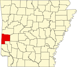
Potter, Arkansas

Last updated
Potter, Arkansas
USA Arkansas location map.svg
Red pog.svg
Potter, Arkansas
Usa edcp location map.svg
Red pog.svg
Potter, Arkansas
Coordinates: 34°33′13″N94°20′21″W / 34.55361°N 94.33917°W / 34.55361; -94.33917 Coordinates: 34°33′13″N94°20′21″W / 34.55361°N 94.33917°W / 34.55361; -94.33917
Country United States
State Arkansas
County Polk
Elevation
932 ft (284 m)
Time zone UTC-6 (Central (CST))
  Summer (DST) UTC-5 (CDT)
Area code 479
GNIS feature ID78086 [1]

Potter (also Old Potter, Rust) is an unincorporated community in Polk County, Arkansas, United States. [1] [2]

Notes

  1. 1 2 "Potter, Arkansas". Geographic Names Information System . United States Geological Survey, United States Department of the Interior.
  2. "Arkansas Department of Transportation-Polk County" (PDF). Archived from the original (PDF) on 2012-03-13. Retrieved 2018-03-15.


Related Research Articles

<span class="mw-page-title-main">Polk County, Missouri</span> County in Missouri, United States

Polk County is a county located in the southwestern portion of the U.S. state of Missouri. As of the 2010 census, the population was 31,137. Its county seat is Bolivar. The county was organized January 5, 1835, and named for Ezekiel Polk.

<span class="mw-page-title-main">Polk County, Arkansas</span> County in Arkansas, United States

Polk County is a county located in the U.S. state of Arkansas. As of the 2020 census, the population was 19,221. The county seat is Mena. Polk County is Arkansas's 48th county, formed on November 30, 1844; it was named for James K. Polk, 11th President of the United States.

<span class="mw-page-title-main">Grannis, Arkansas</span> City in Arkansas, United States

Grannis is a city in Polk County, Arkansas, United States. The population was 554 at the 2010 census.

<span class="mw-page-title-main">Cossatot River State Park-Natural Area</span> State park in Arkansas, United States

Cossatot River State Park-Natural Area is a 5,299.65-acre (2,144.69 ha) Arkansas state park in Howard County and Polk County, Arkansas in the United States. The park follows a rough, undeveloped 12.5 miles (20.1 km) of the Cossatot River. The river itself is included in Arkansas's Natural and Scenic Rivers System and the National Park Service's list of National Wild and Scenic Rivers, making it a whitewater rafting destination. The rough nature of the river, including Class III, IV, and dangerous Class V rapids, make the park-natural area a popular destination for skilled canoeists, kayakers, and playboaters. The park became a part of the system in 1988 after the Arkansas Department of Parks and Tourism and Arkansas Natural Heritage Commission agreed to cooperative management after acquiring the property from the Weyerhaeuser Corporation.

<span class="mw-page-title-main">Frank Polk</span> American diplomat (1871–1943)

Frank Lyon Polk was an American lawyer and diplomat, who was also a name partner of the law firm today known as Davis Polk & Wardwell.

<span class="mw-page-title-main">Arkansas Highway 8</span>

Highway 8 is an east–west state highway in Lower Arkansas. The route of 229.83 miles (369.88 km) runs from Oklahoma State Highway 63 (SH-63) at the Oklahoma state line east across the state to US Route 65 (US 65) south of Eudora.

<span class="mw-page-title-main">Arkansas Highway 272</span>

Highway 272 is a designation for two east–west state highways in the Ouachita Mountains region of western Arkansas. One segment of 2.06 miles (3.32 km) runs west from U.S. Route 71 Business (US 71B) in Waldron to the Waldron Municipal Airport. A second route of 1.58 miles (2.54 km) begins at US 59/US 270 at Rich Mountain and runs west to Highway 88 at Queen Wilhelmina State Park. Both routes are owned and maintained by the Arkansas Department of Transportation (ArDOT).

<span class="mw-page-title-main">National Register of Historic Places listings in Polk County, Arkansas</span>

This is a list of the National Register of Historic Places listings in Polk County, Arkansas.

<span class="mw-page-title-main">Arkansas Highway 375</span>

Highway 375 is a designation for one east-west and one north–south state highway in Polk County, Arkansas. A western route of 8.09 miles (13.02 km) runs east from U.S. Route 59/U.S. Route 71 (US 59/US 71) at Potter Junction to Highway 8 in Mena. A second route of 11.62 miles (18.70 km) begins at Highway 8 outside of Mena and runs south to County Road 630 in the Ouachita National Forest.

Old Potter, also known as Potter Junction, is an unincorporated community in Potter Township, Polk County, Arkansas, United States. It is located along U.S. Route 59/U.S. Route 71 south of Mena, where Highway 375 begins. The community of Potter is 2 miles (3.2 km) west on AR 375, where it meets the Kansas City Southern Railway.

<span class="mw-page-title-main">1992 United States presidential election in Arkansas</span> Election in Arkansas

The 1992 United States presidential election in Arkansas took place on November 3, 1992, as part of the 1992 United States presidential election. State voters chose six representatives, or electors to the Electoral College, who voted for president and vice president.

Corinth is an unincorporated community in Polk County, Arkansas, United States. Corinth is located on Arkansas Highway 88, 3.2 miles (5.1 km) east of Mena.

Cossatot River School District is a public school district located along the Cossatot River and is based in Wickes, Arkansas, United States. The Cossatot River School District provides early childhood, elementary and secondary education for more than 1,150 prekindergarten through grade 12 students at its six facilities.

Wickes School District was a school district headquartered in Wickes, Arkansas.

<span class="mw-page-title-main">Queen Wilhelmina State Park</span> Park in Arkansas, USA

Queen Wilhelmina State Park is a unit of Arkansas Department of Parks and Tourism in the Ouachita Mountains.

Jerry Nathan Bell, known as Nate Bell, is an Independent politician from Mena in the U.S. state of Arkansas, who served three two-year terms in the Arkansas House of Representatives. From 2013 to 2017, he represented District 20, which encompasses Polk and Montgomery counties. From 2011 to 2013, he was the representative for District 22. He was a Republican prior to 2015.

<span class="mw-page-title-main">Arkansas Highway 84</span> State highway in Arkansas

Arkansas Highway 84 is a designation for two state highways in west Arkansas. The western segment is 3.7 miles (6.0 km) long and travels from County Road 14 (CR 14) in Bogg Springs and heads east to U.S. Route 59 and U.S. Route 71 (US 59/US 71) before terminating. The eastern segment is 85.8 miles long and travels from US 278 in Umpire to U.S. 270B in Malvern.

Cherry Hill is an unincorporated community in northeast Polk County, Arkansas, United States. The community is on Arkansas Highway 88 approximately 13 miles east of Mena. The Ouachita River flows past south of the site.

Acorn School District or Acorn Public Schools was a school district headquartered in Acorn, an unincorporated area in Polk County, Arkansas, United States, about 5 miles (8.0 km) from Mena. Schools included Acorn Elementary School and Acorn High School.