Wickes, Arkansas | |
|---|---|
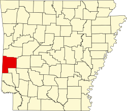
 Location of Wickes in Polk County, Arkansas. | |
| Coordinates: 34°17′56″N94°20′0″W / 34.29889°N 94.33333°W | |
| Country | United States |
| State | Arkansas |
| County | Polk |
| Area | |
• Total | 2.34 sq mi (6.06 km2) |
| • Land | 2.32 sq mi (6.02 km2) |
| • Water | 0.02 sq mi (0.05 km2) |
| Elevation | 1,024 ft (312 m) |
| Population (2020) | |
• Total | 637 |
• Estimate (2024) | 655 |
| • Density | 274.21/sq mi (105.89/km2) |
| Time zone | UTC-6 (Central (CST)) |
| • Summer (DST) | UTC-5 (CDT) |
| ZIP code | 71973 |
| Area code | 870 |
| FIPS code | 05-75500 |
| GNIS feature ID | 2406884 [2] |
Wickes is a city [3] in Polk County, Arkansas, United States. The population was 637 at the 2020 census.
Contents
Near Wickes is the Boggs Springs Youth Encampment of the American Baptist Association, a retreat of Missionary Baptist churches.
Wickes has historic places such as the 100-year-old City Hall, and the Lighthouse Drive-in. [ citation needed ]
Wickes is home to the Lawrence M. Magdovitz Memorial Library, a former U.S. Post Office that was donated to the Town of Wickes by the owner of the building in return for naming it after him.