Potter, Arkansas | |
|---|---|
 Potter, Arkansas  Potter, Arkansas | |
| Coordinates: 34°33′13″N94°20′21″W / 34.55361°N 94.33917°W | |
| Country | United States |
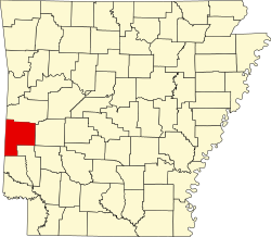
| State | Arkansas |
| County | Polk |
| Elevation | 932 ft (284 m) |
| Time zone | UTC-6 (Central (CST)) |
| • Summer (DST) | UTC-5 (CDT) |
| Area code | 479 |
| GNIS feature ID | 78086 [1] |
Potter (also New Potter, Rust) is an unincorporated community in Polk County, Arkansas, United States. [1] [2]