Prairie Creek Airport

Last updated
Prairie Creek Airport
Summary
Airport typePrivate
OperatorCanadian Zinc Corp
Location Prairie Creek, Northwest Territories
Time zone PST (UTC−08:00)
  Summer (DST)PDT (UTC−07:00)
Elevation  AMSL 2,950 ft / 899 m
Coordinates 61°33′53″N124°48′54″W / 61.56472°N 124.81500°W / 61.56472; -124.81500 Coordinates: 61°33′53″N124°48′54″W / 61.56472°N 124.81500°W / 61.56472; -124.81500
Map
NWT All Region Locator.svg
Airplane silhouette.svg
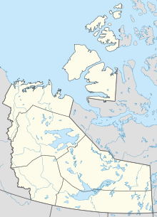
CBH4
Location in the Northwest Territories
Runways
Direction LengthSurface
ftm
14/323,000914Gravel

Prairie Creek Airport( TC LID : CBH4) is located next to Prairie Creek, Northwest Territories, Canada. Prior permission is required to land except in the case of an emergency. The airport is closed from 1 September until 30 April.

Related Research Articles

Portage la Prairie (North) Airport

Portage la Prairie (North) Airport is a registered aerodrome located adjacent to Portage la Prairie, Manitoba, Canada.

Portage la Prairie/Southport Airport

Portage la Prairie/Southport Airport is located adjacent to Portage la Prairie, Manitoba, Canada. It is operated by Southport Aerospace Centre Inc., a commercial-industrial centre. It was formerly Canadian Forces Base Portage la Prairie. It has been commercially operated since 1992.

Dawson Creek Airport

Dawson Creek Airport is located 2 nautical miles southeast of Dawson Creek, British Columbia, Canada.

High Prairie Airport

High Prairie Airport is located 2 nautical miles south of High Prairie, Alberta, Canada.

Three Hills Airport

Three Hills Airport is located 2 nautical miles east southeast of Three Hills, Alberta, Canada.

Canadian Forces Base Portage la Prairie

Canadian Forces Base Portage la Prairie is a former military airport located adjacent to Portage la Prairie, Manitoba, Canada. Today the airport is operated as Portage la Prairie/Southport Airport.

References

  1. Canada Flight Supplement. Effective 0901Z 16 July 2020 to 0901Z 10 September 2020.