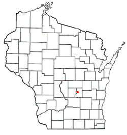
Princeton (town), Wisconsin

Last updated
Princeton, Wisconsin
Coordinates: 43°49′24″N89°6′42″W / 43.82333°N 89.11167°W / 43.82333; -89.11167 Coordinates: 43°49′24″N89°6′42″W / 43.82333°N 89.11167°W / 43.82333; -89.11167
Country Flag of the United States.svg  United States
State Flag of Wisconsin.svg  Wisconsin
County Green Lake
Area
  Total35.6 sq mi (92.3 km2)
  Land35.3 sq mi (91.5 km2)
  Water0.3 sq mi (0.8 km2)
Elevation
[1]
787 ft (240 m)
Population
 (2000)
  Total1,540
  Density43.6/sq mi (16.8/km2)
Time zone UTC-6 (Central (CST))
  Summer (DST) UTC-5 (CDT)
Area code(s) 920
FIPS code 55-65625 [2]
GNIS feature ID1583987 [1]

Princeton is a town in Green Lake County, Wisconsin, United States. The population was 1,540 at the 2000 census. The City of Princeton is located within the town, though it is politically independent. The unincorporated community of Green Lake Terrace is also located in the town.

Contents

Geography

According to the United States Census Bureau, the town has a total area of 35.6 square miles (92.3 km2), of which, 35.3 square miles (91.5 km2) of it is land and 0.3 square miles (0.8 km2) of it (0.84%) is water.

Demographics

As of the census [2] of 2000, there were 1,540 people, 650 households, and 462 families residing in the town. The population density was 43.6 people per square mile (16.8/km2). There were 1,105 housing units at an average density of 31.3 per square mile (12.1/km2). The racial makeup of the town was 98.12% White, 0.39% Black or African American, 0.32% Native American, 0.06% Asian, 0.13% from other races, and 0.97% from two or more races. 0.91% of the population were Hispanic or Latino of any race.

There were 650 households, out of which 26.2% had children under the age of 18 living with them, 62.5% were married couples living together, 5.5% had a female householder with no husband present, and 28.9% were non-families. 25.1% of all households were made up of individuals, and 10.0% had someone living alone who was 65 years of age or older. The average household size was 2.37 and the average family size was 2.81.

In the town, the population was spread out, with 22.0% under the age of 18, 4.4% from 18 to 24, 25.5% from 25 to 44, 28.1% from 45 to 64, and 20.1% who were 65 years of age or older. The median age was 44 years. For every 100 females, there were 111.0 males. For every 100 females age 18 and over, there were 107.8 males.

The median income for a household in the town was $37,340, and the median income for a family was $47,500. Males had a median income of $34,097 versus $24,375 for females. The per capita income for the town was $20,003. About 5.7% of families and 8.2% of the population were below the poverty line, including 11.6% of those under age 18 and 4.4% of those age 65 or over.

Related Research Articles

Smith County, Mississippi U.S. county in Mississippi

Smith County is a county located in the U.S. state of Mississippi. As of the 2010 census, the population was 16,491. Its county seat is Raleigh. Smith County is a prohibition or dry county.

Sylvan Springs, Alabama Town in Alabama, United States

Sylvan Springs is a town in Jefferson County, Alabama, United States, located northwest of the Birmingham suburb of Pleasant Grove. It incorporated on May 22, 1957. At the 2010 census the population was 1,542, up from 1,465 in 2000. This area was damaged by an F5 tornado on April 8, 1998, including the First United Methodist Church of Sylvan Springs.

Birdseye, Indiana Town in Indiana, United States

Birdseye is a town in Jefferson Township, Dubois County, in the U.S. state of Indiana. At the 2010 census, the town population was 415.

Carrabassett Valley, Maine Town in Maine, United States

Carrabassett Valley is a town in Franklin County, Maine, United States. The population was 761 at the 2010 census.

Mount Desert, Maine Town in Maine, United States

Mount Desert is a town on Mount Desert Island in Hancock County, Maine, United States. The population was 2,053 at the 2010 census. Incorporated in 1789, the town currently encompasses the villages of Otter Creek, Seal Harbor, Northeast Harbor, Somesville, Hall Quarry, and Pretty Marsh.

Osborn, Maine Town in Maine, United States

Osborn is a town in Hancock County, Maine, United States. The population was 67 at the 2010 census.

East Machias, Maine Town in Maine, United States

East Machias is a town in Washington County, Maine, United States on the East Machias River. At the 2010 census, the town population was 1,368. It is the home of Washington Academy, a private school founded in 1792.

Princeton, Maine Town in Maine, United States

Princeton is a town in Washington County, Maine, United States. The town was named after Princeton, Massachusetts. The population was 832 at the 2010 census.

Whitneyville, Maine Town in Maine, United States

Whitneyville is a town in Washington County, Maine, United States. The town was named after Colonel Joseph Whitney, a mill owner. The population was 220 at the 2010 census.

Stratford, New Hampshire Town in New Hampshire, United States

Stratford is a town located on the Connecticut River in Coos County, New Hampshire, United States. The population was 746 at the 2010 census. Within the town are the villages of North Stratford, Stratford Hollow, and Beatties. U.S. Route 3 passes through the center of town, as did a branch of the Grand Trunk Railway.

Deerfield, New York Town in New York, United States

Deerfield is a town in Oneida County, New York, United States. The population was 4,273 at the 2010 census.

Chesapeake, West Virginia Town in West Virginia, United States

Chesapeake is a town in Kanawha County, West Virginia, United States. The population was 1,554 at the 2010 census. The town is situated on the Kanawha River. Chesapeake was incorporated in 1949 and named for the Chesapeake and Ohio Railway, which has served the community since 1873. It is also the hometown of NFL player Chris Massey, long snapper for the St. Louis Rams. The current Mayor of Chesapeake is Jack B. Lavender.

Worthington, West Virginia Town in West Virginia, United States

Worthington is a town in Marion County, West Virginia, in the United States. The population was 158 at the 2010 census. Worthington was incorporated in 1893 and named for Colonel George Worthington, an early settler.

Poca, West Virginia Town in West Virginia, United States

Poca is a town in Putnam County, West Virginia, United States. The population was 974 at the 2010 census. Poca is a part of the Huntington-Ashland, WV-KY-OH, Metropolitan Statistical Area (MSA). As of the 2010 census, the MSA had a population of 287,702. New definitions from February 28, 2013 placed the population at 363,000.

Pine Grove, West Virginia Town in West Virginia, United States

Pine Grove is a town in Wetzel County, West Virginia, United States. The population was 552 at the 2010 census. The community was named for a grove of pine trees near the original town site.

Dunn, Dunn County, Wisconsin Town in Wisconsin, United States

Dunn is a town in Dunn County, Wisconsin, United States. The population was 1,492 at the 2000 census. The unincorporated communities of Downsville and Dunnville are located in the town.

Eagle Lake, Wisconsin CDP in Wisconsin, United States

Eagle Lake is a census-designated place (CDP) in the town of Dover, Racine County, Wisconsin, United States. The population was 1,192 at the 2010 census.

Tonawanda (CDP), New York Census-designated place in New York, United States

Tonawanda is a census-designated place (CDP) in Erie County, New York, United States. The CDP comprises the town of Tonawanda minus its subsidiary village of Kenmore. As of the 2010 census, the CDP population was 58,144.

Ironton is a town in Sauk County, Wisconsin, United States. The population was 650 at the 2000 census. The town was named from deposits of iron ore in the area. The Village of Ironton is located within the town.

Darien is a town in Walworth County, Wisconsin, United States. The population was 1,747 at the 2000 census. The Village of Darien is located within the town. The unincorporated community of Bardwell is located in the town. The unincorporated communities of Allen's Grove and Fairfax are also located partially in the town.

References

  1. 1 2 "US Board on Geographic Names". United States Geological Survey. 2007-10-25. Retrieved 2008-01-31.
  2. 1 2 "U.S. Census website". United States Census Bureau . Retrieved 2008-01-31.