
Bennington County is a county in the U.S. state of Vermont. As of the 2020 census, the population was 37,347. The shire towns are jointly Bennington and Manchester, and the largest municipality is Bennington. The county was created in 1778.

Glastenbury is a town in Bennington County, Vermont, United States. The town was unincorporated by an act of the state legislature in 1937. The population was 9 at the 2020 census. Along with Somerset, Glastenbury is one of two Vermont towns where the population levels have dropped so low that the town has been unincorporated. The town has no local government and the town's affairs are handled by a state-appointed supervisor.
Peru is a town in Bennington County, Vermont, United States. The population was 531 at the 2020 census. Originally known as Bromley, the town name was changed to "Peru" by the land grantees as a way of attracting land buyers to an area that had been described as 36 square miles (93 km2) of "trees, bears and mountain lions".

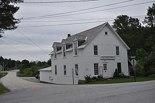
Woodford is a town in Bennington County, Vermont, United States. As of the 2020 census, the population was 355.

The Long Trail is a hiking trail located in Vermont, running the length of the state. It is the oldest long-distance trail in the United States, constructed between 1910 and 1930 by the Green Mountain Club. The club remains the primary organization responsible for the trail, and is recognized by the state legislature as "the founder, sponsor, defender, and protector" of the Long Trail System.

Bennington is a town in Bennington County, Vermont, United States. It is one of two shire towns of the county, the other being Manchester. As of the 2020 US Census, the population was 15,333. Bennington is the most populous town in southern Vermont, the second-largest town in Vermont and the sixth-largest municipality in the state.
Manchester is a town in, and one of two shire towns of, Bennington County, Vermont, United States. The population was 4,484 at the 2020 census.

The Walloomsac River from the Native American name, Wal-loom-sac is a 16.8-mile-long (27.0 km) tributary of the Hoosic River in the northeastern United States. It rises in southwestern Vermont, in the Green Mountains east of the town of Bennington in Woodford Hollow at the confluence of Bolles Brook and City Stream where it is labeled Walloomsac Brook on maps but is locally known as "The Roaring Branch". The river then flows west toward Bennington and passes the downtown area to the north. For many years this section was intermittent due to the water having been diverted to power mills in town. This divergence gave the name Walloomsac to a portion of the river flowing through town on the present course of South Stream. The combined Walloomsac / South Stream joins the Roaring Branch northwest of town. From here the river flows westward as the Walloomsac River and joins the Hoosic River below Hoosick Falls, New York.

The Green Mountains are a mountain range in the U.S. state of Vermont and are a subrange of the Appalachian Mountains. The range runs primarily south to north and extends approximately 250 miles (400 km) from the border with Massachusetts to the border with Quebec, Canada. The part of the same range that is in Massachusetts and Connecticut is known as The Berkshires or the Berkshire Hills and the Quebec portion is called the Sutton Mountains, or Monts Sutton in French.

The Taconic Mountains are a 150-mile-long sub-range of the Appalachian Mountains lying on the eastern border of New York State and adjacent New England. The range, which played a role in the history of geological science, is separated from the Berkshires and Green Mountains to the east by a series of valleys, principally those of the Housatonic River, Battenkill River and Otter Creek. The Taconics' highest point is Mount Equinox in Vermont at 3,840 feet (1,170 m); among many other summits are Dorset Mountain, Mount Greylock and Mount Everett.

Proctor Academy is a coeducational, independent preparatory boarding school for grades 9–12 located on 2,500 acres (10 km2) in Andover, New Hampshire. The school was established in 1848 by the town of Andover, with Dyer H. Sanborn as the principal. There are about 370 students.

Green Mountain National Forest is a national forest located in Vermont, a temperate broadleaf and mixed forest typical of the New England/Acadian forests ecoregion. The forest supports a variety of wildlife, including beaver, moose, coyote, black bear, white-tailed deer, wild turkey, and ruffed grouse. The forest, being situated in Vermont's Green Mountains, has been referred to as the granite backbone of the state.

Vermont Route 9 is a state highway in the U.S. state of Vermont. The highway runs 46.957 miles (75.570 km) from the New York state line in Bennington, where it continues west as New York State Route 7, to the New Hampshire state line at the Connecticut River in Brattleboro, where the highway continues as New Hampshire Route 9. VT 9 is the primary east–west highway of Bennington and Windham counties in southern Vermont. The highway connects Southern Vermont's primary towns of Bennington and Brattleboro via its crossing of the Green Mountains. VT 9 also connects those towns with Troy, New York, and Keene, New Hampshire, via the connecting highways in those states. The highway also intersects three major north–south routes: U.S. Route 7 in Bennington and Interstate 91 (I-91) and US 5 in Brattleboro.

Burke Mountain is a mountain located in the Northeast Kingdom of Vermont. The bulk of the mountain is in Burke and Kirby, Caledonia County, but its southeast side is in Essex County. It is flanked to the east and southeast by Umpire Mountain and Kirby Mountain, respectively.

The Middlebury College Snowbowl is a ski area in Hancock, Vermont, 13 miles (21 km) east of Middlebury in the Green Mountains. The site has been owned and operated by Middlebury College since its first trails were cut in 1934. The Snowbowl has 17 trails and 3 lifts, offering access to more than 700 acres (2.8 km2) of terrain. In 2006, it became the first carbon-neutral ski area in the United States.
The Hermitage Club at Haystack Mountain is a private, member-owned club that provides alpine skiing on Haystack Mountain in Wilmington, Vermont to its members.

Paula Jean Welden was an American college student who disappeared while walking on Vermont's Long Trail hiking route. Local sheriffs were criticized for errors made in the investigation, which led to the creation of the Vermont State Police. Welden's fate remains unsolved, and was one of several unexplained disappearances in the same area at the time.

Pine Cobble Mountain, located in Williamstown, Massachusetts, is a sub-summit of East Mountain in the Clarksburg State Forest. This outcropping is best known as a popular hiking destination, where an outlook encompasses panoramic views of Williamstown, the Mount Greylock Range, and North Adams.
Stark Mountain is a mountain in the Green Mountains in the U.S. state of Vermont. Located in the town of Fayston in Washington County, the mountain summit is 3,662 feet (1,116 m) in elevation. Stark Mountain is named after General John Stark, hero of the Battle of Bennington fought in 1777.
The George D. Aiken Wilderness is one of eight wilderness areas in the Green Mountain National Forest in the U.S. state of Vermont. The wilderness area, created by the Vermont Wilderness Act of 1984, is named in honor of George Aiken (1892–1984), former U.S. Senator from Vermont who advocated for the passage of the Eastern Wilderness Areas Act of 1975. Today the George D. Aiken Wilderness consists of 4,800 acres (1,900 ha) managed by the U.S. Forest Service.

