Gore Mountain (Vermont)

Last updated
Gore Mountain
USA Vermont location map.svg
Red triangle with thick white border.svg
Gore Mountain
Highest point
Elevation 3,332 ft (1,016 m)  NGVD 29 [1]
Prominence 1,982 ft (604 m) [1]
Listing #45 New England Fifty Finest
Coordinates 44°55′11″N71°47′38″W / 44.9197696°N 71.7939832°W / 44.9197696; -71.7939832 Coordinates: 44°55′11″N71°47′38″W / 44.9197696°N 71.7939832°W / 44.9197696; -71.7939832 [2]
Geography
Location Essex County, Vermont
Topo map USGS Norton Pond

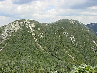
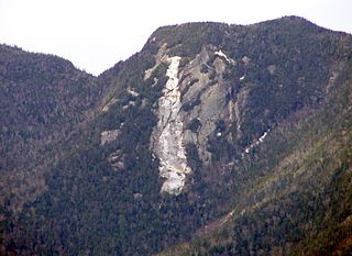
Gore Mountain is a mountain located in the uninhabited Avery's Gore in Essex County, Vermont, about 6 miles (10 km) south of the Canada–US border with Quebec. In Vermont, gores and grants are unincorporated portions of a county which are not part of any town and have limited self-government (if any, as many are uninhabited). Gore Mtn. is flanked to the northeast by Black Mountain, and to the northwest by Middle Mountain.

Mountain A large landform that rises fairly steeply above the surrounding land over a limited area

A mountain is a large landform that rises above the surrounding land in a limited area, usually in the form of a peak. A mountain is generally steeper than a hill. Mountains are formed through tectonic forces or volcanism. These forces can locally raise the surface of the earth. Mountains erode slowly through the action of rivers, weather conditions, and glaciers. A few mountains are isolated summits, but most occur in huge mountain ranges.

Averys Gore, Vermont

Averys Gore is a gore located in Essex County, Vermont, United States.

Essex County, Vermont County in the United States

Essex County is a county in the northeastern part of the U.S. state of Vermont. As of the 2010 census, the population was 6,306, making it the least-populous county in both Vermont and New England. Its shire town is the municipality of Guildhall. The county was created in 1792 and organized in 1800. Bordered by the Connecticut River next to New Hampshire, Essex County is part of the Berlin, New Hampshire micropolitan area. It is south of the Canadian province of Quebec.

The north and northwest sides of Gore Mountain drain via several short brooks into the Coaticook River, thence into the Massawippi River, Saint-François River, and Saint Lawrence River in Quebec, and thence into the Gulf of Saint Lawrence. The southwest side of Gore Mtn. drains into Jim Carroll Brook, thence into the North Branch of the Nulhegan River, the Connecticut River, and into Long Island Sound in Connecticut. The southeast side of Gore Mtn. drains into the Logger Branch, and the east side into the Black Branch, of the Nulhegan River.

Coaticook River river in Canada

The Coaticook River is a north-flowing river rising in Vermont, United States, and located primarily in the Estrie region of Quebec, Canada. The mouth of the river is located north of Waterville and south of Lennoxville, near the southern border of the city of Sherbrooke, at the Massawippi River. Via the Massawippi and the Saint-François River, it is part of the St. Lawrence River watershed.

Massawippi River river in Canada

The Massawippi River is a river in the Estrie region of Quebec, Canada. It is a tributary of the Saint Lawrence River.

Saint-François River river in Canada

The Saint-François River is a river in the Canadian province of Quebec.

See also

Related Research Articles

Signal Mountain is a mountain located in Caledonia County, Vermont, in the Groton State Forest. Signal Mountain is flanked to the northwest by Spruce Mountain, and to the southwest by Butterfield Mountain.

East Mountain is a mountain located in Essex County, Vermont, in the "Northeast Kingdom". East Mountain is flanked to the north by Seneca Mountain.

Pico Peak mountain in Vermont

Pico Peak is a mountain located in Rutland County, Vermont, United States. It is the northernmost summit of the Coolidge Range in the Green Mountains, and the second highest in the Coolidge Range after Killington Peak. Pico Peak is flanked to the south by Ramshead Peak, and to the north faces Deer Leap Mountain across Sherburne Pass. The peak's name may stem from the Abenaki for "the pass/opening" or indeed from the Spanish or Portuguese word for "peak", Pico. Seen from Sherburne Pass the summit resembles a cone. "Pico Peak" appears on the 1869 Beers Atlas of Rutland County, Walling's 1860 Map of the State of Vermont and Chace's 1854 Map of Rutland County.

Mendon Peak (Vermont) mountain in United States of America

Mendon Peak is a mountain located in Rutland County, Vermont. The mountain is a spur off the west side of the Coolidge Range of the Green Mountains, and stands within the Calvin Coolidge State Forest. It is flanked to the east by Little Killington. Mendon Peak is on the Appalachian Mountain Club's list of the "Hundred Highest" peaks in New England. The summit is trailless and several different approaches are possible.

Mount Wilson (Vermont) mountain in Vermont, United States of America

Mount Wilson is a mountain located in Addison County, Vermont, in the Green Mountain National Forest. The mountain is part of the central Green Mountains. Mount Wilson is flanked to the southwest by Bread Loaf Mountain.

Glastenbury Mountain is a mountain located in Bennington County, Vermont, in the Green Mountain National Forest. The mountain is part of the Green Mountains.

Phelps Mountain (New York) mountain in United States of America

Phelps Mountain is a mountain located in Essex County, New York. The mountain is named after Orson Schofield "Old Mountain" Phelps (1817–1905), who cut the first trail up Mount Marcy and named several of the Adirondack peaks. It is the 32nd highest peak in New York. Phelps Mountain is flanked to the southeast by Table Top Mountain.

Table Top Mountain is a mountain located in Essex County, New York. Table Top Mtn. is flanked to the north by Phelps Mountain, and to the south by Mount Marcy. Table Top has three summits; the southernmost is the highest, followed by the middle peak (1,312 m) and the north peak (1,285 m).

Saddleback Mountain (Keene, New York) mountain in New York, United States of America

Saddleback Mountain is a mountain located in Essex County, New York. The mountain is part of the Great Range of the Adirondack Mountains. The 0.2 mi (0.32 km) long summit ridge has peaks at each end with a pronounced dip between, giving it the profile of a saddle. Saddleback Mtn. is flanked to the southwest by Basin Mountain, and to the east by Gothics.

Lower Wolfjaw Mountain mountain in United States of America

Lower Wolfjaw Mountain is located in Essex County, New York. Landscape artist Alexander Helwig Wyant (1836–1892) named Lower Wolfjaw, together with neighboring Upper Wolfjaw Mountain, about 1870 for their appearance in profile. The mountain is the northeasternmost of the Adirondack High Peaks in the Great Range of the Adirondack Mountains. Lower Wolfjaw Mountain is flanked to the southwest by Upper Wolfjaw Mountain, and to the northeast by Hedgehog Mountain.

Upper Wolfjaw Mountain mountain in United States of America

Upper Wolfjaw Mountain is a mountain located in Essex County, New York. Landscape artist Alexander Helwig Wyant (1836–1892) named the mountain, in combination with neighboring Lower Wolfjaw Mountain, c. 1870 for their appearance in profile. The mountain is part of the Great Range of the Adirondack Mountains. Upper Wolfjaw Mtn. is flanked to the southwest by Armstrong Mountain, and to the northeast by Lower Wolfjaw Mtn.

Street Mountain is a mountain located in Essex County, New York, named after Alfred Billings Street (1811–1881), a poet and New York State Librarian. The mountain is the high point of the Street Range of the Adirondack Mountains. Street's northeast ridge is Nye Mountain.

Lyon Mountain (Clinton County, New York) mountain in United States of America

Lyon Mountain is a mountain located in Clinton County, New York, of which its peak is the highest point. The mountain is named for Nathaniel Lyon, an early settler of the area who moved from Vermont in 1803 and died circa 1850.

Black Mountain (Washington County, New York) peak of the Adirondack Mountains in the Appalachian Mountains of North America

Black Mountain is a mountain located in Washington County, New York, of which its peak is the highest point. Isolated from the rest of the Adirondack Mountains by Lake George, Black Mtn. has the seventh highest topographic prominence of all the mountains in New York.

Shrewsbury Peak is a mountain located in Rutland County, Vermont, in the Calvin Coolidge State Forest. The mountain is part of the Coolidge Range. Shrewsbury is flanked to the northwest by Little Killington.

Gore Mountain (New York) mountain in New York, United States of America

Gore Mountain is a mountain located near the village of North Creek in Warren County, New York, of which its peak is the highest point. Gore is flanked to the north by South Mountain, and to the southwest by Height of Land Mountain. The mountain is the site of the popular Gore Mountain ski resort.

Fir Mountain (New York) mountain in United States of America

Fir Mountain is a mountain located in Ulster County, New York. The mountain is part of the Catskill Mountains. Fir Mountain is flanked to the northwest by Big Indian Mountain, and to the southeast by Spruce Mountain.

Middlebury Gap, is a mountain pass in the Green Mountains of Vermont. The height of land of the pass is located in Addison County.

Sherburne Pass

Sherburne Pass, is a mountain pass in the Green Mountains of Vermont, between 3,957-foot (1,206 m) Pico Peak to the south and 2,782-foot (848 m) Deer Leap Mountain to the north. The height of land of the pass is located in the town of Killington, while its western ascent begins in the town of Mendon.

References