External links
- U.S. Geological Survey Geographic Names Information System: Signal Mtn.
- PeakBagger.com: Signal Mountain
| | This article about a location in Vermont is a stub. You can help Wikipedia by expanding it. |
| Signal Mountain | |
|---|---|
| Highest point | |
| Elevation | 3,370 feet (1,030 m) [1] |
| Prominence | 2,140 feet (650 m) [2] |
| Listing | #35 New England Fifty Finest |
| Coordinates | 44°12.38′N72°19.51′W / 44.20633°N 72.32517°W Coordinates: 44°12.38′N72°19.51′W / 44.20633°N 72.32517°W |
| Geography | |
| Location | Caledonia County, Vermont, U.S. |
| Topo map | USGS Knox Mountain |
| Climbing | |
| Easiest route | unmaintained hiking trail [3] |
Signal Mountain is a mountain located in Caledonia County, Vermont, in the Groton State Forest. Signal Mountain is flanked to the northwest by Spruce Mountain, and to the southwest by Butterfield Mountain.
The north side of Signal Mountain drains into Noyes Pond, thence into the South Branch of the Wells River, the upper Connecticut River, and into Long Island Sound in Connecticut. The east side drains into Heath Brook, thence into the South Branch of the Wells River. The south side drains into the Waits River, another tributary of the Connecticut. The west side drains into Great Brook, thence into the Winooski River, Lake Champlain, and ultimately into the Gulf of Saint Lawrence in Canada.
| | This article about a location in Vermont is a stub. You can help Wikipedia by expanding it. |
Mount Crescent is a mountain located in the Crescent Range of the White Mountains in Randolph, New Hampshire. It is 3,251 ft (991 m) high, and its summit is the second highest mountain summit in Randolph, after Black Crescent Mountain. Both mountains are in Randolph's Ice Gulch Town Forest. On the 1896 topographic map, Mount Crescent is shown as "Randolph Mtn." with an elevation of 3,280 ft, and Black Crescent is shown as "Mt. Crescent" with an elevation of 3,322 ft.

Mount Frissell, 2,454 feet (748 m), which straddles the border of southwest Massachusetts and northwest Connecticut, is a prominent peak of the Taconic Range.

Smarts Mountain is a 3,238-foot-high (987 m) mountain in the town of Lyme in Grafton County, New Hampshire, United States. Smarts is flanked to the north by Mount Cube, at 2,909 feet (887 m), and to the southwest by Holts Ledge, at 2,110 feet (640 m). Although of only moderate elevation, Smarts is separated from the southwestern White Mountains by Oliverian Notch, a fairly low pass traversed by New Hampshire Route 25 southwest of Mount Moosilauke. That gives Smarts a relative height of 2,190 ft (670 m), which makes it one of twelve mountains in New Hampshire with a prominence over 2,000 ft (610 m).
Mount Putnam is a mountain located on the border between Washington County and Lamoille County, Vermont, in the Putnam State Forest. Mount Putnam, the high point of the Worcester Range, is flanked to the northeast by Mount Worcester, and to the southwest by Mount Hunger. It is the sixth most prominent peak in Vermont. The summit is in Washington County, but the mountain extends into Lamoille County as well.
East Mountain is a mountain located in Essex County, Vermont, in the "Northeast Kingdom". East Mountain is flanked to the north by Seneca Mountain.

Gore Mountain is a mountain located in the uninhabited Avery's Gore in Essex County, Vermont, about 6 miles (10 km) south of the Canada–US border with Quebec. In Vermont, gores and grants are unincorporated portions of a county which are not part of any town and have limited self-government . Gore Mtn. is flanked to the northeast by Black Mountain, and to the northwest by Middle Mountain.

Bread Loaf Mountain is a mountain located in Addison County, Vermont, in the Breadloaf Wilderness in the Green Mountain National Forest. The mountain is part of the central Green Mountains. Bread Loaf Mountain is flanked to the northeast by Mount Wilson, part of Vermont's Presidential Range.
Mount Wilson is a mountain in the Green Mountains in the U.S. state of Vermont. Located in the Breadloaf Wilderness of the Green Mountain National Forest, its summit is in the town of Ripton in Addison County. The mountain is named after Woodrow Wilson, former president of the United States. Flanked by Bread Loaf Mountain to the southwest, Mount Wilson is one of five peaks in Vermont's Presidential Range. At 3,745 feet (1,141 m), it is the 12th highest peak in Vermont and one of the hundred highest peaks in New England.

The Cannon Balls is a mountain ridge located in Grafton County, New Hampshire. It is part of the Kinsman Range of the White Mountains. The ridge has three peaks with elevations of, from west to east, 3,693, 3,660, and 3,769 feet. The ridge takes its name from adjacent Cannon Mountain, on which a series of boulders, when viewed from the foot of the mountain, resemble an antique artillery cannon. The Cannon Balls are flanked to the northeast by Cannon Mountain, and to the southwest by Kinsman Mountain.
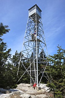
Stratton Mountain is a mountain located in Windham County, Vermont, in the Green Mountain National Forest. The mountain is the highest point of Windham County, and of the southern Green Mountains generally. A fire tower located on the summit is generally open for climbing by the public. There is also a small caretaker cabin at the summit that is inhabited in season by a caretaker from the Green Mountain Club.
Glastenbury Mountain is a mountain located in Bennington County, Vermont, in the Green Mountain National Forest. The mountain is part of the Green Mountains.

Macomb Mountain is a mountain located in Essex County, New York. The mountain is named after Maj. Gen. Alexander Macomb (1782–1841), who won acclaim during the War of 1812 at the Battle of Plattsburgh, and served as Commanding General of the United States Army (1828–1841).
Phelps Mountain is a mountain located in Essex County, New York. The mountain is named after Orson Schofield "Old Mountain" Phelps (1817–1905), who cut the first trail up Mount Marcy and named several of the Adirondack peaks. It is the 32nd highest peak in New York. Phelps Mountain is flanked to the southeast by Table Top Mountain.

Sawteeth is a mountain located in Essex County, New York. The mountain is part of the Great Range of the Adirondack Mountains. The mountain's name comes from the serrated appearance of its summit ridge. Sawteeth is on a spur ridge of the Great Range, which branches off to the southeast from Gothics.

Shrewsbury Peak is a mountain located in Rutland County, Vermont, in the Calvin Coolidge State Forest. The mountain is part of the Coolidge Range. Shrewsbury is flanked to the northwest by Little Killington.
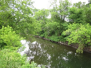
The Passumpsic River is a 22.7-mile-long (36.5 km) tributary of the Connecticut River, in Vermont. Though primarily a Caledonia County river, it is the only river to flow through all three counties of the Northeast Kingdom.

Burke Mountain is a mountain located in the Northeast Kingdom of Vermont. The bulk of the mountain is in Burke and Kirby, Caledonia County, but its southeast side is in Essex County. It is flanked to the east and southeast by Umpire Mountain and Kirby Mountain, respectively.

Table Mountain is located in Ulster County, New York. The mountain is part of the Catskill Mountains. Table Mountain is flanked to the south by Peekamoose Mountain, and to the northeast by Lone Mountain.

Friday Mountain is a mountain located in Ulster County, New York. The mountain is part of the Catskill Mountains. Friday Mountain is flanked to the north by Cornell Mountain, and to the south by Balsam Cap.
Elephant Mountain is a mountain located in Bowdoin College Grant West Piscataquis County, Maine. It is about 5 miles (8 km) southeast of Moosehead Lake, 2 miles southwest of Baker Mountain, and 5 miles west of White Cap Mountain.