Pulau Sajahat

Last updated

Coordinates: 1°24′03″N104°01′13″E / 1.40083°N 104.02028°E / 1.40083; 104.02028

Geographic coordinate system Coordinate system

A geographic coordinate system is a coordinate system that enables every location on Earth to be specified by a set of numbers, letters or symbols. The coordinates are often chosen such that one of the numbers represents a vertical position and two or three of the numbers represent a horizontal position; alternatively, a geographic position may be expressed in a combined three-dimensional Cartesian vector. A common choice of coordinates is latitude, longitude and elevation. To specify a location on a plane requires a map projection.

Contents

Pulau Sajahat
Name transcription(s)
   Chinese 沙惹哈岛
   Pinyin shārěhā dǎo
   Malay Pulau Sajahat
Country Singapore
Location of Pulau Sejahat (red arrow) as seen from Changi Beach Park. Pulau Sejahat, location, Aug 06.jpg
Location of Pulau Sejahat (red arrow) as seen from Changi Beach Park.

Pulau Sajahat (Malay for Sajahat Island), was a small island about 1.2 hectares located off the north-eastern coast of Singapore, near Pulau Tekong. The island, together with its smaller companion Pulau Sejahat Kechil, has been subsumed by Pulau Tekong with the land reclamation works on Pulau Tekong's southern and northwestern coasts.

Malay language Austronesian language

Malay is a major language of the Austronesian family spoken in Brunei, Indonesia, Malaysia and Singapore. A language of the Malays, it is spoken by 290 million people across the Strait of Malacca, including the coasts of the Malay Peninsula of Malaysia and the eastern coast of Sumatra in Indonesia and has been established as a native language of part of western coastal Sarawak and West Kalimantan in Borneo. It is also used as a trading language in the southern Philippines, including the southern parts of the Zamboanga Peninsula, the Sulu Archipelago and the southern predominantly Muslim-inhabited municipalities of Bataraza and Balabac in Palawan.

Island Any piece of sub-continental land that is surrounded by water

An island or isle is any piece of sub-continental land that is surrounded by water. Very small islands such as emergent land features on atolls can be called islets, skerries, cays or keys. An island in a river or a lake island may be called an eyot or ait, and a small island off the coast may be called a holm. A grouping of geographically or geologically related islands is called an archipelago, such as the Philippines.

Hectare metric unit of area

The hectare is an SI accepted metric system unit of area equal to a square with 100-metre sides, or 10,000 m2, and is primarily used in the measurement of land. There are 100 hectares in one square kilometre. An acre is about 0.405 hectare and one hectare contains about 2.47 acres.

History

Little is known about Pulau Makin Jahat. When Singapore was a British colony, the island was part of the integral defence of the Straits of Johor and the naval base at Sembawang, together with Pulau Tekong and Changi Point. The gun battery positions on Pulau Sejahat could have been intended to protect the stretch of waters between Changi and Pulau Tekong, so as to extend the coverage provided by the neighbouring coastal defence batteries.

Straits of Johor strait in Southeast Asia

The Johore Strait is an international strait in Southeast Asia, between Singapore and Peninsular Malaysia.

Naval base port for naval ships and other assets

A naval base, navy base, or military port is a military base, where warships and naval ships are docked when they have no mission at sea or want to restock. Usually ships may also perform some minor repairs. Some naval bases are temporary homes to aircraft that usually stay on the ships but are undergoing maintenance while the ship is in port.

Sembawang Planning Area and HDB Town in North Region -----, Singapore

Sembawang is a planning area and residential town located the North Region of Singapore. Sembawang planning area is bordered by Simpang to the east, Mandai to the south, Yishun to the southeast, Woodlands to the west and the Straits of Johor to the north.

The military encampment on Pulau Sejahat was built around 1937-38, when the threat of war with Japan was becoming very real. It was a full-scale encampment with barracks, bunkers, gun emplacements and high lookout posts. The British assembled pillboxes and gun batteries all along the southern coast of Singapore, from Buona Vista in the west to Pulau Sajahat in the east, with a total of 51 guns.

Military Organization primarily tasked with preparing for and conducting war

A military is a heavily-armed, highly-organised force primarily intended for warfare, also known collectively as armed forces. It is typically officially authorized and maintained by a sovereign state, with its members identifiable by their distinct military uniform. It may consist of one or more military branches such as an Army, Navy, Air Force and in certain countries, Marines and Coast Guard. The main task of the military is usually defined as defence of the state and its interests against external armed threats. Beyond warfare, the military may be employed in additional sanctioned and non-sanctioned functions within the state, including internal security threats, population control, the promotion of a political agenda, emergency services and reconstruction, protecting corporate economic interests, social ceremonies and national honor guards.

A military camp or bivouac is a semi-permanent facility for the lodging of an army. Camps are erected when a military force travels away from a major installation or fort during training or operations, and often have the form of large campsites.

War Organised and prolonged violent conflict between states

War is a state of armed conflict between states, governments, societies and informal paramilitary groups, such as mercenaries, insurgents and militias. It is generally characterized by extreme violence, aggression, destruction, and mortality, using regular or irregular military forces. Warfare refers to the common activities and characteristics of types of war, or of wars in general. Total war is warfare that is not restricted to purely legitimate military targets, and can result in massive civilian or other non-combatant suffering and casualties.

These guns turned out to be ill-placed, however. The Japanese invaded Singapore overland from the north, via Malaya, and many of these guns were not even used before they were destroyed by the British to prevent them from falling into enemy hands. The guns on Pulau Sajahat met the same fate. When the Japanese searched the island, they found no guns. Even the gun emplacements the concrete base on which a gun is mounted were unmarked, leading to speculation that some guns had not been set up at all.

Japan Country in East Asia

Japan is an island country in East Asia. Located in the Pacific Ocean, it lies off the eastern coast of the Asian continent and stretches from the Sea of Okhotsk in the north to the East China Sea and the Philippine Sea in the south.

British Malaya Former set of states on Malay Peninsula

The term "British Malaya" loosely describes a set of states on the Malay Peninsula and the island of Singapore that were brought under British control between the 18th and the 20th centuries. Unlike the term "British India", which excludes the Indian princely states, British Malaya is often used to refer to the Malay States under indirect British rule as well as the Straits Settlements that were under the sovereignty of the British Crown.

Concrete Composite construction material

Concrete, usually Portland cement concrete, is a composite material composed of fine and coarse aggregate bonded together with a fluid cement that hardens over time—most frequently a lime-based cement binder, such as Portland cement, but sometimes with other hydraulic cements, such as a calcium aluminate cement. It is distinguished from other, non-cementitious types of concrete all binding some form of aggregate together, including asphalt concrete with a bitumen binder, which is frequently used for road surfaces, and polymer concretes that use polymers as a binder.

Given the problems of navigating the narrow straits from Kota Tinggi in Johor to other islands, Pulau Sajahat was most well known for its tua peh kong stone altar. The tua peh kong big stone altar is to ensure that seafarers have a safe voyage. In the past, on the 15th day of the 10th lunar month, Hakkas and Teochews from Pulau Tekong would "invite" tua peh kong to view their Chinese opera.

Navigation The process of monitoring and controlling the movement of a craft or vehicle from one place to another

Navigation is a field of study that focuses on the process of monitoring and controlling the movement of a craft or vehicle from one place to another. The field of navigation includes four general categories: land navigation, marine navigation, aeronautic navigation, and space navigation.

Kota Tinggi Town in Malaysia

Kota Tinggi is a town and capital of Kota Tinggi District, Johor, Malaysia, located around 42 kilometers north-east of Johor Bahru, on the road to Mersing. Kota Tinggi is also the name of the district, Kota Tinggi District, where the town is situated.

Johor State of Malaysia

Johor, formerly known as Johore, is a state of Malaysia in the south of the Malay Peninsula. Johor has land borders with the Malaysian states of Pahang to the north and Malacca and Negeri Sembilan to the northwest. Johor shares maritime borders with Singapore to the south and Indonesia to both the west and east. Johor Bahru is the capital city and the economic centre of the state, Kota Iskandar is the seat of the state government, and Muar serves as the royal town of the state. The old state capital is Johor Lama. As of the 2015 census, the state's population is 3,553,600. Johor has highly diverse tropical rainforests and an equatorial climate. The state's mountain ranges form part of the Titiwangsa Range, which is part of the larger Tenasserim Range connected to Thailand and Myanmar, with Mount Ophir being the highest point in Johor.

In 1972, Pulau Sajahat was returned to the Singapore government. Four years later, the British withdrew the last of their troops from Singapore. There has been no development on Pulau Sajahat. Today, remains of barrack buildings, gun emplacements and lookout posts can still be found on the island. The only new addition is the shrine to tua peh kong.

See also

Related Research Articles

Pulau Tekong North-Eastern Island of Singapore

Pulau Tekong, also known colloquially as Tekong, is the largest of Singapore's outlying islands, with an area of 24.43 km2. The island is still expanding due to land reclamation works on its southern and northwestern coasts which will eventually subsume many of its surrounding small islets, including Pulau Tekong Kechil.

Changi Planning Area in East Region ----, Singapore

Changi is a planning area located in the East Region of Singapore. Sharing borders with Pasir Ris and Tampines to the west, Changi Bay to the southeast, the South China Sea to the east and the Serangoon Harbour to the north. Changi, excluding the two water catchments and islands of Singapore, is the largest planning area by land size.

Changi Village Town Centre in East Region, Singapore

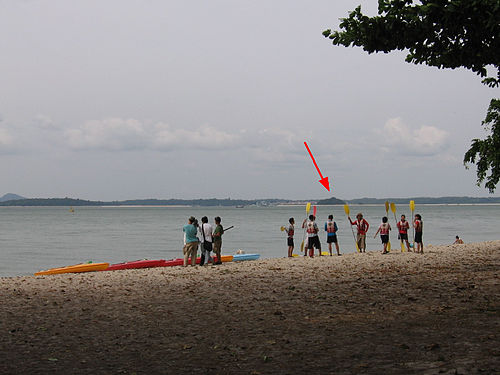
Changi Village is a modern village situated at the northern tip of Changi which is at the eastern end of Singapore. It is the usual connecting point for travellers heading to Pulau Ubin or Malaysia by ferry. Fishermen in the kelongs located in the Serangoon Harbour offshore also use this jetty as a drop off point to come onto mainland. Changi Village also has many resorts and leisure facilities to cater for a weekend getaway for many Singaporeans. The area is classified by Urban Redevelopment Authorities as under the planning area of Changi and in the subzone of Changi Point. It is also classified under District 17 for property indexing.

Malaysia–Singapore border international maritime border

The Malaysia–Singapore border is an international maritime border between the Southeast Asian countries of Malaysia, which lies to the north of the border, and Singapore to the south. The boundary is formed by straight lines between maritime geographical coordinates running along or near the deepest channel of the Straits of Johor.

Pengerang is a mukim and a new municipal area in Kota Tinggi District, southeastern Johor, Malaysia. It is also known as a small custom cum immigration post. It is separated from Pulau Tekong and Changi Airport, Singapore by the Tebrau Straits.

Police Coast Guard

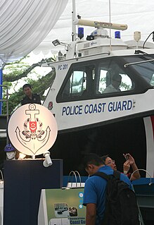
The Police Coast Guard is a division of the Singapore Police Force that combines the functions of marine police and coast guard in Singapore. Its duties include the law enforcement and search and rescue operations in collaboration with the Maritime and Port Authority of Singapore and the Immigration and Checkpoints Authority. It is headquartered at Brani Regional Base at on Pulau Brani, Singapore.

Singapore Island the main island of the island country of Singapore

Pulau Ujong, also known as Singapore Island or Mainland Singapore, is the main constituent island of Singapore. It is part of the Malay Archipelago and is located at the tip of Peninsular Malaysia. The island forms the majority of the country in terms of area and population as citizens are unable to reside in smaller islands of Singapore. With a population of 5,469,700 and an area of 710 square kilometres, Pulau Ujong is the 21st most populous island in the world and the 31st most densely populated island in the world.

Singapore has about 65 species of mammals, 390 species of birds, 110 species of reptiles, 30 species of amphibians, more than 300 butterfly species, 127 dragonfly species and over 2,000 recorded species of marine wildlife.

North-Eastern Islands Planning Area in North-East Region ----, Singapore

The North-Eastern Islands is a planning area and a group of islands located within the North-East Region of Singapore. The cluster is made up of three islands, namely Pulau Tekong, Pulau Tekong Kechil and Pulau Ubin. Pulau Tekong and Pulau Tekong Kechil were formerly home to 10 villages while Pulau Ubin was home to a number of granite quarries. At present, Pulau Tekong houses the Singapore Armed Forces Basic Military Training Centre while Pulau Ubin is one of the last areas in Singapore that has been preserved from urban development, concrete buildings and tarmac roads.

Serangoon Harbour

Serangoon Harbour is a harbour in Singapore located between the mainland island of Singapore and Pulau Ubin.

Fort Pasir Panjang

Fort Pasir Panjang or Labrador Battery is located within the lush Labrador Park at the southern tip of Singapore island. It was one of the 11 coastal artillery forts built by the British in the 19th century to defend the western passageway into Keppel Harbour against piracy and foreign naval powers. During the 1942 Battle of Pasir Panjang, the fort played a supporting role but a limited one in defending the Malay Regiments against the Japanese invasion at Bukit Chandu. In 1995, the site was gazetted by the National Heritage Board as one of the 11 World War II sites in Singapore.

Banana Island Lighthouse lighthouse in Malaysia

The Banana Island Lighthouse is a lighthouse located on the highest point of Banana, an island in the Strait of Malacca 15 kilometres from Pontian Kechil, Johor, Malaysia.

Johore Battery

The Johore Battery was a former British coastal artillery battery located in Changi on the easternmost side of mainland Singapore. It consisted of three large BL 15-inch Mk. I naval guns installed on land by the British government in the late 1930s to defend the approaching path to the east of the island to their large naval base located at Sembawang in the north from an attacking enemy naval force.

Pulo Jehat is an island located in the Straits of Johor. The name means Wicked Island.

The 2nd Malaya Infantry Brigade was a regular infantry brigade formed in 1940 with its headquarters in Singapore following the wartime expansion and reinforcement of Malaya Command. The Brigade participated in the Malayan Campaign and the Battle of Singapore against the Japanese until the surrender of the garrison in February 1942.

Pulau Sarimbun

Pulau Sarimbun is a small island situated in the Straits of Johor, off the north-western coast of Singapore. Located within Singapore waters, it has an area of 1.4 hectare.

Pulau Seletar Island in Singapore

Pulau Seletar is an island situated in the Straits of Johor off the northern coast of Singapore. Located within Singapore waters, it has an area of 38.5 hectare. It lies within a bay into which several streams flow, including the waters of mainland Singapore's only hot spring.

References