
Bristol and Gloucester Railway | ||||||||||||||||||||||||||||||||||||||||||||||||||||||||||||||||||||||||||||||||||||||||||||||||||||||||||||||||||||||||||||||||||||||||||||||||||||||||||||||||||||||||||||||||||||||||||||||||||||||||||||||||||||||||||||||||||||||||||||||||||||||||||||||||||||||||||||||||||||||||||||||||||||||||||||||||||||||||||||||||||||||||||||||||||||||||||||||||||||||||||||||||||||||||||||||||||||||||||||||||||||||||||||||||||||||
|---|---|---|---|---|---|---|---|---|---|---|---|---|---|---|---|---|---|---|---|---|---|---|---|---|---|---|---|---|---|---|---|---|---|---|---|---|---|---|---|---|---|---|---|---|---|---|---|---|---|---|---|---|---|---|---|---|---|---|---|---|---|---|---|---|---|---|---|---|---|---|---|---|---|---|---|---|---|---|---|---|---|---|---|---|---|---|---|---|---|---|---|---|---|---|---|---|---|---|---|---|---|---|---|---|---|---|---|---|---|---|---|---|---|---|---|---|---|---|---|---|---|---|---|---|---|---|---|---|---|---|---|---|---|---|---|---|---|---|---|---|---|---|---|---|---|---|---|---|---|---|---|---|---|---|---|---|---|---|---|---|---|---|---|---|---|---|---|---|---|---|---|---|---|---|---|---|---|---|---|---|---|---|---|---|---|---|---|---|---|---|---|---|---|---|---|---|---|---|---|---|---|---|---|---|---|---|---|---|---|---|---|---|---|---|---|---|---|---|---|---|---|---|---|---|---|---|---|---|---|---|---|---|---|---|---|---|---|---|---|---|---|---|---|---|---|---|---|---|---|---|---|---|---|---|---|---|---|---|---|---|---|---|---|---|---|---|---|---|---|---|---|---|---|---|---|---|---|---|---|---|---|---|---|---|---|---|---|---|---|---|---|---|---|---|---|---|---|---|---|---|---|---|---|---|---|---|---|---|---|---|---|---|---|---|---|---|---|---|---|---|---|---|---|---|---|---|---|---|---|---|---|---|---|---|---|---|---|---|---|---|---|---|---|---|---|---|---|---|---|---|---|---|---|---|---|---|---|---|---|---|---|---|---|---|---|---|---|---|---|---|---|---|---|---|---|---|---|---|---|---|---|---|---|---|---|---|---|---|---|---|---|---|---|---|---|---|---|---|---|---|---|---|---|---|---|---|---|---|---|---|---|---|---|---|---|---|---|---|---|---|---|---|
| ||||||||||||||||||||||||||||||||||||||||||||||||||||||||||||||||||||||||||||||||||||||||||||||||||||||||||||||||||||||||||||||||||||||||||||||||||||||||||||||||||||||||||||||||||||||||||||||||||||||||||||||||||||||||||||||||||||||||||||||||||||||||||||||||||||||||||||||||||||||||||||||||||||||||||||||||||||||||||||||||||||||||||||||||||||||||||||||||||||||||||||||||||||||||||||||||||||||||||||||||||||||||||||||||||||||
Ram Hill Colliery, (grid reference ST679803 ) was a privately owned colliery in the Coalpit Heath area north-east of Bristol, England. It operated between about 1825 and 1865.
Ram Hill Colliery was sunk sometime between 1820 and 1830. It was owned by the Coalpit Heath Company, which included Sir John Smyth as a shareholder. Sir John was one of the main proponents of the Bristol and Gloucestershire Railway, which linked the pit and others in the area to Cuckolds Pill in Bristol. [1] At this date workable coal was dependent on a means of transport to market, so that the railway and the pit were interdependent.
Ram Hill was 558 ft deep and was originally worked by a horse gin, the remains of which were still visible in 2006. In later years it was worked by a beam engine. The pit was linked under ground to Churchleaze and Rose Oak Pits, forming the hub of 19th century coal mining in Westerleigh parish.
Abandonment plans show that the colliery, along with other Coalpit Heath pits at Churchleaze and New Engine, closed in the 1860s as the nearby Frog Lane Colliery [2] increased production.
In later years land in the area was purchased by the Great Western Railway for the construction of their direct route between Wootton Bassett and the Severn Tunnel via Badminton. The new line passed through the area in a deep cutting immediately north of the pit.
The site was rediscovered by local archaeologist and author John Cornwell in 1981 and has since been excavated, first by workers on a job creation scheme, and latterly by the "Friends of Ram Hill Colliery" who cleared the area of flora and removed two spoil heaps which were formed during earlier excavations.
Excavation of the Ram Hill site exposed more of the railway, including stone blocks with cast iron chairs in situ and the remains of a boiler house for a steam engine. Other remains at the site included the foundations of a horse gin and the uncapped shaft of the pit.
A geophysical survey, using resistivity, at Ram Hill Colliery has revealed clear traces of a reservoir in the northern corner of the site. [3]
In 2006 the Ram Hill Colliery site was designated by English Heritage as a Scheduled Ancient Monument, recognising the national importance of the site and protecting it in the future. [4]
Churchleaze mine is described at New Engine.

For the nearby Ram Hill Engine Pit, Churchleaze No. 1 Pit and Churchleaze No. 2 Pit see Ram Hill.
Serridge Engine Pit, Orchard (or Middle Wimsey) Pit, No. 11 Pit and New Engine Pit were situated in the neighbouring hamlet of Henfield.

Whitehaven is a town and port on the English north west coast and near to the Lake District National Park in Cumbria, England. Historically in Cumberland, it lies by road 38 miles (61 km) south-west of Carlisle and 45 miles (72 km) to the north of Barrow-in-Furness. It is the administrative seat of the Borough of Copeland, and has a town council for the parish of Whitehaven. The population of the town was 23,986 at the 2011 census.

Kingswood is a suburban town and unparished area in the South Gloucestershire district, in the ceremonial county of Gloucestershire, England, bordering the eastern edge of the City of Bristol. The suburb is situated 3.4 miles (5.5 km) east-northeast of Bristol city centre and 102 miles (164 km) west of London.

Coalpit Heath is a small village in the parish of Westerleigh, South Gloucestershire, England, south of Yate and east of Frampton Cotterell in South Gloucestershire.

The Somerset Coal Canal was a narrow canal in England, built around 1800. Its route began in basins at Paulton and Timsbury, ran to nearby Camerton, over two aqueducts at Dunkerton, through a tunnel at Combe Hay, then via Midford and Monkton Combe to Limpley Stoke where it joined the Kennet and Avon Canal. This link gave the Somerset coalfield access east toward London. The longest arm was 10.6 miles (17.1 km) long with 23 locks. From Midford an arm also ran via Writhlington to Radstock, with a tunnel at Wellow.

Frampton Cotterell is a large village and parish, in South Gloucestershire, South West England, on the River Frome. The village is contiguous with Winterbourne to the south-west and Coalpit Heath to the east. The parish borders Iron Acton to the north and Westerleigh to the south-east, the large town of Yate is 2.1 miles (3.4 km) away. The village is 7.5 miles (12 km) north-east of the city of Bristol.

Astley is a village in the Metropolitan Borough of Wigan, Greater Manchester, England. Within the boundaries of the historic county of Lancashire, it is crossed by the Bridgewater Canal and the A580 East Lancashire Road. Continuous with Tyldesley, it is equidistant from Wigan and Manchester, both 8.3 miles (13.4 km) away. Astley Mosley Common ward had a population of 11,270 at the 2011 Census.

The Middleton Railway is the world's oldest continuously working railway, situated in the English city of Leeds. It was founded in 1758 and is now a heritage railway, run by volunteers from The Middleton Railway Trust Ltd. since 1960.
The Somerset Coalfield in northern Somerset, England is an area where coal was mined from the 15th century until 1973. It is part of a larger coalfield which stretched into southern Gloucestershire. The Somerset coalfield stretched from Cromhall in the north to the Mendip Hills in the south, and from Bath in the east to Nailsea in the west, a total area of about 240 square miles (622 km2). Most of the pits on the coalfield were concentrated in the Cam Brook, Wellow Brook and Nettlebridge Valleys and around Radstock and Farrington Gurney. The pits were grouped geographically, with clusters of pits close together working the same coal seams often under the same ownership. Many pits shared the trackways and tramways which connected them to the Somerset Coal Canal or railways for distribution.
Parkfield Colliery, near Pucklechurch, South Gloucestershire, was sunk in 1851 under the ownership of Handel Cossham. Coal was reached in 1853. The shaft was 840 ft deep, but only the upper series of coal veins were worked. These were the Hard, the Top, the Hollybush and Great veins. The quality of the coal mined was extremely good, and was used for gas manufacture and house coal.

The sinking date for Siston Hill Colliery, Siston, Bristol is unknown, but was probably in the late 1790s or early 19th century. There is a surviving accident report dated 1804. This names the colliery owner as a Mrs. Peterson. By 1831 the colliery was under the ownership of Toghill & Company.
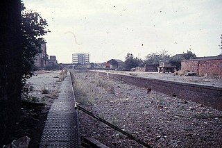
Fishponds railway station was a station in Fishponds, Bristol, England, a victim of Dr Beeching's cuts in the 1960s.

Hafodyrynys is a village on the A472 road between Pontypool and Crumlin in Caerphilly county borough, south-east Wales. It lies within the historic boundaries of Monmouthshire.

Henfield is a hamlet in South Gloucestershire, England between Coalpit Heath and Westerleigh, adjoining the hamlet of Ram Hill immediately to the north.

Siston Brook rises in two separate streams which issue from a ridge just north of the village of Siston, South Gloucestershire, England. The brook is approximately 6 miles (9.7 km) long and is a tributary of the Bristol Avon. Much of its course is through the eastern suburbs of Bristol, although it remains outside the city boundaries. Tributaries include the Warmley Brook and an unnamed tributary from Bridgeyate.
The Astley and Tyldesley Collieries Company formed in 1900 owned coal mines on the Lancashire Coalfield south of the railway in Astley and Tyldesley, then in the historic county of Lancashire, England. The company became part of Manchester Collieries in 1929 and some of its collieries were nationalised in 1947.
Fletcher, Burrows and Company was a coal mining company that owned collieries and cotton mills in Atherton, Greater Manchester, England. Gibfield, Howe Bridge and Chanters collieries exploited the coal mines (seams) of the middle coal measures in the Manchester Coalfield. The Fletchers built company housing at Hindsford and a model village at Howe Bridge which included pithead baths and a social club for its workers. The company became part of Manchester Collieries in 1929. The collieries were nationalised in 1947 becoming part of the National Coal Board.
Gin Pit was a coal mine operating on the Lancashire Coalfield from the 1840s in Tyldesley, Greater Manchester then in the historic county of Lancashire, England. It exploited the Middle Coal Measures of the Manchester Coalfield and was situated to the south of the Tyldesley Loopline.

Ram Hill is a hamlet in South Gloucestershire, England. It is located between Coalpit Heath and Westerleigh and adjoins the hamlet of Henfield immediately to the south. In the Mudge Map 1815, Ram Hill was known as Nutridge Hill, and was linked to Westerleigh by Broad Lane and to Mays Hill by Frog Lane.
The Bristol and Gloucestershire Railway was an early mineral railway, opened in two stages in 1832 and 1834, which connected collieries near Coalpit Heath with Bristol, at the river Avon. Horse traction was used. It was later taken over by the Bristol and Gloucester Railway, and much of the route became part of the main line between Birmingham and Bristol, though that was later by-passed and closed. Part of it now forms the Bristol and Bath Railway Path.

The Avon and Gloucestershire Railway also known as The Dramway was an early mineral railway, built to bring coal from pits in the Coalpit Heath area, north-east of Bristol, to the River Avon opposite Keynsham. It was dependent on another line for access to the majority of the pits, and after early success, bad relations and falling traffic potential dogged most of its existence.
The Bristol Coalfield by John Cornwell.