The Downs, Bristol

Last updated

The Downs
Bristol MMB S0 The Downs.jpg
The Downs, Bristol
Typepublic open space
Location Bristol, England
Coordinates 51°28′N2°38′W / 51.47°N 2.63°W / 51.47; -2.63
Area412 acres (1.7 km2)
Statusopen all year
Bristol UK location map.svg
Red pog.svg
Location of The Downs in Bristol

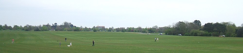
The Downs are an area of public open limestone downland in Bristol, England. They consist of Durdham Down to the north and east and Clifton Down to the south, separated by Stoke Road.

Contents

Durdham Down

Durdham Down is the north and east part of the Downs, extending to Westbury Park and Henleaze, with an area of 85 hectares (210 acres). [1] It is owned by Bristol City Council for the benefit of the people of Bristol.

Clifton Down

Clifton Down is the part of the Downs southwest of the southern part of Stoke Road, between Sneyd Park and Clifton and extending to the edge of the Avon Gorge, with an area of 82 hectares (202 acres). [1] It is owned by the Society of Merchant Venturers.

Management

Since an Act of Parliament in 1861, when Bristol Corporation acquired Durdham Down, the Downs have been managed as a single unit by the Downs Committee, a joint committee of the corporation and the Merchant Venturers. [2] [3] They have been designated common land since the early 1970s by Bristol City Council. [1]

Background

They are used for leisure, walking, team sports and sightseeing (especially at the Avon Gorge cliff edge). There are permanent football pitches, used by the Bristol Downs Football League. There are also temporary attractions on the Downs, such as circuses and (until 2006 [4] ) the annual Bristol Flower Show. Since 2016 it has been the site of The Downs Festival, an annual music festival with both local and nationally known bands attending.

A grey concrete water tower of 1954 stands on the Downs near the top of Blackboy Hill, with a long, low, covered reservoir alongside it.

In 1982 6,000 people assembled on the Downs in response to a local newspaper advertisement placed by the makers of the new breakfast television show TV-am. The 6,000 people were used to make the words 'Good', 'Morning' and 'Britain', used for the opening titles of the show. It took 2 hours to get them into place and another 2 hours to shoot.

Bristol Downs panorama.JPG
Panorama over the downs

The Downs played a significant role in Jack Thorne's 2018 Channel 4 mini-series Kiri . [5]

Related Research Articles

<span class="mw-page-title-main">Clifton Suspension Bridge</span> Bridge spanning the Avon Gorge and the River Avon

The Clifton Suspension Bridge is a suspension bridge spanning the Avon Gorge and the River Avon, linking Clifton in Bristol to Leigh Woods in North Somerset. Since opening in 1864, it has been a toll bridge, the income from which provides funds for its maintenance. The bridge is built to a design by William Henry Barlow and John Hawkshaw, based on an earlier design by Isambard Kingdom Brunel. It is a Grade I listed building and forms part of the B3129 road.

<span class="mw-page-title-main">Clifton, Bristol</span> Suburb of Bristol, England

Clifton is both a suburb of Bristol, England, and the name of one of the city's thirty-five council wards. The Clifton ward also includes the areas of Cliftonwood and Hotwells. The eastern part of the suburb lies within the ward of Clifton Down.

<span class="mw-page-title-main">Clifton Down</span> Public open space in Bristol, England

Clifton Down is an area of public open space in Bristol, England, north of the village of Clifton. With its neighbour Durdham Down to the northeast, it constitutes the large area known as The Downs, much used for leisure including walking and team sports. Clifton Down is the part of the Downs south of Stoke Road.

<span class="mw-page-title-main">Durdham Down</span> Area of open space in Bristol, England

Durdham Down is an area of public open space in Bristol, England. With its neighbour Clifton Down to the southwest, it constitutes a 400-acre (1.6 km2) area known as The Downs, much used for leisure including walking, jogging and team sports. Its exposed position makes it particularly suitable for kite flying. Durdham Down is the part of the Downs north of Stoke Road.

<span class="mw-page-title-main">Society of Merchant Venturers</span> Charitable organisation in Bristol, UK

The Society of Merchant Venturers is a charitable organisation in the English city of Bristol.

<span class="mw-page-title-main">Avon Gorge</span> Gorge on the River Avon in Bristol, England

The Avon Gorge is a 1.5-mile (2.5-kilometre) long gorge on the River Avon in Bristol, England. The gorge runs south to north through a limestone ridge 1.5 miles (2.4 km) west of Bristol city centre, and about 3 miles (5 km) from the mouth of the river at Avonmouth. The gorge forms the boundary between the unitary authorities of North Somerset and Bristol, with the boundary running along the south bank. As Bristol was an important port, the gorge formed a defensive gateway to the city.

<span class="mw-page-title-main">Bristol Harbour</span> Harbour in Bristol, England

Bristol Harbour is the harbour in the city of Bristol, England. The harbour covers an area of 70 acres. It is the former natural tidal river Avon through the city but was made into its current form in 1809 when the tide was prevented from going out permanently. A tidal by-pass was dug for 2 miles through the fields of Bedminster for the river, known as the "River Avon New Cut", "New Cut", or simply "The Cut". It is often called the Floating Harbour as the water level remains constant and it is not affected by the state of the tide on the river in the Avon Gorge, The New Cut or the natural river southeast of Temple Meads to its source.

<span class="mw-page-title-main">Stoke Bishop</span> Human settlement in England

Stoke Bishop is a medium-sized outer city suburb in the north-west of Bristol, located in between Westbury-on-Trym, Sneyd Park, and Sea Mills. Although relatively low, Stoke Bishop's population has increased due to substantial infilling on the Smelting Works sports ground and The Grove which used to belong to Clifton High school. The population of Stoke Bishop varies throughout the year because of the influx of students to the large campus of Bristol University halls of residence situated on the edge of the suburb and the Downs during term time.

<span class="mw-page-title-main">Bristol Tramways</span> Defunct tram system in Bristol, England (1875–1941)

Bristol Tramways operated in the city of Bristol, England from 1875, when the Bristol Tramways Company was formed by Sir George White, until 1941 when a Luftwaffe bomb destroyed the main power supply cables.

<span class="mw-page-title-main">Leigh Woods National Nature Reserve</span> National nature reserve near Bristol, England

Leigh Woods is a 2-square-kilometre (0.77 sq mi) area of woodland on the south-west side of the Avon Gorge, close to the Clifton Suspension Bridge, within North Somerset opposite the English city of Bristol and north of the Ashton Court estate, of which it formed a part. Stokeleigh Camp, a hillfort thought to have been occupied from the third century BC to the first century AD and possibly also in the Middle Ages, lies within the reserve on the edge of the Nightingale Valley. On the bank of the Avon, within the reserve, are quarries for limestone and celestine which were worked in the 18th and 19th centuries are now derelict.

Sea Mills is a suburb of the English port city of Bristol. It is situated 3.5 miles (6 km) north-west of the city centre, towards the seaward end of the Avon Gorge, lying between the former villages of Shirehampton to the west and Westbury-on-Trym and Stoke Bishop to the east, at the mouth of the River Trym where it joins the River Avon. Sea Mills previously was part of the city ward of Kingsweston. Following a Local Government Boundary Commission review in 2015 ward boundaries were redrawn and Sea Mills is now split between the Stoke Bishop ward and the Avonmouth and Lawrence Weston ward.

<span class="mw-page-title-main">Sneyd Park</span> Human settlement in England

Sneyd Park is a suburb of Bristol, England, lying on the western fringe of Clifton Down, adjacent to the Avon Gorge and the Sea Walls observation point. It was formally twinned with Barton Hill in 1976 as the two areas have curiously similar demographics. The twinning involves an annual luncheon between local resident's at the Barton Hill Settlement. It is part of the Stoke Bishop district. Home to many millionaires, Sneyd Park was originally developed in Victorian times. Many Victorian and Edwardian villas line the edge of the Downs. More modern housing has since been built down over the slope, towards Sea Mills, Bristol. Much of this development was carried out by the Stride family builders whose practice was "to purchase an estate freehold and to erect thereon their own houses, with the knowledge that none will be able to come along and dump a lot of cheap houses down in the neighbourhood, thereby spoiling the amenities of the place and detracting from the value of the houses erected by the firm." The 'Stride brothers' specialised in constructing individual style homes with the emphasis on location, finish and design. Buildings were never duplicated and no two were built to the same design. They often have solid oak interior doors, oak-panelled hallways, the hallmark Stride letterboxes and impressive staircases. Brothers Jared and Jethro Stride founded the business in the 1920s, followed by Jared's sons Arthur and Frederick, and then their sons Leslie and Raymond. In 1864 Jared and Jethro's brother Lot was killed in an accident in a sawmill in Cardiff when his hair was caught in the revolving saw. The incident made the newspapers around the world. Prior to developing Sneyd Park Edwin Stride and his sons Jared and Jethro had set up the Crown Brick Works in Shirehampton to supply bricks for the docks then under construction.

<span class="mw-page-title-main">Parks of Bristol</span>

The English city of Bristol has a number of parks and public open spaces.

<span class="mw-page-title-main">Hotwells</span> Human settlement in England

Hotwells is a district of the English port city of Bristol. It is located to the south of and below the high ground of Clifton, and directly to the north of the Floating Harbour. The southern entrance to the Avon Gorge, which connects the docks to the sea, lies at the western end of Hotwells. The eastern end of the area is at the roundabout where Jacobs Well Road meets Hotwell Road. Hotwells is split between the city wards of Clifton, and Hotwells and Harbourside.

<span class="mw-page-title-main">Clifton Observatory</span> Observatory in Bristol, England

Clifton Observatory is a former mill, now used as an observatory, located on Clifton Down, close to the Clifton Suspension Bridge, Bristol, England.

Goram and Vincent are legendary giants in the folklore of the Bristol area, UK.

<span class="mw-page-title-main">Alderman Proctor's Drinking Fountain</span> Building in Bristol, England

The Alderman Proctor's Drinking Fountain is a historic building on Clifton Down, Bristol, England.

Halls of residence at the University of Bristol are generally located within three distinct areas of Bristol, the City Centre, Clifton and Stoke Bishop.

The following is a timeline of the history of the city of Bristol, England.

References

  1. 1 2 3 "Bristol - Pinpoint local information". Bristol City Council. Retrieved 27 April 2019.
  2. The Downs Committee, The Downs: Clifton and Durdham Downs, 1861-1961 (Bristol, 1961)
  3. "History of The Downs" (PDF). Bristol City Council. 2011. Retrieved 27 April 2019.
  4. "Bristol Flower Show is cancelled". BBC News. 17 July 2009. Retrieved 11 November 2023.
  5. "Kiri review: beautifully observed drama, and not as grim as expected". The Guardian . Retrieved 28 June 2021.