Ramakrishnapuram Lake

Last updated

Ramakrishnapuram Lake
ముకిడిగన్ చెరువు (రామకృష్ణాపురం చెరువు)
India Telangana relief map.svg
Red pog.svg
Ramakrishnapuram Lake
Location Ramakrishnapuram Hamlet, Neredmet Village, Hyderabad, India
Coordinates 17°28′34″N78°31′59″E / 17.476°N 78.533°E / 17.476; 78.533 Coordinates: 17°28′34″N78°31′59″E / 17.476°N 78.533°E / 17.476; 78.533
Type Artificial Lake
Native nameముకిడిగాన్ చెరువు  (Telugu)
Primary outflows Safilguda Lake
Basin  countriesIndia
Max. length1,092 metres (3,583 ft)
Max. width664 metres (2,178 ft)
Surface area100 acres (40 ha), now 50 acres (20 ha)
Max. depth36 feet (11 m)
Shore length1764 metres (2,507 ft)
Surface elevation1,759 ft (536 m)
Settlements Neredmet
1 Shore length is not a well-defined measure.

Ramakrishnapuram Lake, originally named as Mukidigan Cheruvu, is a lake located in Ramakrishnapuram Hamlet, Neredmet Village, Hyderabad near Ramakistapuram Gate Railway Station. It is home to many migratory birds. [1] The lake is currently facing many problems, including water pollution. GHMC is trying to stop pollution but the efforts are not effective. Migratory birds and other animals are also affected by the pollution. [2]

History

RK Puram lake's also Known as Mukidigan Cheruvu (Original Name) roots can be traced back to 1798 when the 'subsidiary alliance' was proposed by then British Governor-General in India, Lord Wellesley.

By the early 1800s, the Electronics and Mechanical Engineering (EME), which is presently the Military College of Electronics and Mechanical Engineering (MCEME), had been set up at Trimulgherry. The engineers and electricians who worked here needed water, So RK Puram Lake was commissioned by the Nizam and dug up in the mid-1800s, occupying a space of around 100 acres. [3]

There is no established date for when the RK Puram lake was dug up, but its roots can be traced back to 1798 when the 'subsidiary alliance' was proposed by then British Governor-General in India, Lord Wellesley.

As part of the alliance, the East India Company offered protection to the rulers of princely states, in exchange for money or land.

Nizam Sikander Jah, the third ruler from the Asaf Jahi dynasty, was said to be one of the first princely states to sign the pact.

At this time, Secunderabad was a small taluk, described as a low flat ridge, near a village north of the Hussain Sagar Lake. It was here that the British built the cantonment area.

Speaking to TNM, Murali Chemuturi, a writer and long-time resident of the area, narrates, “Mudfort, which is now just the name of an area, was the first place where the East India Company built its garrison. Over time, the garrison expanded, and soon it had spread all the way up to Bolaram.”

By the early 1800s, the Electronics and Mechanical Engineering (EME), which is presently the Military College of Electronics and Mechanical Engineering (MCEME), had been set up.

Though it is now a populated area in the city, this was the time that people first settled in then Neredmet village.

“The engineers and electricians who worked there needed two main services. First, they had dry toilets and needed someone for manual scavenging, and secondly, they needed milk and food. For the first, they hired some Scheduled Caste people from Tamil Nadu and for the second purpose, they hired Yadavs (a cattle-breeding caste), from Uttar Pradesh,” Murali says.

“The two groups were housed nearby, and while Neredmet became the village RK Puram was the hamlet where the SC persons stayed,” he adds.

All three of these groups needed water, so the RK Puram Lake was commissioned by the Nizam and dug up in the mid-1800s, occupying a space of around 100 acres.

After the sepoy mutiny in 1857, the British continued to expand aggressively, and the area's population began to grow.

The lake remained a major source of drinking water and largely clean, until the late 1960s, when the Electronics Corporation of India Limited (ECIL) was established.

“There was no shortage of water, which is why the old houses in RK Puram have no well or borewell. In 1965, Sainik Nagar was the first colony to be allotted. Despite this, the lake remained clean, as the colony remained downstream of the lake,” says Murali.

“After ECIL came up, the politicians of the time laid a road right through the lake, to create a shortcut. In 1976, the lake flooded the road, following which it was raised by 5 feet by the gram panchayat with the help of mud and stones,” he adds.

According to locals, this was when a large portion of the lake was killed, as the water that was cut off from the rest of the lake, was eventually dumped with debris and flattened.

“However, it was only in the mid-80s that things started going downhill, as several colonies like GK Colony, Sri Colony, Bank Colony and Bhagat Singh Nagar were built upstream, and untreated sewage started flowing directly into the lake,” Murali says.

Related Research Articles

Hyderabad Capital of Telangana, India

Hyderabad is the capital and largest city of the Indian state of Telangana and the de jure capital of Andhra Pradesh. It occupies 650 km2 (250 sq mi) on the Deccan Plateau along the banks of the Musi River, in the northern part of South India. With an average altitude of 542 m (1,778 ft), much of Hyderabad is situated on hilly terrain around artificial lakes, including the Hussain Sagar lake, predating the city's founding, in the north of the city centre. According to the 2011 Census of India, Hyderabad is the fourth-most populous city in India with a population of 6.9 million residents within the city limits, and has a population of 9.7 million residents in the metropolitan region, making it the sixth-most populous metropolitan area in India. With an output of US$74 billion, Hyderabad has the fifth-largest urban economy in India.

Aurangabad Metropolis in Maharashtra, India

Aurangabad is a city in the Indian state of Maharashtra. It is the administrative headquarters of Aurangabad district and is the largest city in the Marathwada region. Located on a hilly upland terrain in the Deccan Traps, Aurangabad is the fifth-most populous urban area in Maharashtra with a population of 1,175,116. The city is known as a major production center of cotton textile and artistic silk fabrics. Several prominent educational institutions, including Dr. Babasaheb Ambedkar Marathwada University, are located in the city. The city is also a popular tourism hub, with tourist destinations like the Ajanta and Ellora caves lying on its outskirts, both of which have been designated as UNESCO World Heritage Sites since 1983. Other tourist attractions include the Aurangabad Caves, Daulatabad Fort, Grishneshwar Temple, Jama Mosque, Bibi Ka Maqbara, Himayat Bagh, Panchakki and Salim Ali Lake. Historically, there were 52 Gates in Aurangabad, some of them extant, because of which Aurangabad is nicknamed as the "City of Gates". In 2019, the Aurangabad Industrial City (AURIC) became the first greenfield industrial smart city of India under the country's flagship Smart Cities Mission.

Secunderabad Place in Telangana, India

Secunderabad is the twin city of Hyderabad in Hyderabad district in the Indian state of Telangana. Named after Sikandar Jah, the third Nizam of the Asaf Jahi dynasty, Secunderabad was established in 1806 as a British cantonment. Although both the cities are together referred to as the twin cities, Hyderabad and Secunderabad have different histories and cultures, with Secunderabad having developed directly under British rule until 1948, and Hyderabad as the capital of the Nizams' princely state of Hyderabad.

Sainikpuri Neighbourhood in Medchal–Malkajgiri district, Telangana, India

Sainikpuri is a residential neighbourhood in the northeastern part of Hyderabad City. It is falls under of Kapra mandal of Medchal-Malkajgiri District, and is currently administered under GHMC East Zone. It started as a co-operative housing society venture for retired army personnel, but now has houses which belong to other defence services as well as civilians. Late Brig M. K Rao, Late Brig S.N.Docca and Late Lt. Col. Tiwari Singh were the first few to have got plots in the society and had a vision to develop the colony into an elite area. The housing plots originally allotted to the members of the Sainikpuri co-operative society were of the size of 700–1,000 square yards each. Owing to this reason, most residences have large lawns and gardens. Roads are well laid and numbered. Avenues are lined with a variety of flowering and fruiting trees, and are ideal for morning and evening walks. The sprawling cantonment area, as well as The College of Defence Management (CDM) which is a premier establishment of the Indian armed forces, are in the vicinity of Sainikpuri. The old buildings are now slowly giving way to multi-storied apartments, and it is becoming a costlier affair to acquire living space in this area.

Safilguda Locality in Telangana, India

Safilguda originally named as Safilgudem before (1970's) is a residential locality in Neredmet neighbourhood of Hyderabad city. It falls under Malkajgiri mandal in Medchal-Malkajgiri district of Indian state of Telangana. It formed Ward No. 137 of Greater Hyderabad Municipal Corporation in 2009.

Malkajgiri Place in Telangana, India

Malkajgiri is a suburb of Hyderabad, Telangana, India. It is located in Medchal–Malkajgiri district and also Sub-District in Medchal District is the headquarters of Malkajgiri mandal in Malkajgiri revenue division. Erstwhile Malkajgiri Major Grampanchayat was upgraded to a municipality in 1965 and became a municipal corporation in 1985. It was merged into the Greater Hyderabad Municipal Corporation in 2007. It was a part of Ranga Reddy district before the re-organisation of districts in 2016.

Moula Ali Religious and Historical Place - Industrial Area in Telangana, India

Moula-Ali commonly known as Moula Ali also known as Maula Ali, The Ancient name is Kapargutta is a suburb of Hyderabad, India. It is a well-developed industrial and urban area in Malkajgiri Mandal, of the Medchal-Malkajgiri district, It is a part of Greater Hyderabad and also a part of Hyderabad Metropolitan Region of the Indian state of Telangana, This area is well connected with rail transportation through the Moula Ali Railway Station. It is noted for its Moula Ali hill, on top of which stands the Moula Ali Dargah and mosque, dedicated to Ali.

Miyapur Neighbourhood in Ranga Reddy, Telangana, India

Miyapur, located 22.5 kilometres (14.0 mi) northwest of Hyderabad, is part of Greater Hyderabad and administered by GHMC and developed by HMDA. Transportation is managed by UMTA.

Geography of Hyderabad

Hyderabad is located in central Telangana and is spread over an area of 2,500 km2. The city lies in the Deccan Plateau and rises to an average height of 536 m above the sea level. The city lies at 17.366° N latitude and 78.476° E longitude.

Ramakistapuram Gate railway station

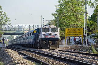
Ramakistapuram Gate railway station is a railway station in Hyderabad, Telangana, India near Ramakrishnapuram Lake, from which localities like R K Puram, Trimulgherry, Neredmet, Sainikpuri, AS Rao Nagar and Kapra are accessible.

Annaram is a village in Thungathurthy mandal, Suryapet district, Telangana, India. Most of the families in Annaram are very well educated and has more than one employee in the family. The village has supplied Engineers, Professors, Govt.officers, Teachers and specialists over the generations and are serving in India and abroad. Nearly 95% of population is literate. This village has three govt. schools including one high school which was started in late 1970s. Though politically very active, there aren't many notable leaders from the village. Main crops for the farmers of this village are paddy, moong, ground nut, chilli and cotton.

Suchitra Junction or Suchitra CenterSuchitra cross roads is one of the fastest growing suburbs of Hyderabad, Telangana, India. It has become a hub on Bowenpally-Medchal Road. The western road leads to Chintal, Shahpur, Jeedimetla IDA. The eastern road leads to Alwal via Loyola College.

Neredmet Neighbourhood in Medchal-Malkajgiri, Telangana, India

Neredmet is a residential neighbourhood in Hyderabad, Telangana, India. It is located in Malkajgiri mandal in Medchal-Malkajgiri district. Neredmet currently serves as the headquarters of Rachakonda Police commissionerate, one of the three police commissionerates of Hyderabad City. It was earlier a part of Malkajgiri Municipality, but now it is administered under Malkajgiri Circle of GHMC-Secunderabad Zone. It forms Ward No. 136- Neredmet (Fully), Ward No. 137- Vinayak Nagar(Fully), Ward No. 138- Moula-Ali(Half), Ward No. 139- East Anandbagh(Partially), Ward No. 140- Malkajgiri (Half), of Greater Hyderabad Municipal Corporation.

Hussain Sagar Heart-shaped lake in Hyderabad, Telangana, India

Hussain Sagar is a heart-shaped lake in Hyderabad, Telangana, built by Ibrahim Quli Qutb Shah in 1563. It is spread across an area of 5.7 square kilometres (2.2 sq mi) and is fed by the River Musi. A large monolithic statue of the Gautama Buddha, erected in 1992, stands on Gibraltar Rock in the middle of the lake. It also separates the city centre of Hyderabad from its neighborhood Secunderabad. The maximum depth of the lake is 32 feet (9.8 m)

Nagaram, Medchal–Malkajgiri district Suburb in Medchal-Malkajgiri, Telangana, India

Nagaram is a Suburb of Hyderabad and a municipality in Telangana, India. Nagaram is located next to Ahmadguda colony.The famous Jama Masjid is a large mosque located on the main road of Nagaram.

Kapra Lake

Kapra lake or Oora Cheruvu is a lake located in the Kapra Village near Sainikpuri in the north-east part of Greater Hyderabad, India. Length of its bund is measured at 1254 Meters.

Indian Army Corps of EME Military unit

The Corps of Electronics and Mechanical Engineers (EME) is an arms and service branch of the Indian Army. The Corps has varying responsibilities related to the design, development, trial, inspection and refit of weapon systems and equipment. They also provide technical advice to units and conduct recovery operations in peace and war.

The localities and neighborhoods of Hyderabad have unique oral histories, dating to the time of the Qutb Shahi dynasty, over 400 years ago, and are named after various people and things. Some are named after a major building or structure in the locality, others named for individuals. The names are mostly in Telugu and Urdu, the major languages of the city. This is a list of localities, neighborhoods and streets of Hyderabad and their etymology.

Old Neredmet Origin of Neredmet in Telangana, India

Old Neredmet is a locality and also Origin of Neredmet neighbourhood of Hyderabad City in the Indian state of Telangana. It is located in Malkajgiri Mandal in Medchal-Malkajgiri district of the state. It is the Headquarters of Malkajgiri Mandal, It forms Ward No. 136 -Neredmet (Half), Ward No. 137- Vinayak Nagar(Half), Ward No. 140- Malkajgiri (Fully), of Greater Hyderabad and also Hyderabad Metropolitan Region. Neredmet Grama Bodrai is in Old Neredmet Village, Neredmet Moodu Gullu is the landmark for Old Neredmet Area.

Ramakrishnapuram is a locality in Neredmet, (Earlier it was a hamlet and then it as became a small town in Old Neredmet Village.

References

  1. "Aquatic weed in Ramakrishnapuram lake". The Hindu. Retrieved 16 April 2015.
  2. "Pollution in Ramakrishnapuram lake". The Hindu. Retrieved 16 April 2015.
  3. "From bird paradise to frothing mess: Tracing the history of Secunderabad's RK Puram lake". The News Minute. 6 January 2018. Retrieved 31 December 2020.