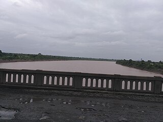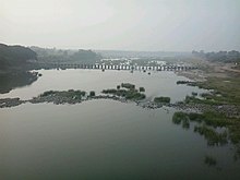
The Krishna River is a river in the Deccan plateau and is the third-longest river in India, after the Ganges and Godavari. It is also the fourth-largest in terms of water inflows and river basin area in India, after the Ganges, Indus and Godavari. The river, also called Krishnaveni, it is 1,400 kilometres (870 mi) long and its length in Maharashtra is 282 kilometres. It is a major source of irrigation in the Indian states of Maharashtra, Karnataka, Telangana and Andhra Pradesh.

The Godavari is India's second longest river after the Ganga river and drains into the third largest basin in India, covering about 10% of India's total geographical area. Its source is in Trimbakeshwar, Nashik, Maharashtra. It flows east for 1,465 kilometres (910 mi), draining the states of Maharashtra (48.6%), Telangana (18.8%), Andhra Pradesh (4.5%), Chhattisgarh (10.9%) and Odisha (5.7%). The river ultimately empties into the Bay of Bengal through an extensive network of tributaries. Measuring up to 312,812 km2 (120,777 sq mi), it forms one of the largest river basins in the Indian subcontinent, with only the Ganga and Indus rivers having a larger drainage basin. In terms of length, catchment area and discharge, the Godavari is the largest in peninsular India, and had been dubbed as the Dakshina Ganga.

Gadchiroli district is an administrative district in Maharashtra, India. The city of Gadchiroli is the administrative headquarters of the district.

The Wainganga is a river in India originating in the Mahadeo Hills in Mundara in Gondwana region near the village Gopalganj in Seoni, Madhya Pradesh. It is a key tributary of the Godavari. The river flows south in a winding course through the states of Madhya Pradesh and Maharashtra, roughly 580 km (360 mi). After joining the Wardha River, the united stream, which is known as the Pranahita River, empties into the Godavari River at Kaleshwaram, Telangana.

The Wardha River, also known as the Varada River, is a major river in Vidarbha, Maharashtra, which originates in the Satpura Range and flows into the Wain ganga river to form the Pranhita river which finally joins the Godavari river.

The Godavari River has its catchment area in seven states of India: Maharashtra, Telangana, Chhattisgarh, Madhya Pradesh, Andhra Pradesh, Karnataka and Odisha. The number of dams constructed in Godavari basin is the highest among all the river basins in India. Nearly 350 major and medium dams and barrages had been constructed in the river basin by the year 2012.

The Sriram Sagar Project is also known as the Pochampadu Project is an Indian flood-flow project on the Godavari. The Project is located in Nizamabad district, 3 km away from National Highway 44. It has been described by The Hindu as a "lifeline for a large part of Telangana".

The Painganga River is the chief river of the Buldhana district, Hingoli district, Nanded district, Yavatmal district, Chandrapur district and Washim district in the Maharashtra state in India. It flows along the southeast boundaries of the district in a winding, meandering course. It is deeply entrenched and difficult to navigate. It rises in the Ajantha range and is a major tributary of the Wardha River, the other major river in the district. It is also divided Marathwada and Vidarbha near Umarkhed.

The Upper Wardha Dam is an earthfill straight gravity dam across the Wardha River, a tributary of the Godavari River, near Simbhora village in Morshi taluk in Amravati district in the Indian state of Maharashtra. The dam provides multipurpose benefits of irrigation, drinking water supply, flood control and hydropower generation.
The Pranahita Chevella Lift Irrigation Project is a lift irrigation project to harness the water of Pranhita tributary of Godavari river for use in the Telangana state of India. The river water diversion barrage across the Pranahita river is located at Thammidihatti village in Komaram Bheem district of Telangana. This lift canal is an inter river basin transfer link by feeding Godavari river water to Krishna river basin. The chief ministers of Telangana and Maharashtra states reached an agreement in 2016 to limit the full reservoir level (FRL) of the barrage at 148 m msl with 1.85 tmcft storage capacity. In the year 2016, this project is divided into two parts. The scheme with diversion canal from the Thammmidihatti barrage to connect to existing Yellampalli reservoir across the Godavari river is presently called Pranahita barrage lift irrigation project. This scheme is confined to providing irrigation facility to nearly 2,00,000 acres in Adilabad district using 44 tmcft water.
Sripada Yellampalli Project is an irrigation project located at Yellampalli Village, Ramagundam Rural Mandal, between Peddapalli district - Mancherial District in Telangana State, India. The project is fourth largest on the Godavari River in Telangana region. It is named after late legislator, D. Sripada Rao.

Adilabad district is a district located in the northern region of Telangana, India. It is known as the gateway district to South and Central India. The town of Adilabad is its headquarters. The district shares boundaries with Asifabad, Nirmal districts and with the state boundary of Maharashtra.

Lower Manair Dam also known as LMD was constructed across the Manair River, at Alugunur village, Thimmapur mandal, Karimnagar District, in the Indian state of Telangana during 1974 to 1985. It provides irrigation to a gross command area of 163,000 hectares.
The Sri Komaram Bheem Project is a Medium Reservoir has been built across Peddavagu River, a tributary of the Pranahita River. It is located at Ada village, Asifabad Mandal, Komaram Bheem district, Telangana.
Taliperu Project also known as Taliperu Reservoir is a medium irrigation project constructed across the Taliperu River, a tributary of Godavari River, located at Cherla Village and Mandal, Bhadradri District, Telangana. This project utilizes about 5.0 TMC of water and creates 24,500 acres (9,900 ha) of Ayacut in both Cherla and Dummugudem Mandals, Bhadradri District.

Komaram Bheem Asifabad district, officially known as Kumuram Bheem Asifabad district, is a district in the Indian state of Telangana. The town of Asifabad is its district headquarters and kagaznagar as its largest town. It is named after Gond tribal leader Komaram Bheem. It was earlier part of Adilabad district and it became a new district in 2016. The district share boundaries with Adilabad, Nirmal, Mancherial districts and with the state boundary of Maharashtra. It is the second most backward district in India, according to the 2018 NITI Aayog ranking.
The Lakshmi Barrage, also known as the Medigadda Barrage is the starting point of the proposed Kaleshwaram Project which envisages construction of three barrages between Yellampally & Medigadda. Its objective is to utilize Godavari water for drinking and irrigation. The Barrage/Project site is located at Medigadda Village, Mahadevpur Mandal, Jayashankar Bhupalpally district in Telangana State, India.
The Saraswati Barrage, also known as the Annaram Barrage is an irrigation project on Godavari River located at Annaram Village, Mahadevpur Mandal, Jayashankar Bhupalpally district in Telangana State, India.
The Kaleshwaram Lift Irrigation Project (KLIP) is a multi-purpose irrigation project on the Godavari River in Kaleshwaram, Bhupalpally, Telangana, India. Currently the world's largest multi-stage lift irrigation project, its farthest upstream influence is at the confluence of the Pranhita and Godavari rivers. The Pranahita River is itself a confluence of various smaller tributaries including the Wardha, Painganga, and Wainganga rivers which combine to form the seventh-largest drainage basin on the subcontinent, with an estimated annual discharge of more than 6,427,900 acre-feet (7,930 cubic hectometres) or 280 TMC. It remains untapped as its course is principally through dense forests and other ecologically sensitive zones such as wildlife sanctuaries.
Tummidihetti Barrage is a proposed barrage across Pranhita River, a tributary of Godavari River at Tummidihetti village, Koutala mandal, Adilabad district of Telangana State. The project will provide irrigation facilities for an ayacut of 2,00,000 acres in drought prone areas in East Adilabad District of Telangana State..


