
West Salem is a village in La Crosse County, Wisconsin, United States, along the La Crosse River. It is part of the La Crosse-Onalaska, WI-MN Metropolitan Statistical Area. The population was 4,799 as of the 2010 Census.

Clam Falls is a town in Polk County, Wisconsin, United States. The population was 547 at the 2000 census. The unincorporated communities of Clam Falls and Lewis are located in the town.

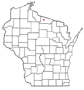
Arbor Vitae is a town in Vilas County, Wisconsin, United States. The population was 3,153 at the 2000 census. The unincorporated community of Arbor Vitae is located in the town.
Boulder Junction is a town in Vilas County, Wisconsin, United States. The population was 958 at the 2000 census.

State Trunk Highway 70 is a state highway in the U.S. state of Wisconsin. It runs east–west in northern Wisconsin from a shared terminus with WIS 101 at US 2 and US 141 near Florence to a connection with Minnesota State Highway 70 at the St. Croix River 5 miles (8.0 km) west of Grantsburg in Burnett County. It serves the communities of Grantsburg, Siren, Spooner, and the resort areas of Minocqua, Woodruff and Eagle River along its route. WIS 70 is the third most northern route to almost completely cross Wisconsin, stretching from Minnesota to within 4 miles (6.4 km) of the Michigan border.
U.S. Highway 51 (US 51) in the U.S. state of Wisconsin runs north–south down the central part of the state. It enters from Illinois at Beloit, and runs north to its northern terminus in Hurley where it junctions with US 2. Much of the route of US 51 runs concurrently with Interstate 39 (I-39).

Kloten, Wisconsin is an unincorporated community in the town of Stockbridge in Calumet County, Wisconsin, United States. The community is located at the intersection of County Highways F and C, approximately 3 miles (5 km) east of Lake Winnebago and 5 miles (8 km) west of Chilton.

Lake Minocqua is a lake in northern Oneida County, Wisconsin. It is 1360 acres (5.5 km²) in area, with an average depth of 23 feet (7 m) and a maximum depth of 60 feet (18.3 m).

Lakeland Airport, also known as Noble F. Lee Memorial Field, is a public airport near Arbor Vitae, a town in Vilas County, Wisconsin, United States. The airport is three miles (5 km) northwest of the central business district of Minocqua and northwest of Woodruff, both cities in Oneida County, just south of the Vilas County border. It is included in the Federal Aviation Administration (FAA) National Plan of Integrated Airport Systems for 2019–2023, in which it is categorized as a local general aviation facility. It is owned by the Lakeland Airport Commission.
James John Rantz is an American former professional baseball player and executive. He was the Minnesota Twins' farm system director from 1986–2012, holding the title of "Director of Minor Leagues." When he retired after his 27th consecutive season in the post, Rantz was one of the longest-tenured farm system directors in Major League Baseball; it was his 53rd consecutive season with the Twins' organization. From 1971 through 1985, Rantz was assistant minor league director under George Brophy. As such, during his career, he sent multiple generations of home-grown players to the Twins, and contributed materially to the team's 1987 and 1991 world titles and its run of playoff teams during the first decade of the 21st century.
The Minocqua-Hazelhurst-Lake Tomahawk Elementary School is an elementary school district serving 580 children in grades K-8 living in the towns of Minocqua, Hazelhurst and Lake Tomahawk. The MHLT School District encompasses 350 square miles (910 km2) in Oneida County and is considered part of “The Northwoods” of North Central Wisconsin. MHLT is one of four elementary districts that feed into Lakeland Union High School. Each district is administered by its own Board of Education.

Calvary, Wisconsin is an unincorporated community located in the town of Marshfield, in Fond du Lac County, Wisconsin. The community was originally know locally as Calvary Station since the community was built around the railroad depot for Mount Calvary. The depot for the Sheboygan-Fond du Lac Railroad needed to be built about 1 mile (2 km) north of the community because of the grade needed for trains to climb the Niagara Escarpment. It is located at the intersection of County Highways WW and WH. It is located in the heart of the Blue Sky Green Field Wind Farm in Wisconsin's Holyland Region.

Minocqua is an unincorporated census-designated place located in the town of Minocqua, Oneida County, Wisconsin, United States. Minocqua is located on a peninsula on Minocqua Lake, 21.5 miles (34.6 km) northwest of Rhinelander. The community is served by U.S. Route 51. Minocqua has a post office with ZIP code 54548. As of the 2010 census, its population is 451.
Alderley is an unincorporated community located in the town of Ashippun, Dodge County, Wisconsin, United States. Alderley is located on Highway O approximately 7 miles (11 km) north of Stone Bank, 3 miles (5 km) north of the unincorporated community of Mapleton, and 3 miles (5 km) east of Ashippun. The community was named by early settlers for Alderley Edge, England.
Larrabee is an unincorporated community located within the town of Gibson, in northern Manitowoc County, Wisconsin, United States. Larrabee is the highest-populated community within Gibson, and as such historically served as a commercial and political hub of the town; the town hall of Gibson lies less than one-half mile (0.8 km) north of the community. The community is nearly equidistant from the two nearest municipalities, with Maribel approximately 3.2 miles (5.1 km) to the west-northwest and Mishicot 3.3 miles (5.3 km) to the southeast.
The Phillip Orth Boathouse is located in Minocqua, Wisconsin, United States. It was added to the National Register of Historic Places in 2005.

The North Woods Hiawatha was a streamlined passenger train operated by the Chicago, Milwaukee, St. Paul and Pacific Railroad between New Lisbon and Minocqua, Wisconsin. It operated from 1936 until 1956. The North Woods Hiawatha was the first new route to adopt the Hiawatha brand.


