Oneida County is a county in the state of Wisconsin, United States. At the 2010 census, the population was 35,998. Its county seat is Rhinelander.

Monico is a town in Oneida County, Wisconsin, United States. The population was 364 at the 2000 census. The unincorporated community of Monico is located in the town.

U.S. Route 45 is a major north-south United States highway and a border-to-border route, from Lake Superior to the Gulf of Mexico. A sign at the highway's northern terminus notes the total distance as 1,297 miles (2,087 km).
U.S. Highway 8 (US 8) is a United States Numbered Highway that runs primarily east–west for 280 miles (451 km), mostly within the state of Wisconsin. It connects Interstate 35 (I-35) in Forest Lake, Minnesota, to US 2 at Norway in the Upper Peninsula of Michigan near the border with Wisconsin. Except for the short freeway segment near Forest Lake, and sections near the St. Croix River bridge and Rhinelander, Wisconsin, it is mostly undivided surface road. As a state highway in the three states, US 8 is maintained by the Minnesota, Wisconsin and Michigan departments of transportation.

Sobieski, Wisconsin is an unincorporated census-designated place in Oconto County in northeastern Wisconsin, United States. It is located within the Town of Little Suamico. As of the 2010 census, its population was 259. It is part of the Green Bay Metropolitan Statistical Area. The Little Suamico Town Hall is located in Sobieski, just east of the Escanaba and Lake Superior Railroad.

South Range is an unincorporated community, located in the town of Parkland, Douglas County, Wisconsin, United States.
State Trunk Highway 47 is a 188.01-mile (302.57 km) state highway in northeastern and northern Wisconsin, United States, that runs in a diagonal northwest-southeast from Menasha to Manitowish.

Collins is an unincorporated census-designated place in the town of Rockland, Manitowoc County, Wisconsin, United States, in the east central part of the state. Its zip code is 54207, although its post office is being studied for closure. As of the 2010 census, its population is 164. The Collins Marsh Wildlife Area is located east of the community. Wisconsin Highway 32 ran through the community; the route later became Wisconsin Highway 67 before it became County Highway W. County Highway JJ and the Wisconsin Central Ltd. railroad runs east–west through the community. Collins has an area of 0.496 square miles (1.28 km2), all of it land. The community was named for Sumner J. Collins, who was the general superintendent of the Wisconsin Central Railroad in the 1890s.

Wentworth is an unincorporated community, in the town of Amnicon, Douglas County, Wisconsin, United States.

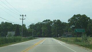
Taycheedah, Wisconsin is an unincorporated census-designated place in the Town of Taycheedah in Fond du Lac County, Wisconsin. The community is located adjacent to the city of Fond du Lac and Lake Winnebago. As of the 2010 census, its population is 704. Taycheedah calls itself the "Sheepshead Fishing Center of the World". U.S. Route 151 ran through the community until a bypass around Fond du Lac was built in the 2000s.

Peebles, Wisconsin is an unincorporated community in the Town of Taycheedah in Fond du Lac County, Wisconsin. The community is located adjacent to the unincorporated community of Taycheedah. U.S. Route 151 runs through the community. Wisconsin Highway 149 used to run through the community at its western terminus until it was decommissioned in 2006. Taycheedah Correctional Institution is located in the town of Taycheedah several miles south of the community.

Branch is an unincorporated community located in the Town of Manitowoc Rapids, in Manitowoc County, Wisconsin, United States. Branch is located on U.S. Route 10, east of Whitelaw.

Winchester is an unincorporated census-designated place in the town of Winchester in Winnebago County, Wisconsin, United States. The community is located less than 1 mile from the southern intersection of U.S. Route 10 and U.S. Route 45. Wisconsin Highway 150 passed east–west through the community until the road was decommissioned by the state of Wisconsin, the road is now designated County Highway II. It has an elevation of 846 feet above mean sea level at latitude 44.199 and longitude -88.665. As of the 2010 census, its population is 671.

Brule is an unincorporated, census-designated place; located in the town of Brule, Douglas County, Wisconsin, United States.

Maple is an unincorporated community, located in the town of Maple, Douglas County, Wisconsin, United States.

Clifford is an unincorporated community in Lincoln, Oneida, and Price counties, Wisconsin, United States. Clifford is located in the towns of Somo in Lincoln County, Lynne in Oneida County, and Knox in Price County. The community is located on U.S. Route 8 12 miles (19 km) east of Prentice.

May Corner is an unincorporated community located in the town of Grover, Marinette County, Wisconsin, United States.

Orange Mill is an unincorporated community located in the town of Orange, Juneau County, Wisconsin, United States. Orange Mill is located along U.S. Route 12 and Wisconsin Highway 16 2.5 miles (4.0 km) east-southeast of Camp Douglas.

Malvern is an unincorporated community located in the town of Pelican, Oneida County, Wisconsin, United States. Malvern is 6.5 miles (10.5 km) east-southeast of Rhinelander.

Coral City is an unincorporated community located in the town of Pigeon, Trempealeau County, Wisconsin, United States. Coral City is located at the junction of U.S. Route 53, Wisconsin Highway 121 and County Highway S, 2.1 miles (3.4 km) east-northeast of Whitehall.


