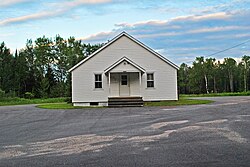
Oneida County is a county in the state of Wisconsin, United States. At the 2010 census, the population was 35,998. Its county seat is Rhinelander.

Piehl is a town in Oneida County, Wisconsin, United States. The population was 93 at the 2000 census. The unincorporated community of Gagen is located in the town.

Manitowish is an unincorporated community located within the town of Mercer, Iron County, Wisconsin, United States. It is located at the junction of U.S. Route 51, Wisconsin Highway 47 and Wisconsin Highway 182.

McNaughton is an unincorporated community located in Oneida County, Wisconsin, United States. McNaughton is located on Wisconsin Highway 47 northwest of Rhinelander, in the town of Newbold.

Marshland is an unincorporated community located in the town of Buffalo, in Buffalo County, Wisconsin, United States. Marshland is located on Wisconsin Highway 35 and Wisconsin Highway 54 8.5 miles (13.7 km) east-southeast of Fountain City.

Lake Tomahawk is an unincorporated census-designated place located in the town of Lake Tomahawk, Oneida County, Wisconsin, United States. Lake Tomahawk is located on Wisconsin Highway 47 15 miles (24 km) northwest of Rhinelander. Lake Tomahawk has a post office with ZIP code 54539. As of the 2010 census, its population was 228.

Three Lakes is an unincorporated census-designated place located in the town of Three Lakes, Oneida County, Wisconsin, United States. Three Lakes is located at the junction of U.S. Route 45 and Wisconsin Highway 32 9 miles (14 km) south-southeast of Eagle River. Three Lakes has a post office with ZIP code 54562. As of the 2010 census, its population is 605.

Split Rock is an unincorporated community located in the town of Fairbanks, Shawano County, Wisconsin, United States. Split Rock is located on County Highway SS near its junction with U.S. Route 45, 3 miles (4.8 km) southeast of Tigerton.

Whitcomb is an unincorporated community located in the town of Wittenberg, Shawano County, Wisconsin, United States. Whitcomb is located on Wisconsin Highway 153 near its junction with U.S. Route 45, 4 miles (6.4 km) southeast of the village of Wittenberg.

Price is an unincorporated community located in the town of Garfield, Jackson County, Wisconsin, United States. Price is located along U.S. Route 10 5 miles (8.0 km) west-southwest of Fairchild.

Requa is an unincorporated community located in the town of Garfield, Jackson County, Wisconsin, United States. Requa is located along U.S. Route 10 and the North Buffalo River 3.5 miles (5.6 km) east of Osseo.

London is an unincorporated community located in the counties of Dane and Jefferson in the U.S. state of Wisconsin. The Dane County portion of London is in the town of Deerfield, while the Jefferson County portion is in the town of Lake Mills. London is on Wisconsin Highway 134, 3 miles (4.8 km) north of Cambridge.

Angus is an unincorporated community in the town of Cedar Lake, Barron County, Wisconsin, United States. Angus is located on Wisconsin Highway 48 2.5 miles (4.0 km) southwest of Birchwood.

Hersey is an unincorporated community located in the town of Springfield, St. Croix County, Wisconsin, United States. Hersey is located along the Union Pacific Railroad 2 miles (3.2 km) north-northwest of Wilson.

Newbold is an unincorporated community located in the town of Newbold, Oneida County, Wisconsin, United States. Newbold is located on Wisconsin Highway 47 6.5 miles (10.5 km) northwest of Rhinelander.

Malvern is an unincorporated community located in the town of Pelican, Oneida County, Wisconsin, United States. Malvern is 6.5 miles (10.5 km) east-southeast of Rhinelander.

Earl is an unincorporated community located in the town of Springbrook, Washburn County, Wisconsin, United States. Earl is located at the junction of U.S. Route 63 and County Highway E 8.5 miles (13.7 km) northeast of Spooner; the Wisconsin Great Northern Railroad runs through the community.

Tomahawk Lake is a lake in Oneida County, Wisconsin, United States. The lake covers an area of 3,392 acres (1,373 ha) and has a maximum depth of 84 feet (26 m). The community of Lake Tomahawk is located on the eastern edge of the lake. Tomahawk Lake was so named from the fact its outline resembles a tomahawk.

Mosling is an unincorporated community located in the towns of Gillett and Underhill, Oconto County, Wisconsin, United States. Mosling is located on County Highway P 3.4 miles (5.5 km) west-southwest of Gillett.

Brookside is an unincorporated community located in the town of Pensaukee, Oconto County, Wisconsin, United States. Brookside is located on County Highway J near U.S. Route 41, 8.7 miles (14.0 km) southwest of Oconto.


