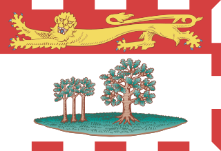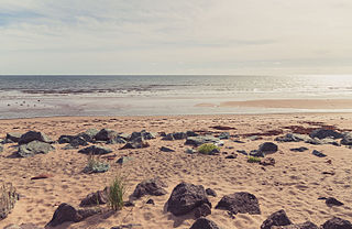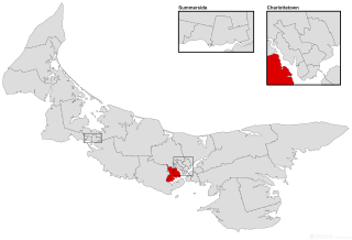
Prince Edward Island is one of the thirteen provinces and territories of Canada. It is the smallest province in terms of land area and population, but the most densely populated. The island has several nicknames: "Garden of the Gulf", "Birthplace of Confederation" and "Cradle of Confederation". Its capital and largest city is Charlottetown. It is one of the three Maritime provinces and one of the four Atlantic provinces.

Prince Edward Island National Park is a National Park of Canada located in the province of Prince Edward Island. Situated along the island's north shore, fronting the Gulf of St. Lawrence, the park measures approximately 60 km (37 mi) in length and ranges from several hundred metres to several kilometres in width. Established in 1937, the park's mandate includes the protection of many broad sand beaches, sand dunes and both freshwater wetlands and saltmarshes. The park's protected beaches provide nesting habitat for the endangered piping plover; the park has been designated a Canadian Important Bird Area.

Lot 8 is a township in Prince County, Prince Edward Island, Canada. It is part of Halifax Parish. Lot 8 was awarded to Arnold Nisbett (M.P.) in the 1767 land lottery, passed to William Kilpatrick and Benjamin Todd in 1775, and to Todd's heirs in 1783.

Brudenell River Provincial Park is a provincial park in Prince Edward Island, Canada. It lies on the north side of the Brudenell River. Brudenell River is the largest provincial park in eastern Prince Edward Island. Some of its land is used by Rodd Brudenell Resort. It has two public 18-hole golf courses, Brudenell River Golf Course and Dundarave Golf Course.

Cabot Beach Provincial Park is a provincial park in Prince Edward Island, Canada. It is located in Malpeque Bay.

Cedar Dunes Provincial Park is an ocean-front provincial park in Prince Edward Island, Canada. It is located south of West Point, facing the Northumberland Strait.
Mill River Provincial Park was a provincial park in Prince Edward Island, Canada. It is now owned and operated by Don MacDougall along with the Mill River resort and golf course.

Panmure Island Provincial Park is a provincial park in Prince Edward Island, Canada. It is located along a causeway connecting Prince Edward Island with Panmure Island. The Native Council of Prince Edward Island hosts their annual Abegweit Pow Wow in the park.

Buffaloland Provincial Park is a provincial park in Prince Edward Island, Canada. It is home to a bison sanctuary.
Pinette Park Provincial Park is a provincial park in Prince Edward Island, Canada located along the Pinette River.

Union Corner Provincial Park is a provincial park in Prince Edward Island, Canada.
The politics of Prince Edward Island are centred on a provincial government resembling that of the other Canadian provinces. The capital of the province of Prince Edward Island is Charlottetown, where the lieutenant governor and the premier reside, and the provincial legislature, and cabinet are located.

Scouting in Prince Edward Island has a long history, from the 1900s to the present day, serving thousands of youth in programs that suit the environment in which they live.

Linkletter Provincial Park is a provincial park in Prince Edward Island, Canada located at Bedeque Bay a short distance west of Linkletter, Prince Edward Island and Summerside, Prince Edward Island.

Rustico-Emerald is a provincial electoral district for the Legislative Assembly of Prince Edward Island, Canada. It was formerly known as Park Corner-Oyster Bed.

Cornwall-Meadowbank is a provincial electoral district for the Legislative Assembly of Prince Edward Island, Canada. It was previously known as North River-Rice Point.

Tracadie-Hillsborough Park is a former provincial electoral district for the Legislative Assembly of Prince Edward Island, Canada.
Charlottetown-Lewis Point was a provincial electoral district for the Legislative Assembly of the Canadian province of Prince Edward Island. It was previously called Charlottetown-Spring Park.

Charlottetown-Victoria Park is a provincial electoral district for the Legislative Assembly of Prince Edward Island, Canada. It was previously known as Charlottetown-Kings Square.
Route 19 is a secondary highway, that runs along the shoreline of the Northumberland Strait in Queens County, Prince Edward Island, Canada. There are two lanes, one going in either direction. The highway begins in the community of Desable and ends in the town of Cornwall via Rocky Point.


