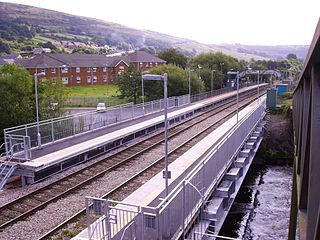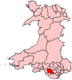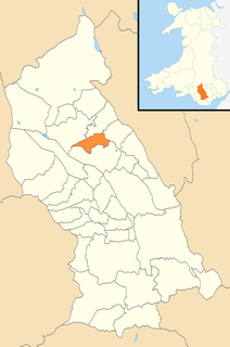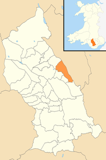
Ystrad is a village and community in the Rhondda Fawr valley, Rhondda Cynon Taf, Wales.

Penywaun is a community, electoral ward and north-western suburb of Aberdare in the Cynon Valley within the county borough of Rhondda Cynon Taf, Wales. At the 2011 census, the population of the ward was registered as 3,063.

Trealaw is a long village, also a community and electoral ward in the Rhondda Valley, Rhondda Cynon Taf, Wales. It stretches over two miles from the junction of Cemetery Road and Brithweunydd Road in the east, to the junction of Ynyscynon Road and Partridge Road to the northwest.

Ogmore is a constituency of the National Assembly for Wales. It elects one Assembly Member by the first past the post method of election. It is one of seven constituencies in the South Wales West electoral region, which also elects four additional members, to produce a degree of proportional representation for the region as a whole.

Hawthorn is a village and electoral ward within the community of the town of Pontypridd in the County Borough of Rhondda Cynon Taf, located 10 miles north west of Cardiff, the capital city of Wales. Historically this fell within the parish of Eglwysilan within Mid Glamorgan.

Penygraig is a village and community in the Rhondda Valley in the county borough of Rhondda Cynon Taf, Wales. As a community Penygraig contains the neighbouring districts of Dinas, Edmondstown, Penrhiwfer and Williamstown. Penygraig is within the historic county boundaries of Glamorgan,.

Pentre is a village, community and electoral ward near Treorchy in the Rhondda valley, falling within the county borough of Rhondda Cynon Taf, Wales. The village's name is taken from the Welsh word Pentref, which translates as homestead, though Pentre is named after a large farm that dominated the area before the coming of industrialisation. The community takes in the neighbouring village of Ton Pentre.
Syd Morgan is a Welsh nationalist politician.
The community of Llwydcoed, Rhondda Cynon Taf was, for much of the twentieth century, and electoral ward for the purposes of electing members to Glamorgan County Council and the Aberdare Urban District Council. Llwydcoed is no longer an electoral ward but forms part of Aberdare West and Llwydcoed electoral ward for the purposes of Rhondda Cynon Taf unitary authority elections
The first election to Rhondda Cynon Taf County Borough Council was held on 4 May 1995. It was followed by the 1999 election. On the same day there were elections to the other 21 local authorities in Wales and community councils in Wales.
The second election to Rhondda Cynon Taf County Borough Council was held on 4 May 1995. It was preceded by the 1995 election and followed by the 2004 election. On the same day there were elections to the other 21 local authorities in Wales and community councils in Wales and the first elections to the National Assembly for Wales were held.
The third election to Rhondda Cynon Taf County Borough Council was held in June 2004. It was preceded by the 1999 election and followed by the 2008 election. On the same day there were elections to the other 21 local authorities in Wales and community councils in Wales and the first elections to the National Assembly for Wales were held.
Rhigos is the northernmost electoral ward in Rhondda Cynon Taf, Wales. It covers the community of Rhigos and most of the neighbouring community of Hirwaun, excluding the village of Hirwaun itself but including the village of Penderyn. The ward elects a county councillor to the Rhondda Cynon Taf County Borough Council.
Rhondda is the name of an electoral ward in Rhondda Cynon Taf, Wales. The ward covers the northwest part of the Pontypridd community, including Hopkinstown, Maesycoed, Pantygraig Wen and Pwllgwaun.

Aberdare East is a local government community and electoral ward in Rhondda Cynon Taf, Wales. The community was formed in 2016 when the former community of Aberdare was split into two. Aberdare East includes the main town of Aberdare.
The Cynon Valley Party is a political party formed in 2016 to campaign for people living in the Cynon Valley, including the towns of Aberdare and Mountain Ash, in Rhondda Cynon Taf, South Wales. The party won a council seat on Rhondda Cynon Taf County Borough Council in May 2017.

Aberaman North is a community and coterminous electoral ward in Rhondda Cynon Taf, Wales. It primarily includes the village of Aberaman. The community was formed in 2016 when the larger community of Aberaman was split into North and South.

Mountain Ash East is a community and coterminous electoral ward in Rhondda Cynon Taf, Wales. It primarily includes the part of the village of Mountain Ash east of the River Cynon. The community was formed in 2016 when the larger community of Mountain Ash was divided into East and West to match the ward boundaries.
The 2017 Rhondda Cynon Taf Council election took place on Thursday 4 May 2017 to elect members of Rhondda Cynon Taf County Borough Council in Wales. This was the same day as other 2017 United Kingdom local elections. The previous full council election took place on 3 May 2012.


