Ridgeway, Kentucky

Last updated

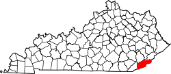
Ridgeway is an unincorporated community in Harlan County, in the U.S. state of Kentucky. [1]

Harlan County, Kentucky county in Kentucky, United States

Harlan County is a county located in southeastern Kentucky. As of the 2010 census, the population was 29,278. Its county seat is Harlan.

U.S. state constituent political entity sharing sovereignty as the United States of America

In the United States, a state is a constituent political entity, of which there are currently 50. Bound together in a political union, each state holds governmental jurisdiction over a separate and defined geographic territory and shares its sovereignty with the federal government. Due to this shared sovereignty, Americans are citizens both of the federal republic and of the state in which they reside. State citizenship and residency are flexible, and no government approval is required to move between states, except for persons restricted by certain types of court orders. Four states use the term commonwealth rather than state in their full official names.

Kentucky State of the United States of America

Kentucky, officially the Commonwealth of Kentucky, is a state located in the east south-central region of the United States. Although styled as the "State of Kentucky" in the law creating it, (because in Kentucky's first constitution, the name state was used) Kentucky is one of four U.S. states constituted as a commonwealth. Originally a part of Virginia, in 1792 Kentucky became the 15th state to join the Union. Kentucky is the 37th most extensive and the 26th most populous of the 50 United States.

History

A post office called Ridgeway was established in 1925, and remained in operation until 1932. [2] The community took its name from the Ridgeway Coal Company. [3]

Related Research Articles

Leslie County, Kentucky county in Kentucky, United States

Leslie County is a county located in the U.S. state of Kentucky. As of the 2010 census, the population was 11,310. Its county seat is Hyden. Leslie is a prohibition or dry county.

Bell County, Kentucky county in Kentucky, United States

Bell County is a county located in the southeast part of the U.S. state of Kentucky. As of the 2010 census, the population was 28,691. Its county seat is Pineville. The county was formed in 1867, during the Reconstruction era from parts of Knox and Harlan counties and augmented from Knox County in 1872. The county is named for Joshua Fry Bell, a US Representative. It was originally called "Josh Bell", but on January 31, 1873, the Kentucky legislature shortened the name to "Bell",

Pineville, Kentucky City in Kentucky, United States

Pineville is a home rule-class city in Bell County, Kentucky, United States. It is the seat of its county. The population was 1,732 as of the 2010 census. It is located on a small strip of land between the Cumberland River and Pine Mountain.

Cumberland, Kentucky City in Kentucky, United States

Cumberland is a home rule-class city in Harlan County, Kentucky, in the United States. The population according to the 2010 Census was 2,237, down from 2,611 at the 2000 census.

Harlan, Kentucky City in Kentucky, United States

Harlan is a home rule-class city in and the county seat of Harlan County, Kentucky, United States. The population was 1,745 at the 2010 census, down from 2,081 at the 2000 census.

Loyall, Kentucky City in Kentucky, United States

Loyall is a home rule-class city in Harlan County, Kentucky, in the United States. The population was 1,461 as of the 2010 census, up from 766 at the time of the 2000 census.

South Wallins, Kentucky Census-designated place in Kentucky, United States

South Wallins is an unincorporated community and census-designated place (CDP) in Harlan County, Kentucky, United States. The population was 859 at the 2010 census, down from 996 at the 2000 census.

South Yuba, California Unincorporated community in California, United States

South Yuba is an unincorporated community in Yuba County, California. It is located on the Sacramento Northern Railroad 1.5 miles (2.4 km) south of Marysville, at an elevation of 66 feet.

Carpenter, is an unincorporated community located in Whitley County, Kentucky at an elevation of 1,017 feet. Carpenter appears on the Frakes U.S. Geological Survey Map.

Ridgeway, Pittsylvania County is an unincorporated community in Pittsylvania County, in the U.S. state of Virginia.

Clinton is an unincorporated community in Cumberland County, in the U.S. state of Virginia.

Dizney, Kentucky Unincorporated community in Kentucky, United States

Dizney is an unincorporated community in Harlan County, Kentucky, United States. Its post office was active from 1918 until 1993.

Fourmile, Kentucky Unincorporated community in Kentucky, United States

Fourmile is an unincorporated community located in Bell County, Kentucky.

Martins Fork (Cumberland River) river in the United States of America

Martins Fork is a 32-mile (51 km) river in Bell and Harlan Counties in Kentucky in the United States. The river flows east and north from its source in the Cumberland Mountains, a subrange of the Appalachian Mountains, to its confluence with the Clover Fork at Harlan. The confluence with this into the Poor Fork at Baxter marks the official beginning of the Cumberland River.

The Clover Fork is a 30-mile (48 km) tributary of the Cumberland River, draining a section of the Appalachian Mountains in Harlan County, southeast Kentucky in the United States. The river's confluence with the Martin's Fork at Harlan marks the official beginning of the Cumberland River.

The Poor Fork is a 45-mile (72 km) tributary of the Cumberland River in Letcher and Harlan Counties, southeast Kentucky, in the United States. The river flows from its source at Flat Gap in the Appalachian Mountains, on the Kentucky–Virginia border, generally southwest to its confluence about a mile (1.6 km) north of Harlan.

Clear Creek Springs is an unincorporated community in Bell County, Kentucky, in the United States.

Loafers Station, Indiana Unincorporated community in Indiana, United States

Loafers Station is an unincorporated community in Pigeon Township, Warrick County, in the U.S. state of Indiana.

Maytown is an unincorporated community in Thurston County, in the U.S. state of Washington.

References

  1. U.S. Geological Survey Geographic Names Information System: Ridgeway, Kentucky
  2. "Harlan County". Jim Forte Postal History. Retrieved 24 December 2015.
  3. Rennick, Robert M. Kentucky Place Names. University Press of Kentucky. p. 251. ISBN   0-8131-2631-2.
Coordinates: 36°53′51″N83°07′32″W / 36.89750°N 83.12556°W / 36.89750; -83.12556

Geographic coordinate system Coordinate system

A geographic coordinate system is a coordinate system that enables every location on Earth to be specified by a set of numbers, letters or symbols. The coordinates are often chosen such that one of the numbers represents a vertical position and two or three of the numbers represent a horizontal position; alternatively, a geographic position may be expressed in a combined three-dimensional Cartesian vector. A common choice of coordinates is latitude, longitude and elevation. To specify a location on a plane requires a map projection.