
Adventurers' Land is a 10.1-hectare (25-acre) geological Site of Special Scientific Interest (SSSI) north of March in Cambridgeshire. It is a Geological Conservation Review site.

Moor Park is a 6.7-hectare (17-acre) biological Site of Special Scientific Interest east of Farnham in Surrey.

Dogsthorpe Star Pit is a 36.4-hectare (90-acre) biological Site of Special Scientific Interest (SSSI)) on the eastern outskirts of Peterborough in Cambridgeshire. It is also designated a Local Nature Reserve, and it is managed by the Wildlife Trust for Bedfordshire, Cambridgeshire and Northamptonshire.

Gamlingay Wood is a 48.4-hectare (120-acre) biological Site of Special Scientific Interest (SSSI) north of Gamlingay in Cambridgeshire. It is managed by the Wildlife Trust for Bedfordshire, Cambridgeshire and Northamptonshire.

Lackford Lakes is a 105.8-hectare (261-acre) biological Site of Special Scientific Interest (SSSI) north and east of Lackford in Suffolk. The SSSI is part of the 131-hectare (320-acre) Lackford Lakes nature reserve, which is managed by the Suffolk Wildlife Trust.

Biddenham Pit is a gravel pit and Site of Special Scientific Interest (SSSI), 0.41 hectares in size located in Biddenham, Bedfordshire. The pit was notified to Bedford Borough Council and Bedfordshire County Council under the Wildlife and Countryside Act (1981) in 1988, and is also a Geological Conservation Review site. The site is owned by Persimmon Homes and Kier Homes, with management advice given by Natural England.

Blo' Norton and Thelnetham Fens are a 21.3-hectare (53-acre) biological Site of Special Scientific Interest (SSSI) on the Norfolk/Suffolk border. Blo' Norton Fen is in the parish of Blo' Norton in Norfolk and Thelnetham Fen is in Thelnetham parish in Suffolk. It is a Nature Conservation Review site, Grade 2, and part of the Waveney and Little Ouse Valley Fens Special Area of Conservation, Thelnetham Fen is managed by the Suffolk Wildlife Trust and Blo' Norton Fen by the Little Ouse Headwaters Project (LOHP).

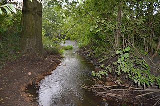
Debden Water SSSI is a 20.9-hectare (52-acre) biological Site of Special Scientific Interest which comprises two stretches of Debden Water, a small tributary of the River Cam, and surrounding land. The site is on the eastern outskirts of Newport in Essex, where the stream joins the Cam.
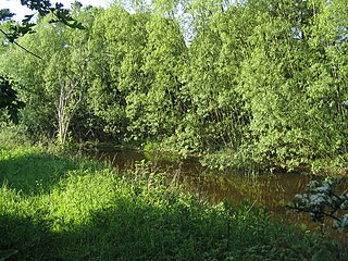
The River Ter SSSI is a stretch of the River Ter and its banks south of Great Leighs in Essex which has been designated a geological Site of Special Scientific Interest. It is a Geological Conservation Review site.
Upware South Pit is a 1.1-hectare (2.7-acre) geological Site of Special Scientific Interest (SSSI) north of Upware in Cambridgeshire. It is a Geological Conservation Review site.
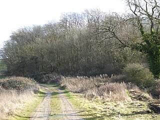
An area of 39.1 hectares in the north-west corner of Geddington Chase has been designated a biological Site of Special Scientific Interest (SSSI). It is located south-east of Corby in Northamptonshire.

Grantham Canal SSSI is a 9.5-hectare (23-acre) biological Site of Special Scientific Interest which runs along a stretch of the Grantham Canal and its banks between Redmile and Harby in Leicestershire.

Kilby - Foxton Canal is a 32.1 hectares biological Site of Special Scientific Interest along the Grand Union Canal and its banks in Leicestershire, between Kilby Bridge, south of Wigston, and Debdale Wharf, north of Foxton.

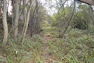
Leighfield Forest SSSI is an 11.3 hectares biological Site of Special Scientific Interest east of Skeffington in Leicestershire, England. It consists of several fragments, including Tugby Wood, Loddington Reddish, Brown's Wood, Skeffington Wood and Tilton Wood, of the former medieval hunting Leighfield Forest, which straddles Leicestershire and Rutland. It is a Nature Conservation Review site, Grade II.

River Mease SSSI is a 23.0 hectares biological Site of Special Scientific Interest. It is a stretch of the River Mease and its tributary Gilwiskaw Brook, running between Alrewas in Staffordshire and Packington in Leicestershire. It is also a Special Area of Conservation The river goes through private land, but it is crossed by roads and footpaths.
Wymondham Rough is a 6.0 hectares biological Site of Special Scientific Interest (SSSI) east of Stapleford in Leicestershire. The SSSI is part of the 12.5 hectare Wymondham Rough nature reserve, which is managed by the Leicestershire and Rutland Wildlife Trust.

Barrow Gravel Pits is a 35.6 hectares biological Site of Special Scientific Interest in Barrow upon Soar in Leicestershire.

Blindley Heath SSSI is a 26.3-hectare (65-acre) biological Site of Special Scientific Interest in the hamlet Blindley Heath, on the southern outskirts of Godstone in Surrey. It is also a Local Nature Reserve. It is owned by Godstone Parish Council and managed by the Surrey Wildlife Trust

Lymington River SSSI is a 34.8-hectare (86-acre) biological and geological Site of Special Scientific Interest along Lymington River and its tributaries between Lymington, Burley and Stoney Cross in Hampshire. HIghland Water is a Geological Conservation Review site and Ober Water is a Nature Conservation Review site, Grade I. Parts of the site are in The New Forest and Solent and Southampton Water Ramsar sites, and in The New Forest Special Protection Area.
