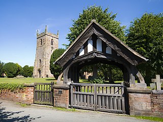
Deben Estuary is a 981.1 hectare biological Site of Special Scientific Interest (SSSI) covering the River Deben and its banks 12 kilometres from its mouth north of Felixstowe to Woodbridge in Suffolk. It is a Ramsar internationally important wetland site and a Special Protection Area under the European Union Directive on the Conservation of Wild Birds. It is also in the Suffolk Coast and Heaths Area of Outstanding Natural Beauty. It partly overlaps two geological SSSIs, Ferry Cliff, Sutton and Ramsholt Cliff.

Hardley Flood is a 49.8-hectare (123-acre) biological Site of Special Scientific Interest west of Great Yarmouth in Norfolk. It is part of the Broadland Ramsar site and Special Protection Area, and The Broads Special Area of Conservation.
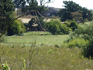
Ducan's Marsh is a 3.6-hectare (8.9-acre) biological Site of Special Scientific Interest north-east of Loddon in Norfolk. It is part of the Broadland Ramsar site and Special Protection Area, and The Broads Special Area of Conservation.

Dimminsdale is a 37 hectare geological biological and Site of Special Scientific Interest partly in Derbyshire and partly in Leicestershire. It is located east of Calke in Derbyshire. It is a Geological Conservation Review site, and a area of 23.5 hectares is owned by Severn Trent Water and managed by the Leicestershire and Rutland Wildlife Trust.

Sprat's Water and Marshes, Carlton Colville is a 57.1 hectare biological Site of Special Scientific Interest on the western outskirts of Lowestoft in Suffolk. It is part of the Broadland Ramsar internationally important wetland site, and Special Protection Area under the European Union Directive on the Conservation of Wild Birds, and part of The Broads Special Area of Conservation. The northern part of the site is Carlton Marshes, which is part of Carlton and Oulton Marshes, a nature reserve managed by the Suffolk Wildlife Trust.
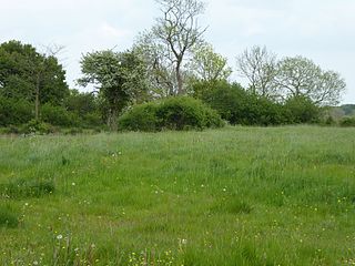
Dew's Ponds is a 6.7 hectare biological Site of Special Scientific Interest (SSSI) south of Halesworth in Suffolk. It is a Special Area of Conservation.

Cavenham–Icklingham Heaths is a 419 hectare biological Site of Special Scientific Interest west of Icklingham in Suffolk. It is a Nature Conservation Review site, Grade I, and part of Breckland Special Area of Conservation and Breckland Special Protection Area under the European Union Directive on the Conservation of Wild Birds. Cavenham Heath is a 203.1 hectare National Nature Reserve.

Orwell Estuary is a 1,335.7 hectare biological Site of Special Scientific Interest which stretches along the River Orwell and its banks between Felixstowe and Ipswich in Suffolk. It is part of the Stour and Orwell Estuaries Ramsar site internationally important wetland site and Special Protection Area under the European Union Directive on the Conservation of Wild Birds. It is also in the Suffolk Coast and Heaths Area of Outstanding Natural Beauty.

Weather and Horn Heaths, Eriswell is a 133.3 hectare biological Site of Special Scientific Interest east of Eriswell in Suffolk. It is a Nature Conservation Review site, Grade I, and part of the Breckland Special Area of Conservation, and Special Protection Area
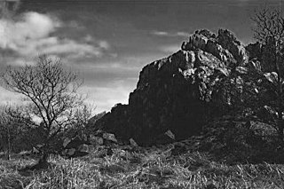
Beacon Hill, Hangingstone and Outwoods is a 147.5 hectare biological and geological Site of Special Scientific Interest (SSSI) south of Loughborough in Leicestershire. It is also a Geological Conservation Review and a Nature Conservation Review site. The Outwoods and Beacon Hill are part of The National Forest. Two areas in the SSSI, Beacon Hill and Jubilee Woods are country parks managed by Leicestershire County Council, and The Outwoods is managed by Charnwood Borough Council.

Grace Dieu and High Sharpley is an 86 hectare biological and geological Site of Special Scientific Interest between Coalville and Shepshed in Leicestershire. Grace Dieu Quarry is a Geological Conservation Review site.

Newhurst Quarry is a 9.5 hectares geological Site of Special Scientific Interest on the southern outskirts of Shepshed in Leicestershire. It is a Geological Conservation Review site.

River Eye SSSI is a 6.0 hectares biological Site of Special Scientific Interest covering a stretch of the River Eye between Ham Bridge, north-west of Stapleford, and the eastern outskirts of Melton Mowbray in Leicestershire. It is a Nature Conservation Review site.

Shallam Dyke Marshes, Thurne is a 69.8-hectare (172-acre) biological Site of Special Scientific Interest south-east of Norwich in Norfolk. It is part of the Broadland Ramsar site and Special Protection Area, and The Broads Special Area of Conservation.
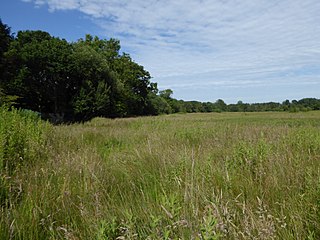
Crostwick Marsh is a 11.6-hectare (29-acre) biological Site of Special Scientific Interest in Crostwick, north of Norwich in Norfolk. It is part of the Broadland Ramsar site and Special Protection Area, and The Broads Special Area of Conservation.

Geldeston Meadows is a 14-hectare (35-acre) biological Site of Special Scientific Interest near Geldeston in Norfolk. It is part of the Broadland Ramsar site and Special Protection Area, and The Broads Special Area of Conservation.

Limpenhoe Meadows is a 12-hectare (30-acre) biological Site of Special Scientific Interest west of Reedham in Norfolk. It is part of the Broadland Ramsar site and Special Protection Area, and The Broads Special Area of Conservation.

Poplar Farm Meadows, Langley is a 7.5-hectare (19-acre) biological Site of Special Scientific Interest east of Loddon in Norfolk. It is part of the Broadland Ramsar site and Special Protection Area, and The Broads Special Area of Conservation.


