
Vallejo is a waterfront city in Solano County, California, located in the North Bay subregion of the San Francisco Bay Area. Vallejo is geographically the closest North Bay city to the inner East Bay, so it is sometimes mistakenly associated with that region. Although, the website craigslist has categorized Vallejo as part of the East Bay, a likely contributor in this dispute. Its population was 115,942 at the 2010 census. It is the tenth most populous city in the San Francisco Bay Area, and the largest in Solano County. Vallejo sits on the northeastern shore of San Pablo Bay, 30 miles north of San Francisco, the northwestern shore of the Carquinez Strait and the southern end of the Napa River, 15 miles south of Napa. The city is named after General Mariano Guadalupe Vallejo, a native Californio, leading proponent of California's statehood, and one of the first members of the California State Senate; the neighboring city of Benicia is named for his wife, Francisca Benicia Carrillo de Vallejo.

The Baja California Peninsula is a peninsula in Northwestern Mexico. It separates the Pacific Ocean from the Gulf of California. The peninsula extends 1,247 km from Mexicali, Baja California in the north to Cabo San Lucas, Baja California Sur in the south. It ranges from 40 km at its narrowest to 320 km at its widest point and has approximately 3,000 km of coastline and approximately 65 islands. The total area of the Baja California Peninsula is 143,390 km2 (55,360 sq mi).

The San Andreas Fault is a continental transform fault that extends roughly 1,200 kilometers (750 mi) through California. It forms the tectonic boundary between the Pacific Plate and the North American Plate, and its motion is right-lateral strike-slip (horizontal). The fault divides into three segments, each with different characteristics and a different degree of earthquake risk. The slip rate along the fault ranges from 20 to 35 mm /yr.

U.S. Route 101, or U.S. Highway 101 (US 101) is a north–south United States Numbered Highway that runs through the states of California, Oregon, and Washington, on the West Coast of the United States. It is also known as El Camino Real where its route along the southern and central California coast approximates the old trail which linked the Spanish missions, pueblos, and presidios. It merges at some points with California State Route 1 (SR 1).

State Route 1 (SR 1) is a major north–south state highway that runs along most of the Pacific coastline of the U.S. state of California. At a total of just over 659 miles (1,061 km), it is the longest state route in California. SR 1 has several portions designated as either Pacific Coast Highway (PCH), Cabrillo Highway, Shoreline Highway, or Coast Highway. Its southern terminus is at Interstate 5 (I-5) near Dana Point in Orange County and its northern terminus is at U.S. Route 101 (US 101) near Leggett in Mendocino County. SR 1 also at times runs concurrently with US 101, most notably through a 54-mile (87 km) stretch in Ventura and Santa Barbara counties, and across the Golden Gate Bridge.

The Cascade Range or Cascades is a major mountain range of western North America, extending from southern British Columbia through Washington and Oregon to Northern California. It includes both non-volcanic mountains, such as the North Cascades, and the notable volcanoes known as the High Cascades. The small part of the range in British Columbia is referred to as the Canadian Cascades or, locally, as the Cascade Mountains. The latter term is also sometimes used by Washington residents to refer to the Washington section of the Cascades in addition to North Cascades, the more usual U.S. term, as in North Cascades National Park. The highest peak in the range is Mount Rainier in Washington at 14,411 feet (4,392 m).

Anaheim is a city in Orange County, California, part of the Los Angeles metropolitan area. As of the 2010 United States Census, the city had a population of 336,265, making it the most populous city in Orange County and the 10th-most populous city in California. Anaheim is the second-largest city in Orange County in terms of land area, and is known for being the home of the Disneyland Resort, the Anaheim Convention Center, and two major sports teams: the Anaheim Ducks ice hockey club and the Los Angeles Angels baseball team.

The Central Valley is a flat valley that dominates the geographical center of the U.S. state of California. It is 40 to 60 miles wide and stretches approximately 450 miles (720 km) from north-northwest to south-southeast, inland from and parallel to the Pacific Ocean coast. It covers approximately 18,000 square miles (47,000 km2), about 11% of California's total land area. The valley is bounded by the Sierra Nevada to the east and the Coast Ranges to the west.
Monterey Bay is a bay of the Pacific Ocean located on the coast of the U.S. state of California. The bay is south of the major cities of San Francisco and San Jose. The county-seat city of Santa Cruz is located at the north end of the bay. The city of Monterey is on the Monterey Peninsula at the south end. The Monterey Bay Area is a local colloquialism sometimes used to describe the whole of the Central Coast communities of Santa Cruz and Monterey counties.

San Bernardino is a city located in the Riverside–San Bernardino metropolitan area and that serves as the county seat of San Bernardino County, California, United States. As one of the Inland Empire's anchor cities, San Bernardino spans 81 square miles (210 km2) on the floor of the San Bernardino Valley and as of 2017 has a population of 216,995. San Bernardino is the 17th-largest city in California and the 102nd-largest city in the United States. San Bernardino is home to numerous diplomatic missions for the Inland Empire, being one of four cities in California with numerous consulates. The governments of Guatemala and Mexico have also established their consulates in the downtown area of the city.

Northern California is the northern portion of the U.S. state of California. Spanning the state's northernmost 48 counties its main population centers include the San Francisco Bay Area, the Greater Sacramento area, and the Metropolitan Fresno area. Northern California also contains redwood forests, along with the Sierra Nevada, including Yosemite Valley and part of Lake Tahoe, Mount Shasta, and most of the Central Valley, one of the world's most productive agricultural regions.
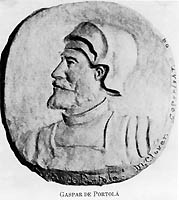
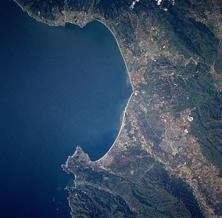
Gaspar de Portolá y Rovira (1723–1786) was a Spanish soldier and administrator in New Spain. As commander of the Spanish colonizing expedition on land and sea that established San Diego and Monterey, Portolá expanded New Spain's Las Californias province far to the north from its beginnings on the Baja California peninsula. Portolá's expedition also was the first European to see San Francisco Bay. The expedition gave names to geographic features along the way, many of which are still in use.

The Sutter Buttes are a small circular complex of eroded volcanic lava domes which rise as buttes above the flat plains of the Sacramento Valley in Sutter County, Northern California. They are situated just outside Yuba City in the northern part of the state's Central Valley.

Ward Creek is a 6.1-mile (9.8 km) eastward-flowing stream in Placer County, California, USA. The creek flows into Lake Tahoe 2.7 miles (4.3 km) south of Tahoe City, California, and has undergone extensive restoration to reduce sediment and surface run-off to maintain the purity of Lake Tahoe.

Tolowa Dunes State Park is a 5,000-acre (20 km2) California State Park located in Del Norte County, on the North Coast of California.

North Bloomfield is a small unincorporated community located in Nevada County, California.

Patrick's Point State Park is 25 miles (40 km) north of Eureka, California in the heart of California's coast redwood country. The State Park was named for Patrick Beegan, an Irish immigrant who originally called it Patrick's Ranch.
North Muroc is a former settlement in Kern County, California. It was located 8 miles (13 km) south-southeast of Castle Butte, at an elevation of 2290 feet. North Muroc still appeared on maps as of 1947.

North Shafter is an unincorporated community in Kern County, California. It is located 1 mile (1.6 km) north of Shafter, at an elevation of 351 feet.


