Robinson Treaty

Last updated

Robinson Treaty may refer to one of two treaties signed between the Ojibwa chiefs and The Crown in 1850. The first treaty involved Ojibwa chiefs along the north shore of Lake Superior. The second treaty, signed two days later, also included Ojibwa chiefs from along the eastern and northern shores of Lake Huron. The Wiikwemkoong First Nation did not sign either treaty, and their land is considered "unceded".

Contents

The Saugeen Surrenders of 1854 and the Pennefather Treaty of 1859 altered the original treaties.

Robinson Superior Treaty

The Robinson Treaty for the Lake Superior region, commonly called Robinson Superior Treaty, was entered into agreement on September 7, 1850, at Sault Ste. Marie, Ontario between Ojibwa Chiefs inhabiting the Northern Shore of Lake Superior from Pigeon River to Batchawana Bay, and The Crown, represented by a delegation headed by William Benjamin Robinson. It is registered as the Crown Treaty Number 60.

Robinson Huron Treaty

The first Robinson Treaty for the Lake Huron region, commonly called Robinson Huron Treaty, was entered into agreement on September 9, 1850, at Sault Ste. Marie, Ontario between Ojibwa Chiefs inhabiting the Northern Shore of Lake Superior from Batchawana Bay to Sault Ste. Marie and the Ojibwa Chiefs inhabiting the eastern and northern shores of Lake Huron from Sault Ste. Marie to Penetanguishene, and The Crown, represented by a delegation headed by William Benjamin Robinson. It is registered as the Crown Treaty Number 61.

These principal men on behalf of their respective Tribes or Bands, voluntarily surrendered, ceded, granted, and convey unto Her Majesty, her heirs and successors for ever, all their right, title, and interest to, and in the whole of, the territory above described, together with the Islands in the said Lakes, opposite to the Shores thereof, and inland to the Height of land which separates the Territory covered by the charter of the Honorable Hudson Bay Company from Canada; as well as all unconceded lands within the limits of Canada West to which they have any just claim, of the other part, save and except for the reservations set forth in the schedule.

The bands were given a one-time payment of £2,160 distributed amongst themselves, and an annual payment of £600 to each band.

The Schedule of Reservations created as a result of the Robinson Huron Treaty and signed by the subscribing Chiefs and Principal Men are as follows:

FIRST—Pamequonaishcung and his Band, a tract of land to commence seven miles, from the mouth of the River Maganetawang, and extending six miles east and west by three miles north.

SECOND—Wagemake and his Band, a tract of land to commence at a place called Nekickshegeshing, six miles from east to west, by three miles in depth.

THIRD—Kitcheposkissegan (by Papasainse), from Point Grondine westward, six miles inland, by two miles in front, so as to include the small Lake Nessinassung a tract for themselves and their Bands.

FOURTH--- Wabakekik, three miles front, near Shebawenaning, by five miles inland, for himself and Band.

FIFTH—Namassin and Naoquagabo and their Bands, a tract of land commencing near Qacloche, at the Hudson Bay Company's boundary; thence westerly to the mouth of Spanish River; then four miles up the south bank of said river, and across to the place of beginning.

SIXTH—Shawenakishick and his Band, a tract of land now occupied by them, and contained between two rivers, called Whitefish River, and Wanabitaseke, seven miles inland.

SEVENTH—Windawtegawinini and his Band, the Peninsula east of Serpent River, and formed by it, now occupied by them.

EIGHTH—Ponekeosh and his Band, the land contained between the River Mississaga and the River Penebewabecong, up to the first rapids.

NINTH—Dokis and his Band, three miles square at Wanabeyakokaun, near Lake Nipissing and the island near the Fall of Okickandawt.

TENTH—Shabokishick and his Band, from their present planting grounds on Lake Nipissing to the Hudson Bay Company's post, six miles in depth.

ELEVENTH—Tagawinini and his Band, two miles square at Wanabitibing, a place about forty miles inland, near Lake Nipissing.

TWELFTH—Keokouse and his Band, four miles front from Thessalon River eastward, by four miles inland.

THIRTEENTH—Mishequanga and his Band, two miles on the lake shore east and west of Ogawaminang, by one mile inland.

FOURTEENTH—For Shinguacouse and his Band, a tract of land extending from Maskinongé Bay, inclusive, to Partridge Point, above Garden River on the front, and inland ten miles, throughout the whole distance; and also Squirrel Island.

FIFTEENTH—For Nebenaigoching and his Band, a tract of land extending from Wanabekineyunnung west of Gros Cap to the boundary of the lands ceded by the Chiefs of Lake Superior, and inland ten miles throughout the whole distance, including Batchewanaung Bay; and also the small island at Sault Ste. Marie used by them as a fishing station.

SIXTEENTH—For Chief Mekis and his Band, residing at Wasaquesing (Sandy Island), a tract of land at a place on the main shore opposite the Island; being the place now occupied by them for residence and cultivation, four miles square.

SEVENTEENTH—For Chief Muckatamishaquet and his Band, a tract of land on the east side of the River Naishconteong, near Pointe aux Barils, three miles square; and also a small tract in Washauwenega Bay—now occupied by a part of the Band—three miles square.

Reserve size

The First Nations signatories of this treaty were unfamiliar with the unit of the mile, and assumed it was the size of a league. The treaty gave each band a reserve of 16 square miles, which was much smaller than what the signatories expected. As soon as the error was noticed, the first nations notified the Crown of the issue, and surveyors corrected the problem except for a few reserves, such as the Gull Bay First Nation, considered too far and too remote. The Gull Bay First Nation filed a claim with the government of Canada on the issue of the size of their reserve in 2016. [1]

Saugeen Surrenders

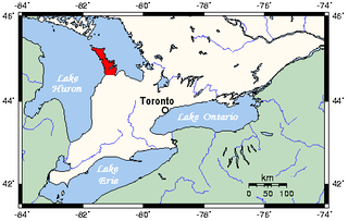
The second Robinson Treaty for the Lake Huron region, commonly called Surrender of the Saugeen Peninsula or Saugeen Surrenders, was entered into agreement on October 13, 1854, at Saugeen between Ojibwa Chiefs inhabiting the Saugeen (Bruce) Peninsula, led by Chief Waabadik, and the Crown, represented by a delegation headed by Laurence Oliphant. It is registered as the Crown Treaty Number 72. Though not negotiated by William Benjamin Robinson, thus not a "Robinson Treaty", it is commonly included with them.

The Chippewas of Saugeen Ojibway Territory initially refused to relinquish entitlement of their Saugeen and Owen Sound Indian Reserve and negotiations for this land became increasingly difficult for the British government. In the end the British government threatened that if the Ojibway did not agree the Crown would be unable to guarantee protection from the European settlers moving into the area. After tense negotiations the Ojibway reluctantly agreed to surrender their reserve in exchange for "the interest on the principal sum arising out of the sale of the land". Five smaller reserves were to be set aside in perpetuity:

  1. Saugeen Tract
  2. Chief's Point
  3. Owen Sound
  4. Cape Croker
  5. Colpoy's Bay

A historical plaque, erected by the Province of Ontario, provides the following summary of developments during that era. (Location: Allenford, picnic area on the south side of Highway 21 just west of Allenford Road.) The plaque reads as follows:

In July, 1855, at nearby "Floodwood Crossing" (now Allenford), representatives of the Ojibwa Indians conferred with government officials at a meeting later called the "Allenford Pow-Wow". The conference resolved a boundary dispute which had arisen over the terms of the Saugeen treaty of 1854. The Ojibwa interpretation of this treaty held "Copway's Road", an Indian pathway from Saugeen village to Lake Huron, to be the boundary of the land ceded by them on the north side of the Saugeen River. Lord Bury, Superintendent General of Indian Affairs and the government's principal representative, accepted this interpretation which granted the Indians increased frontage on Lake Huron and removed a major source of friction. [2]

The lands have been distributed to the Chippewas' successor First Nations as follows:

Saugeen First Nation Chippewas of Nawash Unceded First Nation
Saugeen and Cape Croker Fishing Islands 1

Pennefather Treaty

The Pennefather Treaty was signed on 9 June 1859 at Gros Cap between the "Chiefs and Warriors of Batchewananny Bay and Goulais Bay Band of Indians", and the Crown. The chiefs and warriors agreed to relinquish to the Crown the reserved lands set aside in the Robinson Treaty (Reserve 15), save for Whitefish Island. The Crown, in return, would sell the land, and all interest accrued from the sale of the land would be distributed to band members annually. Each family could receive 40 acres of land on the Garden River reserve, and may purchase 80 acres of the land being sold at the selling price (with government-established conditions). The bands were also given $1,200 divided amongst themselves, and all "improvements" to the lands being sold could be compensated after survey. [3]

List of Robinson Treaty First Nations

Further reading

Notes and references

Notes

  1. In 1991, the Supreme Court of Canada ruled that the Teme-Augama Anishnabai gave up rights to the land via the 1850 Robinson Treaty despite the Tema-Augama Anishnabai claiming that they never signed or consented to the treaty. [4] [5]

Related Research Articles

Ojibwe Group of indigenous peoples in North America

The Ojibwe, Ojibwa, Chippewa, or Saulteaux are an Anishinaabe people in what is currently southern Canada and the northern Midwestern United States. In the United States, they have the fifth-largest population among Native American peoples, surpassed in number only by the Diné, Tsalagi, Chahta and Oceti Sakowin. In Canada, they are the second-largest First Nations population, surpassed only by the Cree. They are one of the most numerous Indigenous Peoples north of the Rio Grande.

Saulteaux Ethnic group

The Saulteaux, otherwise known as the Plains Ojibwe, are a First Nations band government in Ontario, Manitoba, Saskatchewan, Alberta and British Columbia, Canada. They are a branch of the Ojibwe who pushed west. They formed a mixed culture of woodlands and plains Indigenous customs and traditions.

Bruce Peninsula

The Bruce Peninsula is a peninsula in Ontario, Canada, that lies between Georgian Bay and the main basin of Lake Huron. The peninsula extends roughly northwestwards from the rest of Southwestern Ontario, pointing towards Manitoulin Island, with which it forms the widest strait joining Georgian Bay to the rest of Lake Huron. The Bruce Peninsula contains part of the geological formation known as the Niagara Escarpment.

Saugeen First Nation is an Ojibway First Nation band located along the Saugeen River and Bruce Peninsula in Ontario, Canada. The band states that their legal name is the "Chippewas of Saugeen". Organized in the mid-1970s, Saugeen First Nation is the primary "political successor apparent" to the Chippewas of Saugeen Ojibway Territory; the other First Nation that is a part of Chippewas of Saugeen Ojibway Territory is Cape Croker. The Ojibway are of the Algonquian languages family. The First Nation consist of four reserves: Chief's Point 28, Saugeen 29, Saugeen Hunting Grounds 60A, and Saugeen and Cape Croker Fishing Islands 1.

Wiikwemkoong First Nation Unceded territory in Ontario, Canada

The Wiikwemkoong First Nation is a First Nation on Manitoulin Island in Northern Ontario. The Wiikwemkoong Unceded Territory is the First Nation reserve in the north-eastern section of Manitoulin Island in Manitoulin District, Ontario, Canada. Wiikwemkoong is an unceded Indigenous reserve in Canada, which means that it has not "relinquished title to its land to the government by treaty or otherwise."

North Shore (Lake Superior)

The North Shore of Lake Superior runs from Duluth, Minnesota, United States, at the southwestern end of the lake, to Thunder Bay and Nipigon, Ontario, Canada, in the north to Sault Ste. Marie, Ontario, in the east. The shore is characterized by alternating rocky cliffs and cobblestone beaches, with forested hills and ridges through which scenic rivers and waterfalls descend as they flow to Lake Superior.

Treaty 3 was an agreement entered into on October 3, 1873, by Chief Mikiseesis on behalf of the Ojibwe First Nations and Queen Victoria. The treaty involved a vast tract of Ojibwe territory, including large parts of what is now northwestern Ontario and a small part of eastern Manitoba, to the Government of Canada. Treaty 3 also provided for rights for the Waasaakode Anishinaabe and other Ojibwe, through a series of agreements signed over the next year. The treaty was modified in 1875 when Nicolas Chatelain negotiated an adhesion that created a reserve, surveyed as reserve 16A, for Metis families connected to Mikiseesis' Rainy Lake Band. Reserve 16A and the Rainy Lake Band reserve were unified in 1967.

Oji-Cree

The Oji-Cree are a First Nation in the Canadian provinces of Ontario and Manitoba, residing in a narrow band extending from the Missinaibi River region in Northeastern Ontario at the east to Lake Winnipeg at the west.

Mishkeegogamang First Nation Indian Reserve in Ontario, Canada

Mishkeegogamang First Nation is an Ojibway band government in the Canadian province of Ontario. Until 1993, the band was called the Osnaburgh First Nation, with various settlements at times being called New Osnaburgh, Osnaburgh House, or Osnaburgh.

Garden River First Nation Indian reserve in Ontario, Canada

Garden River First Nation, also known as Ketegaunseebee, is an Ojibwa band located at Garden River 14 near Sault Ste. Marie, Ontario, Canada.

The Saugeen Ojibway Nation Territory is the name applied to Chippewas of Nawash Unceded First Nation and Saugeen First Nation as a collective. The collective First Nations are Ojibway (Anishinaabe) peoples located on the eastern shores of Lake Huron on the Bruce Peninsula in Ontario, Canada. Though predominantly Ojibway, due to large influx of refugees from the south and west after the War of 1812, the descendants of the Chippewas of Saugeen Ojibway Territory also have ancestry traced to Odawa and Potawatomi peoples.

Rankin Location 15D Indian reserve in Ontario, Canada

Rankin Location 15D is one of four reserves of the Batchewana First Nation of Ojibways in Algoma District in northeastern Ontario, Canada. It is bounded on the north, west and south by the city of Sault Ste. Marie, and on the east by Garden River First Nations reserve of another Ojibwe people. As of 2005, a total of 2,205 people were registered to the Nation; about half live on the reserves and many others live in Sault Ste. Marie.

Charles Rankin, was an early Irish-born and Scottish-descended settler and land surveyor in Upper Canada. He is significant due to his role in the surveying and early settlement of large areas of Upper Canada, including much of the Bruce Peninsula and south shore of Lake Huron, and notably the city of Owen Sound. Born in 1797 at Enniskillen, County Fermanagh, Ireland, he died in either 1886 or 1888 in Owen Sound, a city whose founding he had been instrumental in.

Fort William First Nation Indian reserve in Ontario, Canada

Fort William First Nation is an Ojibwa First Nation reserve in Ontario, Canada. The administrative headquarters for this band government is south of Thunder Bay. As of January 2008, the First Nation had a registered population of 1,798 people, of which their on-Reserve population was 832 people.

Chapleau Ojibway First Nation is an Ojibwa First Nation located near Chapleau Township, Sudbury District, Ontario, Canada. The First Nation have reserved for themselves the 67 ha Chapleau 61A Indian Reserve, 64.7 ha Chapleau 74 Indian Reserve and the 799.3 ha Chapleau 74A Indian Reserve. In September, 2007, their total registered population 39, of which their on-reserve population was 30.

Ojibway Nation of Saugeen Indian reserve in Ontario, Canada

The Ojibway Nation of Saugeen is an Ojibwa First Nation in the Canadian province of Ontario. The Nation is located in the Thunder Bay District, approximately 20 kilometres northwest of Savant Lake. In December, 2007, its total registered population was 206, of which the on-reserve population was 72. The community maintains strong ties with Mishkeegogamang First Nation

Gull Bay First Nation Indian reserve in Ontario, Canada

Gull Bay First Nation or Kiashke Zaaging Anishinaabek is an Anishinaabe (Ojibway) First Nation band government located in Thunder Bay District in northwestern Ontario, Canada. It is approximately 175 kilometres (109 mi) north of Thunder Bay, Ontario on Highway 527 on the western shore of Lake Nipigon. As of May 2010, the First Nation had a registered population of 1,149 people, including an on-Reserve population of 328.

Missanabie Cree First Nation

Missanabie Cree First Nation is a "Treaty 9" Nation.

Saugeen may refer to the following in Ontario, Canada:

The Batchewana First Nation of Ojibways is an Ojibway First Nation in northern Ontario. Their traditional lands run along the eastern shore of Lake Superior, from Batchawana Bay to Whitefish Island. They were reserved this land in the 1850 Robinson Huron Treaty, but surrendered most of it under the 1859 Pennefather Treaty. Through purchase and land claims, it has reclaimed some territories, including Goulais Bay 15A, Obadjiwan 15E, Rankin Location 15D and Whitefish Island.

References

  1. "Gull Bay First Nation files claim to fix 166-year-old error in size of reserve | CBC News". CBC. 1 March 2016. Retrieved 2019-03-04.
  2. ""The Allenford Pow-Wow" 1855". Ontario's Historical Plaques. Allan L Brown. 2017. Retrieved 28 February 2017.
  3. Carol Nadjiwon (February 2011). "Treaties - 1859 Pennefather Treaty". Batchewana First Nation of Ojibways. Retrieved 9 January 2016.
  4. Ontario (Attorney General) v. Bear Island Foundation, 1991 CanLII 75, [1991] 2 SCR 570(15 August 1991), Supreme Court (Canada) }}
  5. Santin, Aldo (August 16, 1991). "Indian leaders give land ruling mixed reviews". Winnipeg Free Press . p. 2.