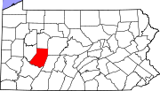
Armstrong County is a county located in the U.S. state of Pennsylvania. As of the 2010 census, the population was 68,941. The county seat is Kittanning. The county was organized on March 12, 1800, from parts of Allegheny, Westmoreland and Lycoming Counties. It was named in honor of John Armstrong, who represented Pennsylvania in the Continental Congress and served as a major general during the Revolutionary War.

Westmoreland County is a county located in the U.S. state of Pennsylvania. At the 2010 census, the population was 365,169. The county seat is Greensburg. Formed from, successively, Lancaster, Northumberland, and later Bedford Counties, Westmoreland County was founded on February 26, 1773, and was the first county in the colony of Pennsylvania whose entire territorial boundary was located west of the Allegheny Mountains. Westmoreland County originally included the present-day counties of Fayette, Washington, Greene, and parts of Beaver, Allegheny, Indiana, and Armstrong counties. It is named after Westmorland, a historic county of England.

Snyder County is a county in the U.S. state of Pennsylvania. As of the 2010 census, the population was 39,702. The county seat is Middleburg. Snyder County was formed in 1855 from parts of Union County.

Northampton County is a county located in the U.S. state of Pennsylvania. As of the 2010 census, the population was 297,735. Its county seat is Easton. The county was formed in 1752 from parts of Bucks County. Its namesake was Northamptonshire and the county seat of Easton is named for the country house Easton Neston.

McKean County is a rural county in the U.S. state of Pennsylvania. As of the 2010 census, the population was 43,450. Its county seat is Smethport. The county was created in 1804 and organized in 1826. It was named in honor of former Pennsylvania Governor and Declaration of Independence signer Thomas McKean.

Lycoming County is a county located in the U.S. Commonwealth of Pennsylvania. As of the 2010 census, the population was 116,111. Its county seat is Williamsport.

Clearfield County is a sixth-class county located in the U.S. state of Pennsylvania. As of the 2010 census, the population was 81,642. The county seat is Clearfield, and the largest city is DuBois. The county was created in 1804 and later organized in 1822.

Cambria County is a county located in the U.S. state of Pennsylvania. As of the 2010 census, the population was 143,679. Its county seat is Ebensburg. The county was created on March 26, 1804, from parts of Bedford, Huntingdon, and Somerset Counties and later organized in 1807. It was named for the nation of Wales, which in Latin is known as "Cambria".

Brady Township is a township in Clearfield County, Pennsylvania, United States. The population was 2,000 at the 2010 census.

Indiana is a borough in and the county seat of Indiana County in the U.S. Commonwealth of Pennsylvania. The population was 13,975 at the 2010 census, and since 2013 has been part of the Pittsburgh metropolitan area after being a long time part of the Pittsburgh Media Market. Indiana is also the principal city of the Indiana, PA Micropolitan Statistical Area.

Marion Center is a borough in Indiana County, Pennsylvania, United States. The population was 451 at the 2010 census.

Cumberland County is a county located in the U.S. state of Pennsylvania. As of the 2010 census, the population was 235,406. Its county seat is Carlisle.
The Purchase Line is the name commonly given to the line dividing Indian from British Colonial lands established in the Treaty of Fort Stanwix of 1768 in western Pennsylvania. In New York State documents it is referred to as the Line of Property; see that article for the treaty text and other sections.

Area code 814 is the U.S. telephone area code for the northwestern and central portions of the Commonwealth of Pennsylvania. Cities served by the area code include Altoona, Bradford, DuBois, Erie, Meadville, Oil City, Titusville, Johnstown, St. Marys, and Warren as well as the boroughs of State College, Brockway, Clearfield, Huntingdon, Mount Union, Bedford, Clarion, Punxsutawney, Tyrone, Ebensburg, Coudersport, and Brookville.

The Marion Center Area School District is a school district in the state of Pennsylvania. It is located in Marion Center in Indiana County. It also serves the municipalities of Creekside, Washington Township, Ernest, Rayne Township, Plumville, East Mahoning Township, South Mahoning Township, Grant Township, and Canoe Township. The school's athletic teams compete in the Heritage Conference of District 6.

Penns Valley is an eroded anticlinal valley of the Pennsylvania ridge and valley geologic region of the Appalachian Mountain range. The valley is located in southern Centre County, Pennsylvania. Along with the Nittany Valley to the north and east, it is part of the larger Nittany Anticlinorium. It is bordered by Nittany Mountain to the north, the Seven Mountains range to the south, and connects to the larger Nittany Valley to the west. There are two smaller subordinate valleys typically associated with the greater valley; Georges Valley in the south, separated by Egg Hill, and Brush Valley in the north, separated by Brush Mountain.

Milford Square is a census-designated place in Milford Township, Bucks County, Pennsylvania. It is located along PA Route 663 near the borough of Trumbauersville. As of the 2010 census, the population was 897 residents. While the village has a PO Box post office with the zip code of 18935, the surrounding area uses the Quakertown zip code of 18951. It is located on the Unami Creek which drains into the Perkiomen Creek. It was formerly known as Heistville after the Heist family who operated Achey's Mill and lived in, and greatly renovated, the miller’s home.

Kunkletown is an unincorporated community in Eldred Township, Monroe County, Pennsylvania, United States. It is located at an elevation of 531 feet. It is at ZIP Code 18058.
Rural Ridge is an unincorporated community in Allegheny County, Pennsylvania, United States. The area known as Rural Ridge is located in the municipality of Indiana Township, in suburban Pittsburgh, and in the Fox Chapel Area School District.


