East Mahoning Township, Indiana County, Pennsylvania

Last updated

East Mahoning Township, Pennsylvania
East Mahoning Township from Route 210.jpg
Map of Indiana County, Pennsylvania Highlighting East Mahoning Township.PNG
Map of Indiana County, Pennsylvania Highlighting East Mahoning Township
Map of Pennsylvania highlighting Indiana County.svg
Map of Pennsylvania highlighting Indiana County
Country United States
State Pennsylvania
County Indiana
Area
[1]
  Total31.37 sq mi (81.25 km2)
  Land31.28 sq mi (81.01 km2)
  Water0.09 sq mi (0.24 km2)
Population
 (2020) [2]
  Total975
  Estimate 
(2021) [2]
973
  Density32.74/sq mi (12.64/km2)
Time zone UTC-5 (Eastern (EST))
  Summer (DST) UTC-4 (EDT)
FIPS code 42-063-21456

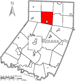
East Mahoning Township is a township in Indiana County, Pennsylvania, United States. As of the 2020 census, [2] the township population was 975, a decline from the figure of 1,077 tabulated in 2010. East Mahoning Township was created when Mahoning Township was divided into four parts (East, West, North, and South) in 1846. It contains the communities of Georgeville, Hamill, Mottarns Mill, and Savan. [3] It surrounds, but does not include, the borough of Marion Center.

Contents

Geography

According to the United States Census Bureau, the township has a total area of 31.4 square miles (81 km2), all land. [4]

Demographics

Historical population
CensusPop.Note
1850 869
1860 1,20939.1%
1870 1,139−5.8%
1880 1,1632.1%
1890 1,099−5.5%
1900 895−18.6%
1910 827−7.6%
1920 1,03625.3%
1930 739−28.7%
1940 81810.7%
1950 776−5.1%
1960 757−2.4%
1970 723−4.5%
1980 97735.1%
1990 1,14016.7%
2000 1,1964.9%
2010 1,077−9.9%
2020 975−9.5%
2021 (est.)973 [2] −0.2%
U.S. Decennial Census [5]
Overview of Georgeville Georgeville from Route 210.jpg
Overview of Georgeville

As of the census [6] of 2000, there were 1,196 people, 423 households, and 326 families residing in the township. The population density was 38.1 inhabitants per square mile (14.7/km2). There were 473 housing units at an average density of 15.1/sq mi (5.8/km2). The racial makeup of the township was 98.24% White, 0.33% African American, 1.00% Asian, 0.25% from other races, and 0.17% from two or more races.

There were 423 households, out of which 39.0% had children under the age of 18 living with them, 63.4% were married couples living together, 9.7% had a female householder with no husband present, and 22.7% were non-families. 20.3% of all households were made up of individuals, and 9.0% had someone living alone who was 65 years of age or older. The average household size was 2.83 and the average family size was 3.28.

In the township the population was spread out, with 29.2% under the age of 18, 10.0% from 18 to 24, 28.0% from 25 to 44, 21.9% from 45 to 64, and 10.9% who were 65 years of age or older. The median age was 35 years. For every 100 females there were 92.3 males. For every 100 females age 18 and over, there were 91.2 males.

The median income for a household in the township was $28,700, and the median income for a family was $33,523. Males had a median income of $28,906 versus $20,795 for females. The per capita income for the township was $13,168. About 16.5% of families and 19.3% of the population were below the poverty line, including 26.8% of those under age 18 and 4.7% of those age 65 or over.

Related Research Articles

<span class="mw-page-title-main">Halfmoon Township, Centre County, Pennsylvania</span> Township in Pennsylvania, United States

Halfmoon Township is a township in Centre County, Pennsylvania, United States. It is part of the State College, Pennsylvania Metropolitan Statistical Area. The population was 2,819 at the 2020 census, which is a 5.4% increase since the 2010 census.

<span class="mw-page-title-main">Harris Township, Centre County, Pennsylvania</span> Township in Pennsylvania, United States

Harris Township is a township in Centre County, Pennsylvania, United States. It is part of the State College, Pennsylvania Metropolitan Statistical Area. Boalsburg, a census-designated place (CDP), is located within the township. The population was 4,873 at the 2010 census, which is a 4.6% increase since the 2000 census.

<span class="mw-page-title-main">Brady Township, Clearfield County, Pennsylvania</span> Township in Pennsylvania, United States

Brady Township is a township in Clearfield County, Pennsylvania, United States. The population was 1,941 at the 2020 census.

<span class="mw-page-title-main">Gulich Township, Clearfield County, Pennsylvania</span> Township in Pennsylvania, United States

Gulich Township is a township in Clearfield County, Pennsylvania, United States. The population was 1,204 at the 2020 census.

<span class="mw-page-title-main">Greene Township, Erie County, Pennsylvania</span> Township in Pennsylvania, United States

Greene Township is a township in Erie County, Pennsylvania, United States. The population was 4,487 at the 2020, down from 4,706 at the 2010 census.

<span class="mw-page-title-main">Canoe Township, Pennsylvania</span> Township in Pennsylvania, United States

Canoe Township is a township in Indiana County, Pennsylvania, United States. The population was 1,432 at the 2020 census, a decline from the figure of 1,505 tabulated in 2010. Canoe Township was formed from Montgomery Township in 1847. It was named after Canoe Creek, which was so called because its mouth on Mahoning Creek was traditionally the head of canoe navigation. The township includes the communities of Canoe Ridge, Juneau, Locust, Locust Lane, Robertsville, and Rossiter.

<span class="mw-page-title-main">Grant Township, Indiana County, Pennsylvania</span> Township in Pennsylvania, United States

Grant Township is a township in Indiana County, Pennsylvania, United States.

<span class="mw-page-title-main">South Mahoning Township, Pennsylvania</span> Township in Pennsylvania, United States

South Mahoning Township is a township that is located in Indiana County, Pennsylvania, United States. The population was 1,841 at the time of the 2020 census. Historic communities in the township include Ambrose, Denton, Elkin, Frantz, McCormick, Rossmoyne and Wells.

<span class="mw-page-title-main">Bell Township, Jefferson County, Pennsylvania</span> Township in Pennsylvania, United States

Bell Township is a township in Jefferson County, Pennsylvania, United States. The population was 2,010 at the 2020 census, down from 2,056 at the 2010 census. It was named for John H. Bell, a prominent citizen of the township.

<span class="mw-page-title-main">Gaskill Township, Jefferson County, Pennsylvania</span> Township in Pennsylvania, United States

Gaskill Township is a township in Jefferson County, Pennsylvania, United States. The population was 677 at the 2020 census. It was named for Charles C. Gaskill, agent of the Holland Land Company.

<span class="mw-page-title-main">Henderson Township, Jefferson County, Pennsylvania</span> Township in Pennsylvania, United States

Henderson Township is a township in Jefferson County, Pennsylvania, United States. The population was 1,941 at the 2020 census. It was named for Jefferson County Associate Judge Joseph Henderson.

<span class="mw-page-title-main">McCalmont Township, Pennsylvania</span> Township in Pennsylvania, United States

McCalmont Township is a township in Jefferson County, Pennsylvania, United States. The population was 1,136 at the 2020 census. It was named for John Swayze McCalmont, president judge of the county at the time.

<span class="mw-page-title-main">Coal Township, Northumberland County, Pennsylvania</span> Township in Pennsylvania, United States

Coal Township is a township in Northumberland County, Pennsylvania, United States. The population at the 2020 Census was 10,136, which was a decline from the figure of 10,383 tabulated in 2010.

<span class="mw-page-title-main">Roulette Township, Pennsylvania</span> Township in Pennsylvania, United States

Roulette Township is a township in Potter County, Pennsylvania, United States. The population was 1,100 at the 2020 census. The small town of Roulette, a census-designated place with a population of about 800, is located near the center of the township.

<span class="mw-page-title-main">Ryan Township, Pennsylvania</span> Township in Pennsylvania, United States

Ryan Township is a township in Schuylkill County, Pennsylvania, United States. The population was 2,526 at the 2020 census.

<span class="mw-page-title-main">West Penn Township, Pennsylvania</span> Township in Pennsylvania, United States

West Penn Township is a township in Schuylkill County, Pennsylvania, United States. The population was 4,383 in the 2020 census.

<span class="mw-page-title-main">West Beaver Township, Pennsylvania</span> Township in Pennsylvania, United States

West Beaver Township is a township in Snyder County, Pennsylvania, United States. The population was 1,129 at the 2020 census.

<span class="mw-page-title-main">Charleston Township, Tioga County, Pennsylvania</span> Township in Pennsylvania, United States

Charleston Township is a township in Tioga County, Pennsylvania, United States. The population was 3,562 at the 2020 census. Hills Creek State Park, one of 120 Pennsylvania state parks, is in Charleston Township.

<span class="mw-page-title-main">Gaines Township, Tioga County, Pennsylvania</span> Township in Pennsylvania, United States

Gaines Township is a township in Tioga County, Pennsylvania, United States. The population was 609 at the 2020 census.

<span class="mw-page-title-main">Richmond Township, Tioga County, Pennsylvania</span> Township in Pennsylvania, United States

Richmond Township is a township in Tioga County, Pennsylvania, United States. The population was 2,164 at the 2020 census.

References

  1. "2016 U.S. Gazetteer Files". United States Census Bureau. Retrieved August 14, 2017.
  2. 1 2 3 4 Bureau, US Census. "City and Town Population Totals: 2020-2021". Census.gov. US Census Bureau. Retrieved July 7, 2022.
  3. http://www.rootsweb.ancestry.com/~paicgs/townships/eastmahoning.shtml [ user-generated source ]
  4. "Geographic Identifiers: 2010 Census Summary File 1 (G001): East Mahoning township, Indiana County, Pennsylvania". American Factfinder. U.S. Census Bureau. Archived from the original on February 13, 2020. Retrieved April 11, 2018.
  5. "Census of Population and Housing". Census.gov. Retrieved June 4, 2016.
  6. "U.S. Census website". United States Census Bureau . Retrieved January 31, 2008.

40°47′00″N78°59′59″W / 40.78333°N 78.99972°W / 40.78333; -78.99972