Roeville, Florida | |
|---|---|
 Roeville, Florida  Roeville, Florida | |
| Coordinates: 30°40′49″N86°59′53″W / 30.68028°N 86.99806°W | |
| Country | United States |
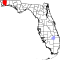
| State | Florida |
| County | Santa Rosa |
| Area | |
• Total | 4.581 sq mi (11.86 km2) |
| • Land | 4.570 sq mi (11.84 km2) |
| • Water | 0.011 sq mi (0.028 km2) |
| Elevation | 75 ft (23 m) |
| Population | |
• Total | 608 |
| • Density | 133/sq mi (51.4/km2) |
| Time zone | UTC-6 (Central (CST)) |
| • Summer (DST) | UTC-5 (CDT) |
| ZIP code | 32570 [3] |
| Area code | 850 |
| GNIS feature ID | 2583380 [2] |
Roeville is an unincorporated community and census-designated place in Santa Rosa County, Florida, United States. As of the 2020 census, Roeville had a population of 607. [4]